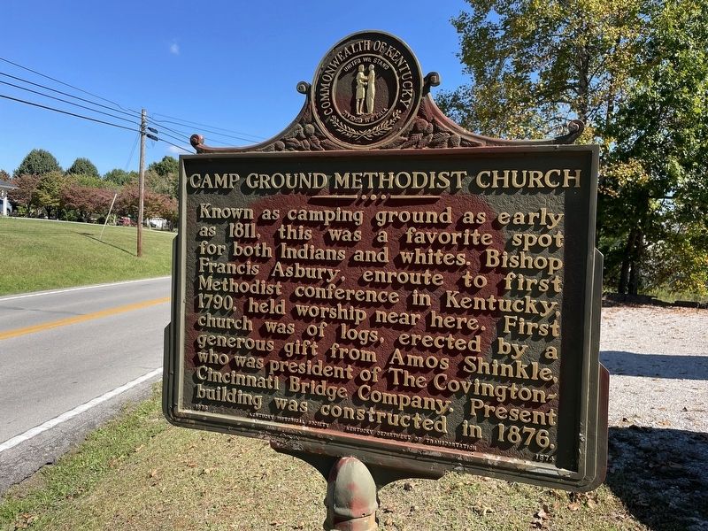
Near London in Laurel County, Kentucky — The American South (East South Central)
Camp Ground Methodist Church
Erected 1976 by Kentucky Historical Society and Kentucky Department of Transportation. (Marker Number 1574.)
Topics. This historical marker is listed in these topic lists: Churches & Religion • Native Americans • Settlements & Settlers. A significant historical year for this entry is 1811.
Location. 37° 2.21′ N, 83° 59.818′ W. Marker is near London, Kentucky, in Laurel County. Marker is at the intersection of Barbourville Road (Kentucky Route 229) and Laurel River Church Road, on the left when traveling west on Barbourville Road. Touch for map. Marker is at or near this postal address: 7050 Barbourville Rd, London KY 40744, United States of America. Touch for directions.
Other nearby markers. At least 8 other markers are within 5 miles of this marker, measured as the crow flies. Modrel's Station (approx. 2.1 miles away); Wilderness Road Inn (approx. 3.4 miles away); CSA Returns to Tenn. (approx. 3.7 miles away); First Lt. Carl H. Dodd / Medal of Honor Winner (approx. 3.8 miles away); Levi Jackson Historic Stump (approx. 4.4 miles away); Laurel County (approx. 4˝ miles away); Defeated Camp Burial Ground (approx. 4˝ miles away); Daniel Boone's Trail (approx. 4˝ miles away). Touch for a list and map of all markers in London.
Credits. This page was last revised on October 17, 2023. It was originally submitted on October 16, 2023. This page has been viewed 93 times since then and 34 times this year. Photo 1. submitted on October 16, 2023. • James Hulse was the editor who published this page.
Editor’s want-list for this marker. A wide area view photo showing the marker and its surrounding area. A photo of the church. • Can you help?
