North Charleroi in Washington County, Pennsylvania — The American Northeast (Mid-Atlantic)
Community of Lock Four
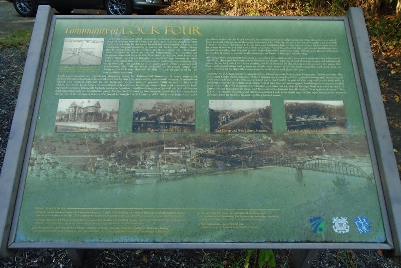
Lock Four was the original community name for the lower floodplain area of present North Charleroi. This area was originally settled by the Frye family in the 1770s. In 1838, the Monongahela Navigation Company began building a series of locks and dams along the Monongahela River to facilitate river navigation. The fourth lock, located at mile 40.9 from Pittsburgh, was constructed between 1840 and 1844 on the Frye farm, at a place then known as Frye's Shoals or Frye's Ripples. A small village, known as Lock Four, grew up at this lock site, as shown on the accompanying 1876 map (on left). In addition to a store, post office, and several residences, the village then included a telegraph office and boatyard, which was the only facility of its type operated by the navigation company.
Lock Four became an important shipping point for Fallowfield Township farmers, especially before the introduction of local rail lines in the latter decades of the nineteenth century. A steamboat wharf was located adjacent to the boatyard, at the foot of present Fifth Street. In the early 1880s, however, Lock Four contained scarcely a dozen buildings, most clustered around the lock site and occupied primarily by lock workers, boatmen, and boat engineers, as well as the lock keeper and superintendent. Significant growth occurred following the completion of the Monongahela division of the Pennsylvania Railroad through Lock Four in 1880-1881, and John Conrad's purchase of part of the Frye farm and its subdivision into building lots in 1885. These lots occupied land bounded by present Monongahela and East Liberty avenues between Fourth and Seventh streets. In 1890, Theodore J. Allen laid out building lots in the block south of Seventh Street between Water Street and East Liberty Avenue. More than half of the still extant buildings date from this initial period of rapid growth in the late 1880s and early 1890s. Village growth was sufficient to enable it to incorporate as the Borough of North Charleroi in July 1894.
Although the community began as a shipping port and service location connected with the lock and dam, the rapid industrial development of nearby Charleroi and Monessen spurred additional growth in the Lock Four area during the last decade of the nineteenth century. By 1900, the borough population had grown to nearly 500, many of whom worked at the lock and dam, or were employed by the railroad or nearby coal mine and glass factory.
In 1897, the U.S. Government acquired the Monongahela Navigation Company. Subsequently, the U.S. Army Corps of Engineers (USACE) began operating Lock No. 4 and the boatyard, removing all tolls on the locks. Between ca. 1913 and 1917, the USACE replaced the original stone lock with a modern concrete structure and constructed two houses and support buildings in a secure, walled area just north of Second Street. A house constructed ca. 1891 by George Nutt was sold to the U.S. Government boatyard in 1903, and thus became known locally as the "Navigation House.” The U.S. Government maintained the boatyard at Lock Four until 1947, when operations were moved downstream to Neville Island, in Allegheny County.
[Top left photo caption reads]
The village of Lock Four in 1876
[Bottom inset photos, left to right]
IMAGE DESCRIPTIONS
1. Private residence known as the Navigation House, in 1908. This building was moved from its original location nearer the river to make way for the U.S. Government Boat Yard expansion.
2. Ca. 1923 view of Lock Four showing the U.S. Government Boat Yard, left of center.
3. Early 1900s view looking up East Liberty and West Liberty avenues from the Charleroi-Monessen Bridge.
4. Ca. 1910 view of newly reconstructed Lock Four and U.S. Government housing. The houses are no longer standing.
5. [Full bottom background photo] Early 1900s aerial view of Lock Four.
Erected by Pennsylvania Historical and Museum Commission, PennDOT, and US Coast Guard.
Topics. This historical marker is listed in these topic lists: Industry & Commerce • Settlements & Settlers • Waterways & Vessels. A significant historical month for this entry is July 1894.
Location. 40° 9.076′ N, 79° 54.467′ W. Marker is in North Charleroi, Pennsylvania, in Washington County. Marker is at the intersection of Lincoln Avenue/Pennsylvania Avenue and Lock Street, on the left when traveling north on Lincoln Avenue/Pennsylvania Avenue. Touch for map. Marker is in this post office area: Charleroi PA 15022, United States of America. Touch for directions.
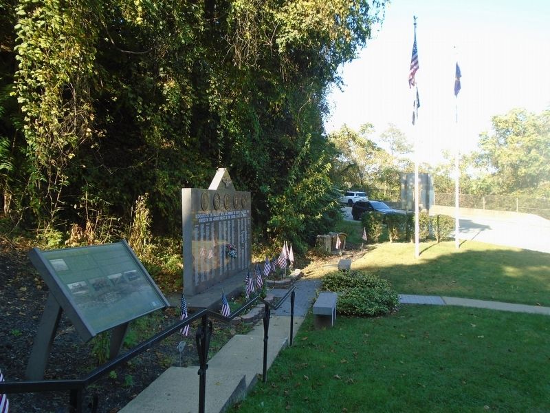
Other nearby markers. At least 8 other markers are within one mile of this marker, measured as the crow flies. Veterans Memorial (here, next to this marker); Lock View Veterans Memorial (approx. 0.4 miles away); Louis Goaziou: 1864-1937 (approx. ¾ mile away); John K. Tener (approx. 0.9 miles away); United States Post Office (approx. 0.9 miles away); Medal of Honor (approx. one mile away); World War I Memorial (approx. one mile away); Charleroi Veterans Memorial (approx. one mile away).
Credits. This page was last revised on October 17, 2023. It was originally submitted on October 17, 2023, by William Fischer, Jr. of Scranton, Pennsylvania. This page has been viewed 66 times since then and 29 times this year. Photos: 1, 2. submitted on October 17, 2023, by William Fischer, Jr. of Scranton, Pennsylvania.

