Near Indian Land in Lancaster County, South Carolina — The American South (South Atlantic)
Old Six Mile Cemetery
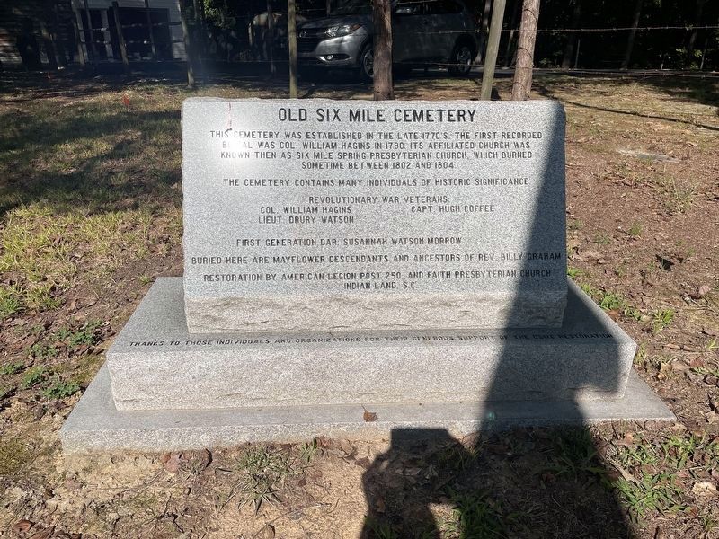
The cemetery contains many individuals of historic significance. Revolutionary war veterans Col. William Hagins, Lieut. Drury Watson, Capt. Hugh Coffee; First generation DAR Susannah Watson Morrow.
Buried here are Mayflower descendants and ancestors of Rev. Billy Graham.
Restoration by American Legion Post 250 and Faith Presbyterian Church, Indian Land, SC. Thanks to those individuals and organizations for their generous support of the OSMC restoration.
Topics. This historical marker is listed in this topic list: Cemeteries & Burial Sites. A significant historical year for this entry is 1790.
Location. 34° 56.915′ N, 80° 49.32′ W. Marker is near Indian Land, South Carolina, in Lancaster County. Marker can be reached from State Road S-29-22, 0.3 miles north of Aycoth Road, on the left when traveling north. Do not park in or block the driveways. Touch for map. Marker is in this post office area: Fort Mill SC 29707, United States of America. Touch for directions.
Other nearby markers. At least 8 other markers are within 5 miles of this marker, measured as the crow flies. Revolutionary War Women’s Memorial (a few steps from this marker); a different marker also named Old Six Mile Cemetery (within shouting distance of this marker); Andrew Jackson (approx. 4.4 miles away in North Carolina); 107 West South Main Street (approx. 4.7 miles away in North Carolina); 101 West South Main Street (approx. 4.7 miles away in North Carolina); Trading Path (approx. 4.7 miles away in North Carolina); 100 East South Main Street (approx. 4.7 miles away in North Carolina); Waxhaw Military Wall of Honor (approx. 4.7 miles away in North Carolina). Touch for a list and map of all markers in Indian Land.
Credits. This page was last revised on October 20, 2023. It was originally submitted on October 20, 2023, by Ronald Patton of Lancaster, South Carolina. This page has been viewed 87 times since then and 41 times this year. Photo 1. submitted on October 20, 2023, by Ronald Patton of Lancaster, South Carolina. • J. J. Prats was the editor who published this page.
Editor’s want-list for this marker. A wide shot of the monument showing it in its surroundings • A view or two of the cemetery • a view of each of the gravestones for the persons mentioned • Can you help?
