Near Port Republic in Rockingham County, Virginia — The American South (Mid-Atlantic)
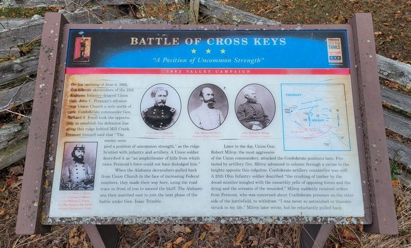
Battle of Cross Keys
"A Position of Uncommon Strength"
— 1862 Valley Campaign —
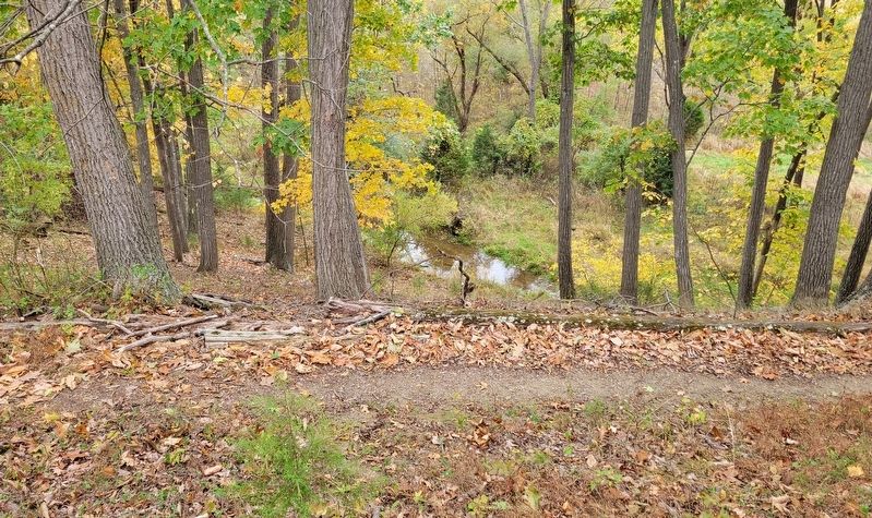
On the morning of June 8, 1862, Confederate skirmishers of the 15th Alabama Infantry delayed Union Gen. John C. Frémont's advance near Union Church a mile north of here. Confederate commander Gen. Richard S. Ewell took the opportunity to establish his defensive line along this ridge behind Mill Creek. Frémont himself said that "The enemy occupied a position of uncommon strength," as the ridge bristled with infantry and artillery. A Union soldier described it as "an amphitheater of hills from which twice Frémont's force could not have dislodged him."
When the Alabama skirmishers pulled back from Union Church in the face of increasing Federal numbers, they made their way here, using the road trace in front of you to ascend the bluff. The Alabamians then marched east to join the next phase of the battle under Gen. Isaac Trimble.
Later in the day, Union Gen. Robert Milroy, the most aggressive of the Union commanders, attacked the Confederate positions here. Protected by artillery fire, Milroy advanced in column through a ravine to the heights opposite this ridgeline. Confederate artillery counterfire was stiff. A 25th Ohio Infantry soldier described "the crushing of timber by the dread missiles mingled with the unearthly yells of opposing forces and the dying and the screams of the wounded." Milroy suddenly received orders from Frémont, who was concerned about Confederate pressure on the other side of the battlefield, to withdraw. "I was never so astonished or thunderstruck in my life," Milroy later wrote, but he reluctantly pulled back.
(Captions):
Gen. John C. Frémont
Courtesy Library of Congress
Gen. Richard S. Ewell
Courtesy Library of Congress
Gen. Robert H. Milroy
Courtesy Library of Congress
Capt. William C. Oates, 15th Alabama Infantry, from William C. Oates, The War between the Union and the Confederacy (1905)
Erected by Virginia Civil War Trails and Shenandoah Valley Battlefields Foundation.
Topics. This historical marker is listed in this topic list: War, US Civil. A significant historical date for this entry is June 8, 1862.
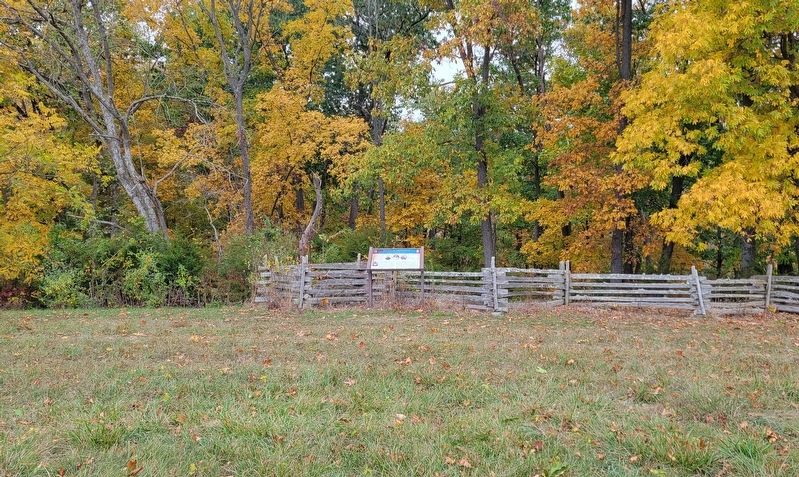
Location. 38° 20.742′ N, 78° 50.15′ W. Marker is near Port Republic, Virginia, in Rockingham County. Marker can be reached from Bowtie Drive, 0.2 miles north of Artillery Road, on the right when traveling north. Marker is located at the Cross Keys Battlefield Artillery Ridge Trail. Touch for map. Marker is at or near this postal address: 2000 Bowtie Drive, Port Republic VA 24471, United States of America. Touch for directions.
Other nearby markers. At least 8 other markers are within one mile of this marker, measured as the crow flies. To the Talbot Boys (within shouting distance of this marker); Cross Keys Battlefield (approx. 0.6 miles away); a different marker also named Battle of Cross Keys (approx. 0.6 miles away); a different marker also named The Battle of Cross Keys (approx. 0.9 miles away); a different marker also named Battle of Cross Keys (approx. 0.9 miles away); Cross Keys Cemetery (approx. 0.9 miles away); Mill Creek Church and Cemetery (approx. one mile away); Mill Creek Church (approx. one mile away). Touch for a list and map of all markers in Port Republic.
Credits. This page was last revised on October 20, 2023. It was originally submitted on October 20, 2023, by Bradley Owen of Morgantown, West Virginia. This page has been viewed 96 times since then and 34 times this year. Photos: 1, 2, 3. submitted on October 20, 2023, by Bradley Owen of Morgantown, West Virginia.


