Logan Township in Patterson in Wayne County, Missouri — The American Midwest (Upper Plains)
Fort Benton
A State Divided:The Civil War in Missouri
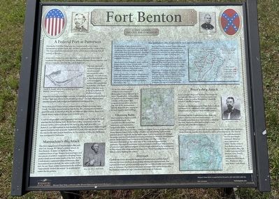
During the Civil War, Patterson, Mo., located south of the Union encampment at Pilot Knob, Mo., became a regular post for Union soldiers. The outpost at Patterson was part of the overall plan to maintain federal control of the area.
In late 1862, Union Gen. John Davidson took command of the Army of Southeast Missouri. He ordered Gen. William Plummer Benton and the 25th Missouri Infantry to fortify the post at Patterson.
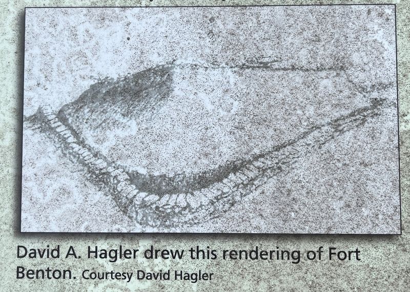
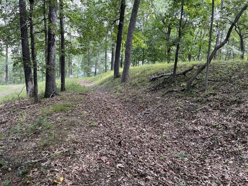
The 25th Missouri turned a church into a storehouse and surrounded it with a palisade. On a hill above it, they built Fort Benton, a 100-foot square, earthen fort surrounded by trenches. The inside walls of the fort were held up by timbers. It sheltered a buried magazine and supported light cannons. A Confederate major remarked that it looked "ugly and vicious on its elevated position." The 25th Missouri also improved roads, built bridges and established a telegraph line.
More than 7,000 Union troops camped north of Patterson along Camp Creek. The army moved south to Van Buren, Mo., leaving men behind to guard the post. In March of 1863, the 3rd Missouri State Militia, under Col. Edwin Smart, replaced the garrison's Federal units.
Confederate generals John Sappington Marmaduke and Sterling Price each attacked the fort during raids. By the end of 1864, companies of the 7th Kansas Cavalry manned the post. On April 15, 1865, eight days after Gen. Robert E. Lee surrendered at Appomattox, Va. the 7th Kansas Cavalry fought against bushwackers at nearby McKenzie's Creek. This was the last action of the war for the little post at Patterson. By the summer of 1865, the 7th Kansas was reassigned to Nebraska.
Marmaduke's 1863 Attack
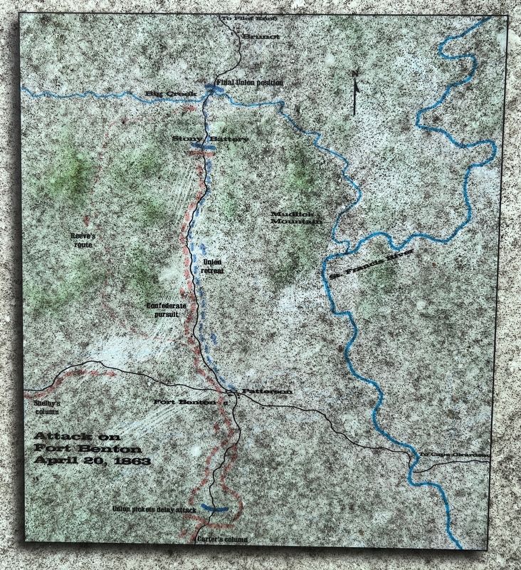
The first engagement of Marmaduke's 1863 raid was Col. George W. Carter's cavalry attack on Fort Benton. At dawn on April 20, 1863, a combined force of 450 Texans, local partisans and two pieces of artillery surprised a sleeping Union picket detail several miles south of the fort. As the Confederates continued toward Patterson, they encountered more pickets two miles south of the fort. As on Texas soldier commented, the artillery, "imprudently shelled the woods" in an attempt to scatter the few pickets.
At the fort, Smart had 400 soldiers ready to move if Marmaduke's army showed up in force. Tipped off by the booming of cannons in the distance, Smart reinforced the pickets and temporarily halted the attackers. The rest of the encampment quickly departed after setting fire to their supplies and buildings.
A Running Battle
The Union force headed north toward Pilot Knob. The Confederates discovered this movement and impulsively surged after them. A running battle
took place for seven miles ending at a rugged, narrow gorge known as Stoney Battery. Smart formed a line of battle and allowed the battered rear guard to pass to the front. As the battle raged, Union troops moved through the gorge, and the Confederate partisans circled to cut them off. Realizing the threat, Smart sent troops forward to the bridge over Big Creek. They reformed their lines on the other side of the creek and dispersed the partisans. The main Confederate forces retreated to Patterson with a number of prisoners and captured wagons. Union troops reported to the commander at Pilot Knob, who telegraphed his superiors, "Smart has fallen back to Stony Battery and is fighting like a hero."
Aftermath
Confederate losses during the engagement totaled about 25 wile Smart reported his losses at about 50, including missing and captured men. The captured men were quickly paroled except for the officers who were released later in Arkansas. Fort Benton was soon reoccupied by Union troops after Marmaduke's defeat at Cape Girardeau and escape to Arkansas.
Price's 1864 Attack
In late summer 1864, Gen. Sterling Price began his last raid into Missouri. Price's troops numbered nearly 12,000, including Marmaduke's and Col. Joseph O. Shelby's brigades.
On Sept. 22, Shelby approached Fort Benton which was manned by companies of the 47th Missouri
Infantry and 3rd Missouri State Militia Cavalry.
Knowing that the Confederates were close, the cavalry was mounted and ready to leave. A bystander noted that they "had horses saddled all the time, blankets rolled and buckled to their saddles, and arms all buckled on."
As the 3rd Missouri Cavalry left the post headed north, Shelby's men attacked them. Reacting quickly, they headed to safety at Fort Davidson. The men of the 47th abandoned the fort and fought eastward. About 30 were captured or killed. Shelby ordered Fort Benton burned. By November 1864, the Union reoccupied Fort Benton. Gen. Price's army was later defeated at Pilot Knob, Mo., Westport, Mo., and Mine Creek, Kans.
(Sidebar in upper right, shaded in light blue):
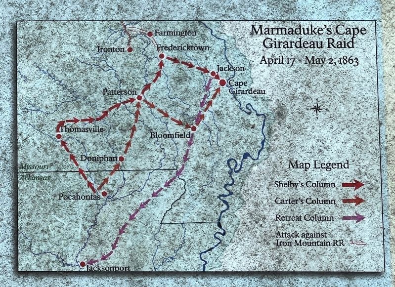
Marmaduke's 1863 Expedition to Cape Girardeau
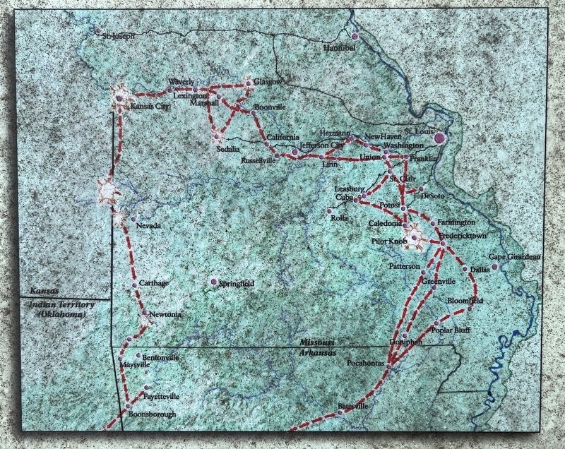
In the spring of 1863, Federal forces threatened the Confederate strongholds of Vicksburg, Miss. and Little Rock, Ark. As a distraction, Brig. Gen. Marmaduke marched from Arkansas with his cavalry division to destroy federal facilities and supplies in southeast Missouri.
Marmaduke's four brigades, under colonels Joseph Shelby, colton Greene, John Burbridge, and George W. Carter, contained 10 pieces of artillery and about 5,000 Missouri, Arkansas and Texas cavalry.
Entering Missouri on April 19, Marmaduke's army split into two columns commanded
by Carter and Shelby. Carter's column seized Fort Benton on April 20 and continued to Bloomfield, Mo.
Brig. Gen. John H. McNeil, Union commander of the District of Southeast Missouri was stationed at Bloomfield with 2,000 federal troops. He learned of the approaching army and retreated to Cape Girardeau, Mo.
In the meantime, Marmaduke went with Shelby's column to attack the Iron Mountain Railroad. They waited at Fredericktown, Mo., until April 25, and then marched on to Cape Girardeau to meet up with Carter's column.
Since Cape Girardeau was strongly defended, Marmaduke withdrew to Jackson, Mo., on April 26. He left Shelby's brigade to create a diversion, which escalated into the four hour battle of Cape Girardeau. Union troops pursued Marmaduke, who escaped into Arkansas. His raid accomplished little.
Topics. This historical marker is listed in this topic list: War, US Civil. A significant historical month for this entry is March 1863.
Location. 37° 11.143′ N, 90° 33.235′ W. Marker is in Patterson, Missouri, in Wayne County. It is in Logan Township. Marker is on Wayne County 312B, on the right when traveling south. The parking area for Fort Benton, and the marker, is located just south of the Patterson Cemetery. From the parking area, the fort location is about 1/4 mile walk up the service road. Touch for map. Marker is in this post office area: Patterson MO 63956, United States of America. Touch for directions.
Other nearby markers. At least
8 other markers are within 8 miles of this marker, measured as the crow flies. Greenville Bike Trail - Greenville Trailhead (approx. 7 miles away); World War I Memorial (approx. 7 miles away); Wayne County Veterans Memorial (approx. 7 miles away); Wayne County (approx. 7 miles away); The Civil War in the Missouri - Arkansas Borderlands, 1862-1865 (approx. 7˝ miles away); The Upper Greenville Bridge, 1906-1947 (approx. 7˝ miles away); The "Surprise at Greenville," July 20, 1862 (approx. 7˝ miles away); Greenville School (approx. 7.9 miles away).
Also see . . .
1. Fort Benton. National Register documentation for the fort. (Submitted on October 28, 2023, by Craig Swain of Leesburg, Virginia.)
2. Fort Benton. An article detailing the history of Fort Benton. (Submitted on October 28, 2023, by Craig Swain of Leesburg, Virginia.)
Credits. This page was last revised on October 28, 2023. It was originally submitted on October 21, 2023, by Craig Swain of Leesburg, Virginia. This page has been viewed 90 times since then and 48 times this year. Photos: 1. submitted on October 21, 2023, by Craig Swain of Leesburg, Virginia. 2, 3, 4, 5, 6. submitted on October 28, 2023, by Craig Swain of Leesburg, Virginia.
