Near Scituate in Plymouth County, Massachusetts — The American Northeast (New England)
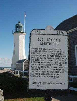
Old Scituate Lighthouse
Erected 1976 by Scituate Historical Society.
Topics and series. This historical marker is listed in these topic lists: Landmarks • Military • War of 1812. In addition, it is included in the Lighthouses series list. A significant historical year for this entry is 1810.
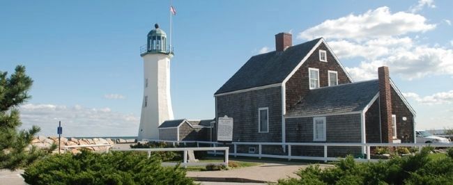
Location. 42° 12.296′ N, 70° 42.969′ W. Marker is near Scituate, Massachusetts, in Plymouth County. Marker is on Lighthouse Road. Marker is on the lighthouse grounds, roughly 100 feet northwest of the lighthouse itself. The lighthouse is at Cedar Point, on the north side of the entrance to Scituate harbor and 20 miles southeast of Boston, Massachusetts. Touch for map. Marker is in this post office area: Scituate MA 02066, United States of America. Touch for directions.
Other nearby markers. At least 8 other markers are within 2 miles of this marker, measured as the crow flies. The Italian Freighter Etrusco (within shouting distance of this marker); “Don’t Give Up The Ship” (within shouting distance of this marker); Williams-Barker House (approx. half a mile away); Satuit Brook (approx. one mile away); Men of Kent Cemetery (approx. 1.3 miles away); First Meeting House (approx. 1.3 miles away); Site of the First Church (approx. 1.3 miles away); First Training Field (approx. 1.4 miles away). Touch for a list and map of all markers in Scituate.
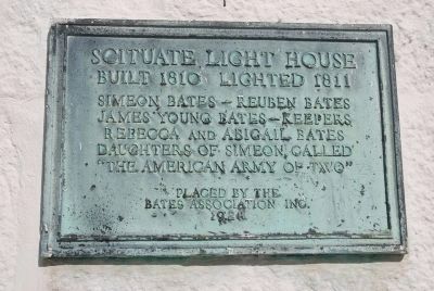
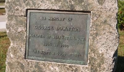
Regarding Old Scituate Lighthouse. A bronze plaque (photo 3), affixed to a stone near the foot of the marker, honors a recent lighthouse keeper. Two others are mounted on the base of the lighthouse itself. One is a generic plaque (not pictured) of the National Register of Historic Places. The other (photo 2) dates from 1928 and carries information similar to that on the main marker.
Credits. This page was last revised on November 2, 2020. It was originally submitted on October 20, 2009, by Roger W. Sinnott of Chelmsford, Massachusetts. This page has been viewed 1,618 times since then and 15 times this year. Photos: 1, 2, 3, 4. submitted on October 20, 2009, by Roger W. Sinnott of Chelmsford, Massachusetts. • Kevin W. was the editor who published this page.


