Middletown in Frederick County, Virginia — The American South (Mid-Atlantic)
Eve of Battle
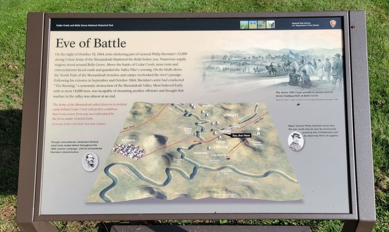
On the night of October 18, 1864, tents sheltering part of General Philip Sheridan's 32,000 strong Union Army of the Shenandoah blanketed the fields before you. Numerous supply wagons stood around Belle Grove. Above the banks of Cedar Creek, more tents and entrenchments faced south and guarded the Valley Pike's crossing. On the bluffs above the North Fork of the Shenandoah trenches and camps overlooked the river's passage. Following his victories in September and October 1864, Sheridan's army had conducted “The Burning,” a systematic destruction of the Shenandoah Valley. Most believed Early, with at most 14,000 men, was incapable of mounting another offensive and thought that warfare in the valley was almost at an end.
The Army of the Shenandoah settled down in its fortified camp behind Cedar Creek with perfect confidence that it was secure from any successful attack by the forces under General Early.
A veteran of the 121st New York State Infantry
(Captions):
Though outnumbered, Lieutenant General Jubal Early eluded defeat throughout the 1864 summer campaign, until he encountered Sheridan's determination.
The Union 19th Corps parade in review before Union headquarters at Belle Grove.
Sketch by James E. Taylor, an artist for Frank Leslie's Illustrated Newspaper, 1864
Major General Philip Sheridan knew that the war could only be won by tenaciously pursuing the Confederates and by depriving them of supplies.
Erected by National Park Service, United States Department of the Interior.
Topics. This historical marker is listed in this topic list: War, US Civil. A significant historical date for this entry is October 18, 1864.
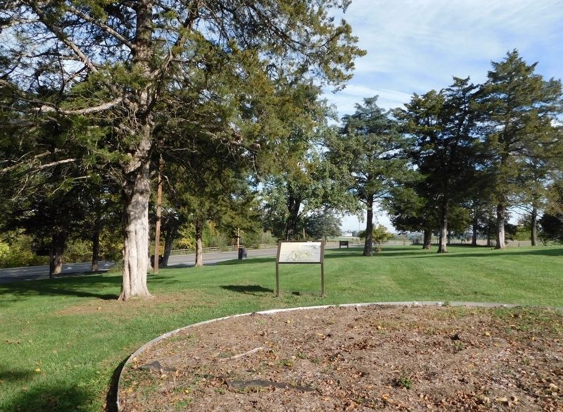
Location. 39° 0.698′ N, 78° 18.312′ W. Marker is in Middletown, Virginia, in Frederick County. Marker is on Valley Pike (U.S. 11) 0.4 miles north of Water Plant Road, on the right when traveling north. Marker is located on the north side of the Morning Attack Trails parking area. Touch for map. Marker is at or near this postal address: 8693 Valley Pike, Middletown VA 22645, United States of America. Touch for directions.
Other nearby markers. At least 8 other markers are within walking distance of this marker. Slowing the Advance (within shouting distance of this marker); The Shenandoah Valley / Battle of Cedar Creek, October 19, 1864 (within shouting distance of this marker); Stand of the Eighth Vermont (about 600 feet away, measured in a direct line); Cedar Creek (about 600 feet away); Signal Knob During the Civil War (approx. 0.2 miles away); a different marker also named Eve of Battle (approx. 0.2 miles away); Battle of Cedar Creek (approx. 0.2 miles away); South Carolina Troops at Cedar Creek (approx. ¼ mile away). Touch for a list and map of all markers in Middletown.
Credits. This page was last revised on October 22, 2023. It was originally submitted on October 22, 2023, by Bradley Owen of Morgantown, West Virginia. This page has been viewed 66 times since then and 20 times this year. Photos: 1, 2. submitted on October 22, 2023, by Bradley Owen of Morgantown, West Virginia.

