Canton in Haywood County, North Carolina — The American South (South Atlantic)
The Canton Area History Museum

Photographed by Tom Bosse, October 21, 2023
1. The Canton Area History Museum Marker
William B. Umstead, North Carolina's then governor along with various Champion Paper officials, including Reuben B. Robertson, company chairman of the board were present and participated in the dedication.
The hand painted mural by nature artist Joy Postle forms a surrounding border on the first floor. She was commissioned by the Robertson family. In later years, an addition was added to house the ever expanding children's section. For a season, a portion of the basement floor housed the local health department. In 1990, when the library was moved to a new location, this became the home of the Canton Area History Museum.
Topics. This historical marker is listed in this topic list: Notable Buildings. A significant historical year for this entry is 1954.
Location. 35° 31.966′ N, 82° 50.369′ W. Marker is in Canton, North Carolina, in Haywood County. It is on Park Street, on the left when traveling east. Touch for map. Marker
this page online

Regionally, this marker is in the Mountains, specifically in Greater Asheville, and in the Great Smoky Mountains. It is also in the American South, specifically in the Upper South, in Appalachia, and specifically in Southern Appalachia. Globally, it is in North America, the Western Hemisphere, the Western World, and the Anglosphere. Historically, it finds itself in what was once the original Cherokee Nation, the territory of the Mississippian Culture, one of the original Thirteen Colonies, one of the Confederate States of America, and the Antebellum South.
Other nearby markers. At least 8 other markers are within 4 miles of this marker, measured as the crow flies: Haywood County World War II Monument (a few steps from this marker); Morning Star Church (within shouting distance of this marker); Colonial Theatre (within shouting distance of this marker); Arnold Guyot (approx. ¼ mile away); Locust Field Cemetery (approx. 0.4 miles away); Rutherford Trace (approx. 1.6 miles away); Garden Creek (approx. 1.7
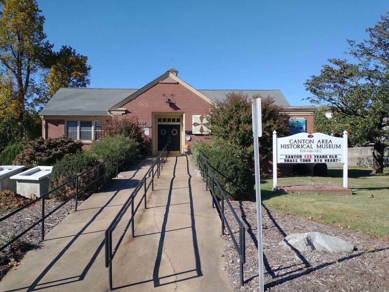
Photographed by Tom Bosse, October 21, 2023
2. The Canton Area History Museum Marker
Credits. This page was last revised on October 31, 2023. It was originally submitted on October 23, 2023, by Tom Bosse of Jefferson City, Tennessee. This page has been viewed 254 times since then and 31 times this year. Photos: 1, 2. submitted on October 23, 2023, by Tom Bosse of Jefferson City, Tennessee. • Andrew Ruppenstein was the editor who published this page.
