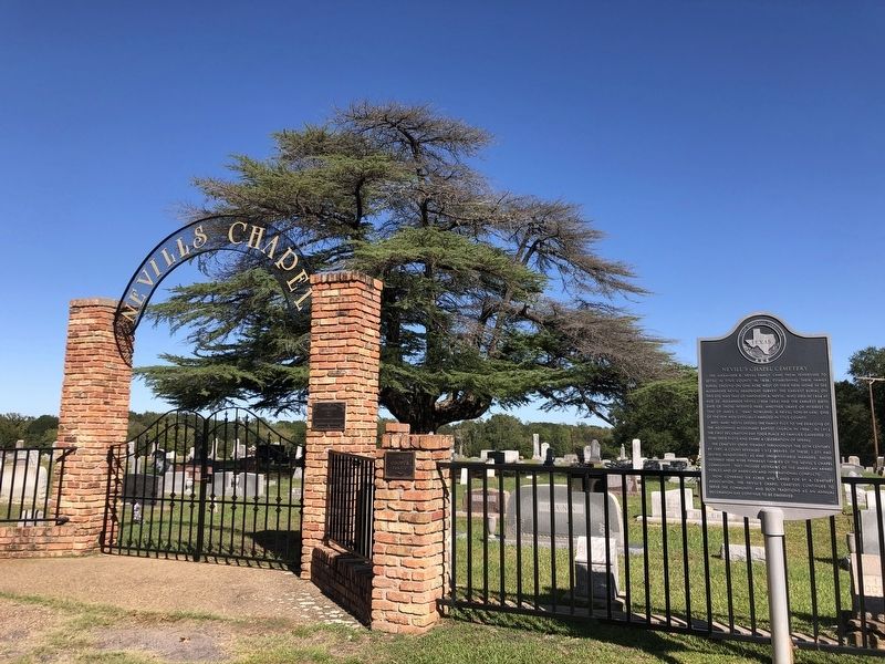
Near Mount Pleasant in Titus County, Texas — The American South (West South Central)
Nevill's Chapel Cemetery
Mrs. Mary Nevill deeded the family plot to the deacons of the adjoining Missionary Baptist Church in 1906. In 1913 the first decoration day took place as families gathered to tend their plots and share a celebration of spring.
The cemetery grew steadily throughout the 20th century. By 1997, a count revealed 1,113 graves. Of these, 1,071 had legible headstones; 42 had unidentifiable markers. Those interred here were primarily families of the Nevill's Chapel community. They include veterans of the American Armed Forces and of American and international conflicts.
Now covering six acres and cared for by a cemetery association, the Nevill's Chapel Cemetery continues to serve the community, and such traditions as an annual dedication day continue to be observed.
Erected 1998 by Texas Historical Commission. (Marker Number 12227.)
Topics. This historical marker is listed in these topic lists: Cemeteries & Burial Sites • Settlements & Settlers. A significant historical year for this entry is 1854.
Location. 33° 11.65′ N, 94° 57.397′ W. Marker is near Mount Pleasant, Texas, in Titus County. Marker is at the intersection of County Road 3210 and County Road 3205, on the right when traveling west on County Road 3210. Touch for map. Marker is at or near this postal address: 113 Co Rd 3210, Mount Pleasant TX 75455, United States of America. Touch for directions.
Other nearby markers. At least 8 other markers are within 10 miles of this marker, measured as the crow flies. First Presbyterian Church of Mt. Pleasant (approx. 2˝ miles away); Titus County C.S.A. (approx. 2.7 miles away); Titus County Confederate Monument (approx. 2.7 miles away); Henry Clay Thruston (approx. 2.7 miles away); Dellwood Park (approx. 3.4 miles away); Titus County (approx. 7.6 miles away); Caddo Indian Communities in the Cypress Creek Drainage (approx. 7.9 miles away); Winfield Cemetery Veterans Memorial (approx. 9.3 miles away). Touch for a list and map of all markers in Mount Pleasant.
Also see . . . Nevills Chapel Cemetery. Find a Grave entry on the burial ground. (Submitted on October 25, 2023, by Duane and Tracy Marsteller of Murfreesboro, Tennessee.)
Credits. This page was last revised on October 25, 2023. It was originally submitted on October 25, 2023, by Duane and Tracy Marsteller of Murfreesboro, Tennessee. This page has been viewed 113 times since then and 69 times this year. Photos: 1, 2. submitted on October 25, 2023, by Duane and Tracy Marsteller of Murfreesboro, Tennessee.

