Washburn in McLean County, North Dakota — The American Midwest (Upper Plains)
Ferry Boats on the Missouri
— Washburn Discovery Trail/Lewis & Clark Legacy Trail —
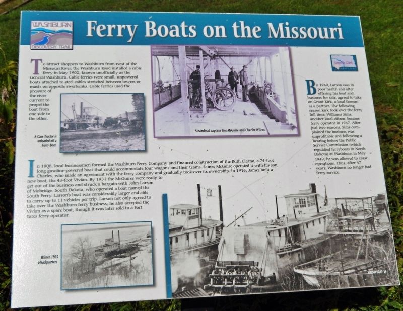
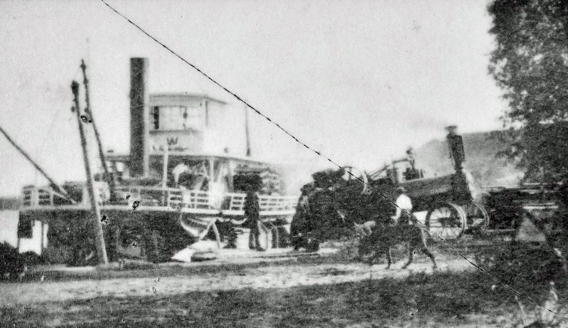
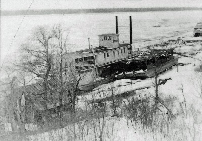
To attract shoppers to Washburn from west of the Missouri River, the Washburn Road installed a cable ferry in May 1902, known unofficially as the General Washburn. Cable ferries were small, unpowered boats attached to steel cables stretched between towers or masts on opposite riverbanks. Cable ferries used the pressure of the river current to propel the boat from one side to the other.
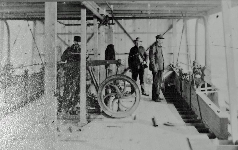
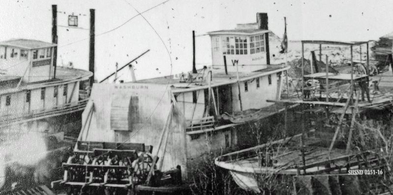
In 1908, local businessmen formed the Washburn Ferry Company and financed construction of the Ruth Clarno, a 74-foot long gasoline-powered boat that could accommodate four wagons and their teams. James McGuire operated it with his son, Charles, who made an agreement with the ferry company and gradually took over its ownership. In 1916, James built a new boat, the 43-foot Vivian. By 1931 the McGuires were ready to get out of the business and struck a bargain with John Larson of Mobridge, South Dakota, who operated a boat named the South Ferry. Larson's boat was considerably larger and able to carry up to 11 vehicles per trip. Larson not only agreed to take over the Washburn ferry business, he also accepted the Vivian as a spare boat, though it was later sold to a Fort Yates ferry operator.
By 1940, Larson was in poor health and after offering his boat and business for sale, agreed to take on Grant Kirk, a local farmer, as a partner. The following season Kirk took over the ferry full time. Williams Sims, another local citizen, became ferry operator in 1947. After just two seasons, Sims complained the business was unprofitable and following a hearing before the Public Service Commission (which regulated ferryboats in North Dakota) at Washburn in May 1949, he was allowed to cease operations. Thus, after 47 years, Washburn no longer had ferry service.
Erected by Washburn Discovery Trail.
Topics. This historical marker is listed in these topic lists: Industry & Commerce • Waterways & Vessels. A significant historical month for this entry is May 1902.
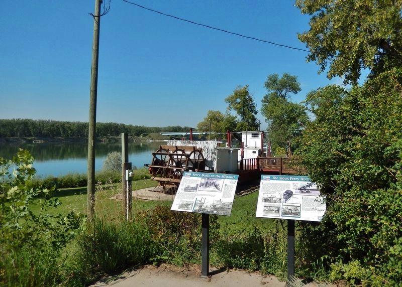
Location. 47° 17.289′ N, 101° 2.112′ W. Marker is in Washburn, North Dakota, in McLean County. Marker is on Boat Ramp Road just west of 1st Avenue, on the left when traveling west. The marker is located along the Washburn Discovery Trail, in Riverside Park, overlooking the Missouri River. Touch for map. Marker is in this post office area: Washburn ND 58577, United States of America. Touch for directions.
Other nearby markers. At least 8 other markers are within walking distance of this marker. The Sioux Ferry Boat (here, next to this marker); Sioux (within shouting distance of this marker); River Boats on the Missouri (approx. 0.2 miles away); Walter R. Hjelle Bridge (approx. ¼ mile away); Nettle Creek Country School (approx. 0.3 miles away); Soo Line Railroad & Depot (approx. 0.3 miles away); Taylor Cabin (approx. half a mile away); The Washburn Plant (approx. half a mile away). Touch for a list and map of all markers in Washburn.
Related markers. Click here for a list of markers that are related to this marker. Washburn Discovery Trail
Also see . . .
1. James McGuire (Find A Grave). Excerpt:
(Underwood Cemetery, Underwood, North Dakota)(Submitted on October 27, 2023, by Cosmos Mariner of Cape Canaveral, Florida.)
In 1901 Captain James McGuire came to Washburn in the employment of the Washburn Company. At the turn of the century, Washburn was one of the last stops for riverboats traveling from St. Louis, Missouri. The boats exchanged grocery and hardware materials for buffalo hides, furs, and grains. At that time, the Missouri River, which was open for traffic seven and a half months of the year, was known for currents so strong that it took two weeks to travel the approximately 800 miles upstream and four days to go downstream. Some of the other problems encountered were shifting channels, sandbar, varying water levels, and ice.
2. Charles Henry McGuire (Find A Grave). Excerpt:
(Saint Marys Cemetery, Bismarck, North Dakota)(Submitted on October 27, 2023, by Cosmos Mariner of Cape Canaveral, Florida.)
In 1909, Charles and Josephine came to Washburn, North Dakota where Charles took charge of the ferry, the Ruth Clarno, which his father, Capt. James McGuire had been operating for the Washburn Ferry Co. Ferry boating was at its peak as a means for grain transportation. According to a newspaper article, Josephine said: "Sometimes there used to be as many as 25 to 30 grain wagons lined up on the west bank of the river, waiting to be ferried across to Washburn." The ferry also transported horses, autos and people from bank to bank. Some of the Missouri boats that he and his father built were the Washburn, the Marion, and the Vivian.
Credits. This page was last revised on October 27, 2023. It was originally submitted on October 27, 2023, by Cosmos Mariner of Cape Canaveral, Florida. This page has been viewed 59 times since then and 13 times this year. Photos: 1, 2, 3, 4, 5, 6. submitted on October 27, 2023, by Cosmos Mariner of Cape Canaveral, Florida.
