Washburn in McLean County, North Dakota — The American Midwest (Upper Plains)
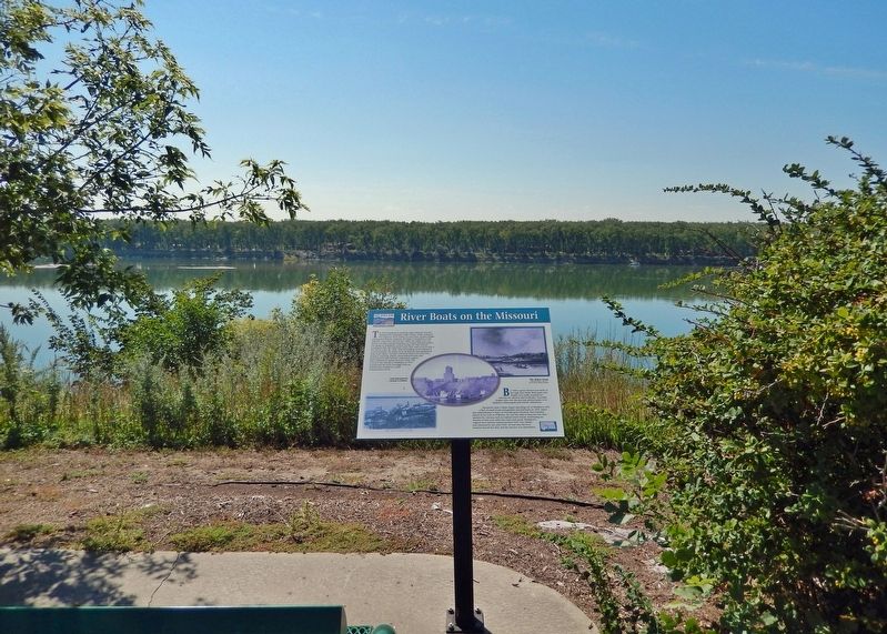
River Boats on the Missouri
— Washburn Discovery Trail/Lewis & Clark Legacy Trail —
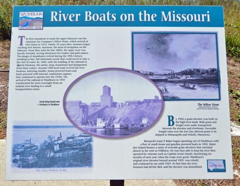
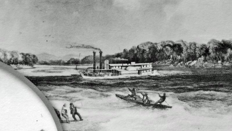
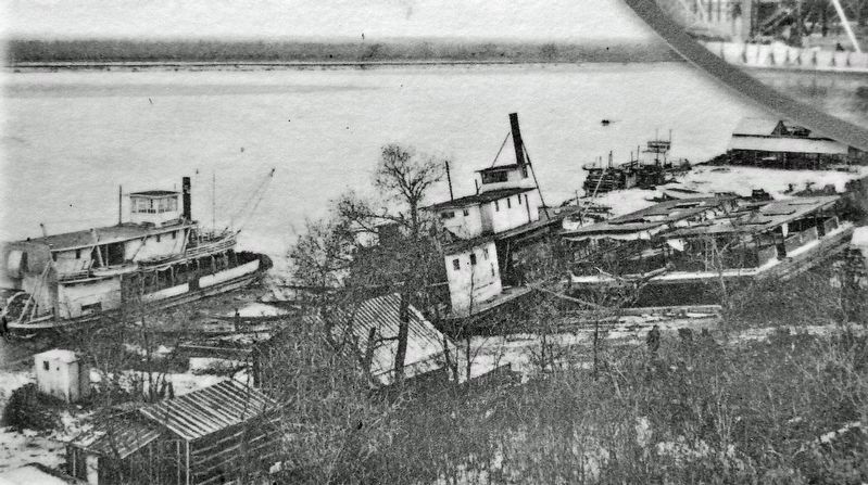
The first steamboat to reach the upper Missouri was the American Fur Company's Yellow Stone, which arrived at Fort Union in 1832. Nearly 30 years later, steamers began reaching Fort Benton, Montana, the head of navigation on the Missouri. From then until the late 1880s, the upper river was heavily traveled, serving Montana's fur traders and gold miners. The design of steamboats evolved during the 19th Century, resulting in fast, flat-bottomed vessels that could travel in only a few feet of water. By 1888, with the building of the railroad to central Montana, the earlier, large steamboats had disappeared from these waters. Around 1900 local trade revived the river business, featuring smaller, steam-powered boats and boats powered with internal combustion engines; they continued to operate into the 1930s. The arrival of the railroad at Washburn in 1901 transformed the town overnight from an isolated river landing to a small transportation center.
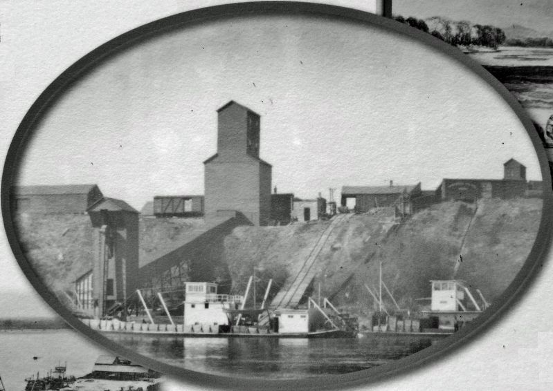
By 1902 a grain elevator was built on the high river bank. Bulk grain and freight were easily transported between the elevator and riverboats. Favorable freight rates over the Soo Line allowed grain to be shipped to Minneapolis and Duluth, Minnesota.
Bismarck's Isaac P. Baker began operating out of Washburn with a fleet of small steam and gasoline powered boats in 1902. Baker also helped finance a series of riverside grain elevators that extended almost as far west as Williston. He was thus able to keep his river fleet, operated by veterans such as Captain Grant Marsh, functioning six months of each year when the crops were good. Washburn's original river elevator burned around 1905, was rebuilt, and continued in use until 1929. At that time the river business had all but died, and the elevator was demolished.
Erected by Washburn Discovery Trail.
Topics. This historical marker is listed in these topic lists: Industry & Commerce • Railroads & Streetcars • Waterways & Vessels. A significant historical year for this entry is 1832.
Location. 47° 17.186′ N, 101° 1.882′ W. Marker is in Washburn, North Dakota, in McLean County. Marker can be reached from the intersection of 8th Street and 1st Avenue when traveling south. The marker is located along the Washburn Discovery Trail, just east of the Washburn North Dakota Dog Park. Access to the marker is via the trail, on bicycle or foot. Touch for map. Marker is at or near this postal address: 45 8th Street, Washburn ND 58577, United States of America. Touch for directions.
Other nearby markers. At least 8 other markers are within walking distance of this marker. Soo Line Railroad & Depot (about 600 feet away, measured in a direct line); Ferry Boats on the Missouri (approx. 0.2 miles away); The Sioux Ferry Boat (approx. 0.2 miles away); Sioux (approx. ¼ mile away); Taylor Cabin (approx. 0.3 miles away); Walter R. Hjelle Bridge (approx. half a mile away); Nettle Creek Country School (approx. half a mile away); The Washburn Plant (approx. 0.7 miles away). Touch for a list and map of all markers in Washburn.
Related markers. Click here for a list of markers that are related to this marker. Washburn Discovery Trail
Also see . . . History of Washburn. Excerpt:
Until 1898, Washburn was one of the last stops for riverboats traveling from St. Louis, Missouri. The boats exchanged grocery and hardware materials for buffalo hides, furs and grains. At that time, the Missouri River, which was open for traffic seven and a half months of the year, was known for currents so strong that it took two weeks to travel the approximately 800 miles upstream and four days to go downstream. Coupled with shifting channels, sandbars, varying water stages and limited variety of downstream cargo, the economic and physical problems of steam boating were great. The river was still the best method of travel and at one time 40 boats plied the river with about 1,200 men working on or for them.(Submitted on October 28, 2023, by Cosmos Mariner of Cape Canaveral, Florida.)
Credits. This page was last revised on October 28, 2023. It was originally submitted on October 27, 2023, by Cosmos Mariner of Cape Canaveral, Florida. This page has been viewed 56 times since then and 15 times this year. Photos: 1, 2, 3, 4, 5. submitted on October 28, 2023, by Cosmos Mariner of Cape Canaveral, Florida.
