Atlantic Beach in Horry County, South Carolina — The American South (South Atlantic)
Atlantic Beach
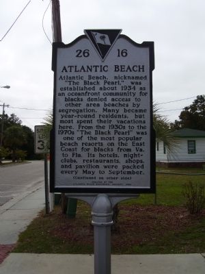
Atlantic Beach, nicknamed "The Black Pearl," was established about 1934 as an oceanfront community for blacks denied access to other area beaches by segregation. Many became year-round residents, but most spent their vacations here. From the 1930s to the 1970s "The Black Pearl" was one of the most popular beach resorts on the East Coast for blacks from Va. to Fla. Its hotels, nights-clubs, restaurants, shops, and pavilion were packed every May to September.
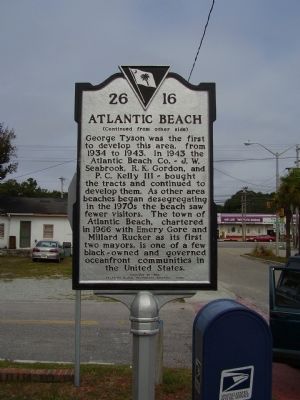
George Tyson was the first to develop this area, from 1934 to 1943. In 1943 the Atlantic Beach Co.- J.W. Seabrook, R.K.Gordon, and P.C.Kelly III-bought the tracts and continued to develop them. As other area beaches began desegregating in the 1970s the beach saw fewer visitors. The town of Atlantic Beach, chartered in 1966 with Emery Gore and Millard Rucker as its first two mayors, is one of a few black-owned and governed oceanfront communities in the United States.
Erected 2005 by Atlantic Beach Historical Society. (Marker Number 26-16.)
Topics. This historical marker is listed in these topic lists: African Americans • Notable Places. A significant historical year for this entry is 1934.
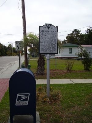
Location. 33° 48.323′ N, 78° 43.101′ W. Marker is in Atlantic Beach, South Carolina, in Horry County. Marker is at the intersection of 30th Avenue South and South 3rd Street on 30th Avenue South. Touch for map. Marker is at or near this postal address: 911 30th Ave S, North Myrtle Beach SC 29582, United States of America. Touch for directions.
Other nearby markers. At least 8 other markers are within 10 miles of this marker, measured as the crow flies. Roberts Pavilion / Ocean Drive Pavilion (approx. 2.8 miles away); Washington's Southern Tour (approx. 3.6 miles away); Chestnut Consolidated School (approx. 4 miles away); Fort Randall (approx. 4.6 miles away); Sonny’s Pavilion (approx. 4.6 miles away); Rebecca Randall Bryan (approx. 7.8 miles away); Rev. George Whitefield (approx. 7.8 miles away); Boundary House (approx. 9.3 miles away).
Credits. This page was last revised on October 6, 2021. It was originally submitted on October 21, 2009, by Stanley and Terrie Howard of Greer, South Carolina. This page has been viewed 1,960 times since then and 50 times this year. Photos: 1, 2, 3. submitted on October 21, 2009, by Stanley and Terrie Howard of Greer, South Carolina. • Kevin W. was the editor who published this page.


