Rowlesburg in Preston County, West Virginia — The American South (Appalachia)
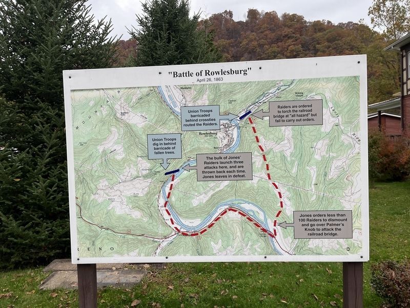
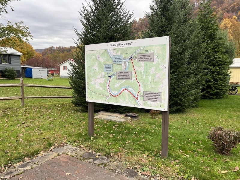
"Battle of Rowlesburg"
April 26, 1863
Union Troops barricaded behind crossties routed the Raiders.
Raiders are ordered to torch the railroad bridge at "all hazard" but fail to carry out orders.
Union Troops dig behind barricade of fallen trees.
The bulk of Jones' Raiders launch three attacks here, and are thrown back each time. Jones leaves in defeat.
Jones orders less than 100 Raiders to dismount and go over to Palmer's Knob to attack the railroad bridge.
Topics. This historical marker is listed in these topic lists: Railroads & Streetcars • War, US Civil. A significant historical date for this entry is April 26, 1863.
Location. 39° 20.88′ N, 79° 40.114′ W. Marker is in Rowlesburg, West Virginia, in Preston County. Marker is on East Main Street just west of North Diamond Street, on the right when traveling west. Touch for map. Marker is at or near this postal address: 43 E Main St, Rowlesburg WV 26425, United States of America. Touch for directions.
Other nearby markers. At least 8 other markers are within walking distance of this marker. The 1841 Mountain Howitzer, thought to be the type used in Rowlesburg during the Civil War (here, next to this marker); a different marker also named Battle of Rowlesburg (here, next to this marker); a different marker also named Battle of Rowlesburg (here, next to this marker); Rowlesburg Area Honor Roll (within shouting distance of this marker); 34 South Church Street (about 300 feet away, measured in a direct line); 32 South Church Street (about 300 feet away); Rowlesburg Post Office Postmasters (about 400 feet away); Rowlesburg School (about 600 feet away). Touch for a list and map of all markers in Rowlesburg.
Credits. This page was last revised on October 28, 2023. It was originally submitted on October 28, 2023, by Devry Becker Jones of Washington, District of Columbia. This page has been viewed 50 times since then and 10 times this year. Photos: 1, 2. submitted on October 28, 2023, by Devry Becker Jones of Washington, District of Columbia.

