South Los Angeles in Los Angeles County, California — The American West (Pacific Coastal)
The Crenshaw Corridor
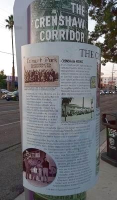
Crenshaw Rising
The Crenshaw/LAX light rail line, the fifth line built by Metro, is a public transportation milestone in that it finally connects light rail riders to the city's major airport. But it is also significant because it officially recognizes the Crenshaw district's central location in Los Angeles (it is roughly equidistant from the Westside, downtown, and mid-city/Hollywood), as well as its status as a one of the city's most significant cultural hubs. The area encompassing Baldwin Hills, Windsor Hills, View Park, and Leimert Park began in the early 1900s as a collection of leafy, white-only neighborhoods. Leimert Park, created in 1927 by developer Walter H. Leimert, was considered a complete lifestyle development that boasted its own small park, shopping area, and Art Deco movie theater that fronted a park on what is now 43rd Place. The boulevard running through the heart of the district was named in 1904 for banker and real estate developer George (unreadable) Crenshaw, between Washington and Venice Boulevards) is also named.
Like so many areas of Los Angeles, the demographics of Crenshaw shifted dramatically after racial housing covenants fell in the 1940s, followed by urban unrest in the 1960s. Blacks largely replaced whites, and by the 1980s, Crenshaw was firmly established as the (unreadable), economic, and civic nerve center of black Los Angeles, while Leimert Park flourished as an arts enclave that was home to galleries, restaurants, museums, jazz spots, media centers, theaters, gift shops, and bookstores. Despite this, Crenshaw was not exactly seen as a desirable destination. The 1992 unrest, with its fires and images of conflict in the streets, did nothing new to bolster its profile, and by the 2000s, it had fallen into a kind of isolation - well-known, but not well-traveled by the majority of Los Angeles residents, to say nothing of tourists.
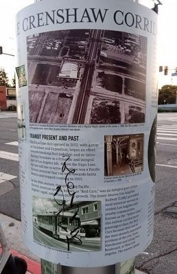
Transit Present and Past
The Expo Line that opened in 2012, with a stop at Crenshaw and Exposition, began an effort towards breaking that isolation and re-introducing Crenshaw as a dynamic and integral part of Los Angeles life. Before the Expo Line, the last rail line to serve Crenshaw was a Pacific Electric streetcar that ran west towards Santa Monica and stopped running in 1953.
In the 20th century, the sprawling Pacific Electric streetcar system, known as "Red Cars," was an integral part of Los Angeles' rapid, suburban-driven growth. The lesser-known Los Angeles Railway (LARy) provided local streetcar service in central Los Angeles and nearby communities. Known as the "Yellow Cars," this railway carried more passengers than the Red Cars because they ran in the most densely populated portions of the city, from Hawthorne and along Pico Boulevard, to West Los Angeles. The narrow-gauge Yellow Cars operated until the end of rail service in 1963. The county public transportation system at the time, known as the MTA (not related to Metro) was reorganized and relaunched as the Southern California Rapid Transit District in 1964.
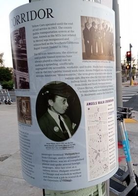
For African Americans, the streetcar and public transit systems have always played a crucial role in making a sprawling, unofficially segregated city accessible, workable, and livable. Blacks have also played a key role in the city's public transit work force. Arcola Philpott was the city's first African American "Motormanette," the term given to women who drove the railway cars. She was also the first black drive the railway hired. She drove the Yellow Car F Line from 116th and South Vermont Avenue to Union Station, which traveled up Vermont to Santa Barbara (now Martin Luther King Jr. Boulevard), and to the Union Station passenger terminal. Philpott was from Chicago, and in addition to being a driver, was an accomplished pianist and spoke several foreign languages. After her stint as a railway driver, Philpott returned to Chicago and worked in welfare and then took a job in research at the University of Chicago.
Erected 2018 by City of Los Angeles.
Topics. This historical marker is listed in these topic lists: African Americans • Railroads & Streetcars • Women. A significant historical year for this entry is 1927.
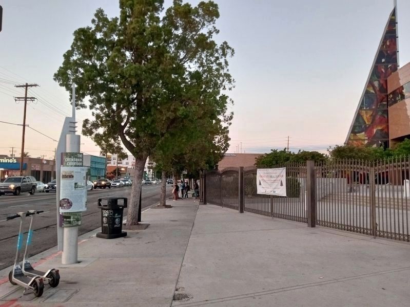
Location. 34° 1.367′ N, 118° 20.099′ W. Marker is in Los Angeles, California, in Los Angeles County. It is in South Los Angeles. Marker is at the intersection of West Exposition Boulevard and Crenshaw Boulevard, on the left when traveling east on West Exposition Boulevard. Touch for map. Marker is at or near this postal address: 3428 W Exposition Blvd, Los Angeles CA 90018, United States of America. Touch for directions.
Other nearby markers. At least 8 other markers are within walking distance of this marker. West Angeles Church (about 300 feet away, measured in a direct line); Pacific Electric (about 400 feet away); Holiday Bowl (approx. ¼ mile away); Los Angeles Sentinel (approx. 0.4 miles away); Crenshaw Square (approx. half a mile away); Tom Bradley (approx. 0.6 miles away); Crenshaw Plaza (approx. ¾ mile away); Guasti Villa (approx. one mile away). Touch for a list and map of all markers in Los Angeles.
Also see . . . Angels Walk L.A. Self-guided walking tours of historic neighborhoods in Los Angeles. This marker is part of the Crenshaw walk. (Submitted on October 30, 2023.)
Credits. This page was last revised on December 11, 2023. It was originally submitted on October 29, 2023, by Jason Voigt of Glen Carbon, Illinois. This page has been viewed 72 times since then and 28 times this year. Photos: 1, 2, 3, 4. submitted on October 29, 2023, by Jason Voigt of Glen Carbon, Illinois.


