Fort Gratiot in St. Clair County, Michigan — The American Midwest (Great Lakes)
What Lies Beneath
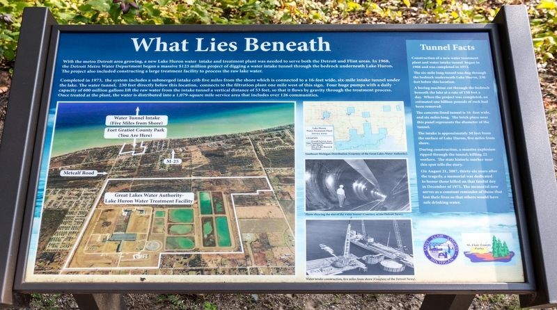
With the metro Detrolit area growing, a new Lake Huron water intake and treatment plant was needed to serve both the Detroit and Flint areas. In 1968, the Detroit Metro Water Department began a massive $125 million project of digging a water intake tunnel through the bedrock underneath Lake Huron. The project also included constructing a large treatment facility to process the raw lake water.
Completed in 1973, the system includes a submerged intake crib five miles from the shore which is connected to a 16-feet wide, six-mile intake tunnel under the lake. The water tunnel, 230 feet directly below this location, connects to the filtration plant one mile west of this sign. Four huge pumps with a daily capacity of 600 million gallons lift the raw water from the intake tunnel a vertical distance of 53 feet, so that it flows by gravity through the treatment process. Once treated at the plant, the water is distributed into a 1,079-square mile service area that includes over 126 communities.
Tunnel Facts.
• Construction of a new water treatment plant and water intake tunnel began in 1968 and was completed in 1973.
• The six-mile long tunnel was dug through the bedrock underneath Lake Huron, 230 feet below this location.
• A boring machine cut through the bedrock beneath the lake at a rate of 150 feet a day. When the project was completed, an estimated one billion pounds of rock had been removed.
• The concrete lined tunnel is 16 -feet wide, and six miles long. The brick plaza near this panel represents the diameter of the tunnel.
• The intake is approximately 50 feet from the surface of Lake Huron, five miles from shore.
• During construction, a massive explosion ripped through the tunnel, killing 22 workers. The state historic marker near this spot tells the story.
• On August 21, 2007, thirty-six years after the tragedy, a memorial was dedicated to honor those killed on that fateful day in December of 1971. The memorial now serves as a constant reminder of those that lost their lives so that others would have safe drinking water.
Erected by Saint Clair County Michigan, and St. Clair County Parks.
Topics. This historical marker is listed in these topic lists: Industry & Commerce • Man-Made Features. A significant historical year for this entry is 1968.
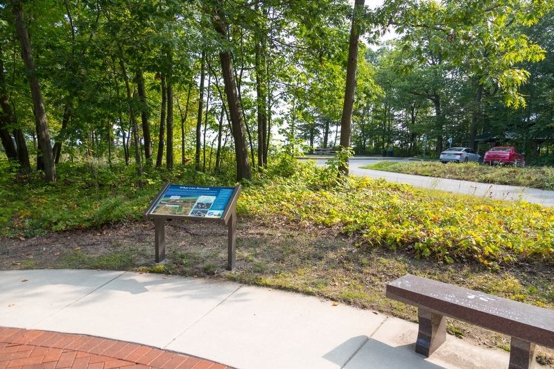
Location. 43° 4.924′ N, 82° 28.179′ W. Marker is in Fort Gratiot, Michigan, in St. Clair County. Marker is on the park road, in the median. It is in Fort Gratiot County Park. The entrance to the park is about 0.1 mile east of M-25 on Metcalf Road. The park road is unnamed, but is a loop, with the memorial about 0.3 miles into the park. Touch for map. Marker is in this post office area: Fort Gratiot MI 48059, United States of America. Touch for directions.
Other nearby markers. At least 8 other markers are within 6 miles of this marker, measured as the crow flies. The 1971 Water Tunnel Explosion Memorial (within shouting distance of this marker); Lake Huron Water Supply Project / Tunnel Explosion (within shouting distance of this marker); Seeing the Light (approx. 5.7 miles away); The Storm (approx. 5.7 miles away); Learning from Lake Huron (approx. 5.7 miles away); Sending a Signal (approx. 5.7 miles away); Keepers Duties (approx. 5.7 miles away); Fort Gratiot Light (approx. 5.7 miles away). Touch for a list and map of all markers in Fort Gratiot.
More about this marker. This interpretive panel contains four illustrations. The main illustration is a map showing the water treatment facility and the location of the tunnel relative to it. A smaller map shows the service areas for the Lake Huron water that is extracted through the tunnel. Two black-and-white photographs show the size of the water tunnel relative to a worker standing in it, and the “water intake under construction, five miles from shore.”
Credits. This page was last revised on November 3, 2023. It was originally submitted on November 3, 2023, by J. J. Prats of Powell, Ohio. This page has been viewed 56 times since then and 14 times this year. Photos: 1, 2. submitted on November 3, 2023, by J. J. Prats of Powell, Ohio.

