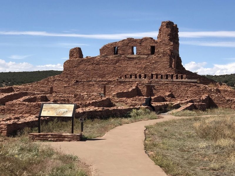
Near Abó in Torrance County, New Mexico — The American Mountains (Southwest)
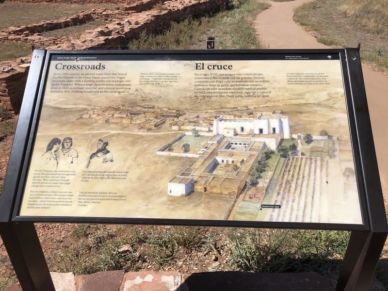
Crossroads/El cruce
— Salinas Pueblo Missions National Monument —
[Caption] The new stone church and convento were large compared to Abó's earlier homes and plazas. This artist's concept shows the village and mission as they may have appeared in the 1660s.
El cruce En el siglo XVII, una antigua ruta comercial que conectaba el Rio Grande con las grandes Ilanaras compartia este frágil valle montañoso con un pueblo bullicioso lleno de gente que hablaban tompiro. Cuando un solo sacerdote español entró al pueblo en 1622, una revolución espiritual, material y cultural dio comienzo en Abó. Nada jamás volveria ser igual.
[Leyenda] La nueva iglesia y convento de piedra fueron grandes comparados con las casas y plazas de Abó construidas antes. Este dibujo del artista muestra el pueblo y la misión tal como se veian en los años 1660.
Erected by National Park Service.
Topics and series. This historical marker is listed in these topic lists: Churches & Religion • Native Americans. In addition, it is included in the National Historic Landmarks series list. A significant historical year for this entry is 1622.
Location. 34° 27.027′ N, 106° 22.493′ W. Marker is near Abó, New Mexico, in Torrance County. Marker can be reached from Abó Ruins Road (State Road 513) 0.7 miles north of U.S. 60, on the left when traveling north. Marker is in Mission San Gregorio de Abó National Historic Landmark. Touch for map. Marker is at or near this postal address: 69 Abó Ruins Rd, Mountainair NM 87036, United States of America. Touch for directions.
Other nearby markers. At least 8 other markers are within walking distance of this marker. Abo Ruins (a few steps from this marker); A Kiva Here?/¿Una kiva aquí? (within shouting distance of this marker); New Songs/Cantos Nuevos (within shouting distance of this marker); People at Work/Manos a la obra (within shouting distance of this marker); Fred Sisneros' Grave/Don Federico (within shouting distance of this marker); Prayers and Hymns/Rezos e himnos (within shouting distance of this marker); A Grander Church/Una iglesia más grande (within shouting distance of this marker); Village of Abó/Pueblo de Abó (about 400 feet away, measured in a direct line). Touch for a list and map of all markers in Abó.
Credits. This page was last revised on November 4, 2023. It was originally submitted on November 3, 2023, by Duane and Tracy Marsteller of Murfreesboro, Tennessee. This page has been viewed 48 times since then and 5 times this year. Photos: 1. submitted on November 3, 2023, by Duane and Tracy Marsteller of Murfreesboro, Tennessee. 2. submitted on November 4, 2023, by Duane and Tracy Marsteller of Murfreesboro, Tennessee.

