Death Valley National Park in Inyo County, California — The American West (Pacific Coastal)
Saratoga Springs
A Remote Rest Stop
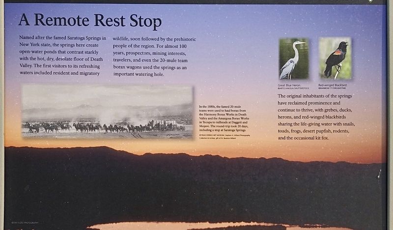
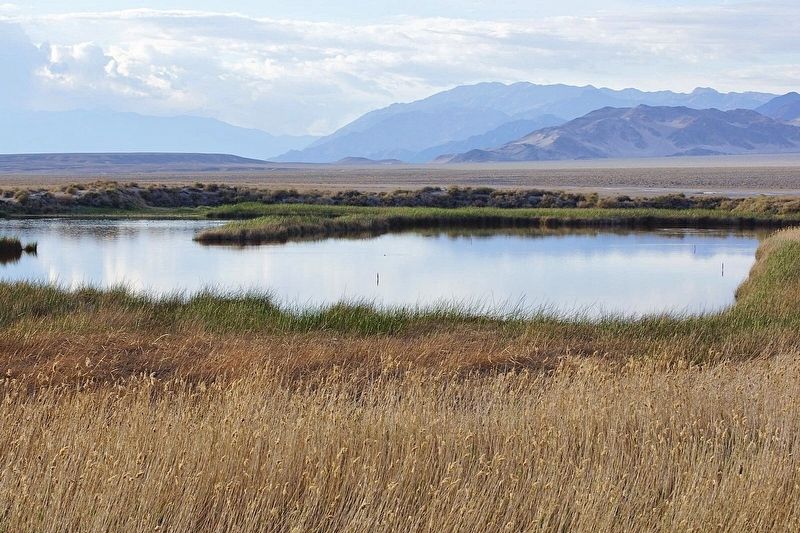
Named after the famed Saratoga Springs in New York state, the springs here create open-water ponds that contrast starkly with the hot, dry, desolate floor of Death Valley. The first visitors to its refreshing waters included resident and migratory wildlife, soon followed by the prehistoric people of the region. For almost 100 years, prospectors, mining interests, travelers, and even the 20-mule team borax wagons used the springs as an important watering hole.
In the 1880s, the famed 20-mule teams were used to haul borax from the Harmony Borax Works in Death Valley and the Amargosa Borax Works in Tecopa to railheads at Dagget and Mojave. The round-trip took 20 days, including a stop at Saratoga Springs.
The original inhabitants of the springs have reclaimed prominence and continue to thrive, with grebes, ducks, herons, and red-winged blackbirds sharing the life-giving water with snails, toads, frogs, desert pupfish, rodents, and the occasional kit fox.
Erected by Death Valley National Park.
Topics. This historical marker is listed in these topic lists: Industry & Commerce • Natural Resources • Parks & Recreational Areas.
Location. 35° 40.844′ N, 116° 25.263′ W. Marker is in Death Valley National Park, California, in Inyo County. Marker is on Saratoga Springs Road, 10 miles west of California Route 127. Touch for map. Marker is in this post office area: Shoshone CA 92384, United States of America. Touch for directions.
Other nearby markers. At least 3 other markers are within 9 miles of this marker, measured as the crow flies. Harry Wade Exit Route (approx. 8 miles away); Salt Creek Hills (approx. 8.6 miles away); Salt Creek (approx. 8.7 miles away).
More about this marker. High ground clearance vehicle recommended. Avoid traveling in remote areas during severe weather.
Credits. This page was last revised on November 5, 2023. It was originally submitted on November 4, 2023, by Craig Baker of Sylmar, California. This page has been viewed 47 times since then and 12 times this year. Photos: 1, 2, 3. submitted on November 4, 2023, by Craig Baker of Sylmar, California.


