Truckee in Nevada County, California — The American West (Pacific Coastal)
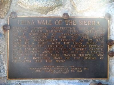
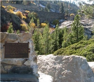
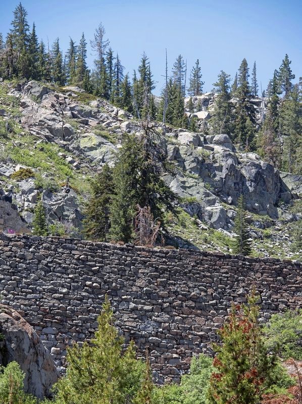
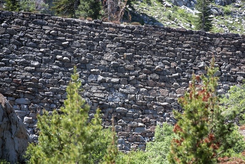
China Wall of the Sierra
Erected 1984 by Truckee-Donner Historical Society, Inc and the Chief Truckee Chapter No. 3691, E Clampus Vitus.
Topics and series. This historical marker is listed in this topic list: Railroads & Streetcars. In addition, it is included in the E Clampus Vitus series list.
Location. 39° 19.012′ N, 120° 19.178′ W. Marker is in Truckee, California, in Nevada County. Marker is on Donner Pass Road (Old Highway 40), on the left when traveling west. Touch for map. Marker is at or near this postal address: 17844 Donner Pass Road, Truckee CA 96161, United States of America. Touch for directions.
Other nearby markers. At least 8 other markers are within walking distance of this marker. China Wall (about 300 feet away, measured in a direct line); Sacred Symbols From Ancient Times (about 300 feet away); Petroglyphs (about 400 feet away); Donner Pass (about 700 feet away); McGlashan Point (about 700 feet away); Transcontinental Railroad (about 700 feet away); Rainbow Bridge (about 700 feet away); Stephens – Townsend – Murphy Party of 1844 (about 700 feet away). Touch for a list and map of all markers in Truckee.
Also see . . . Chinese-American Contribution to the Transcontinental Railroad. This article by the Central Pacific Railroad Museum chronicles the contribution made by Chinese laborers and exhibits several vintage photographs. (Submitted on October 23, 2009, by Syd Whittle of Mesa, Arizona.)
Additional commentary.
1. Construction of the Rail Bed Over the Summit
The CPRR rail line had reached Dutch Flat on the fourth of July, 1866. By the fall of 1866 line was laid all the way to Cisco. The winters of 1866-7 and 1867-8 were treacherous in the Sierra. Working conditions near the Summit were extremely hazardous. The CPRR imported Chinese labor to do the work because of their endurance and willingness to work for a fraction of normal pay. Many lost their lives while setting charges to blast a road bed out of the rock solid cliffs. Others froze to death. By the spring of 1868 the great railroad tunnel east of Cisco had opened. Only nine miles remained to be built to connect with the rails previously laid at Coburn's. Four thousand men worked continuously for twelve days on a five-mile stretch to complete it (Dutch Flat Enquirer, June 6, 1868). In June, 1868 the CPRR made its first run from Sacramento to Lake's crossing at the eastern foot of the Sierra in Nevada Territory. (Dutch Flat Enquirer, Saturday, June 27, 1868.) Regular passenger service from Sacramento to what soon became Reno, began shortly thereafter. Coburn's burned down the following month and residents quickly rebuilt, calling the town, 'Truckee'. The final link in the transcontinental railroad was completed the following year, 1869, at Promontory, Utah.
Source: http://westerly-journeys.com/goldrush/goldcprr.html#summit
— Submitted October 23, 2009, by Syd Whittle of Mesa, Arizona.
Credits. This page was last revised on July 2, 2021. It was originally submitted on October 23, 2009, by Syd Whittle of Mesa, Arizona. This page has been viewed 4,426 times since then and 130 times this year. Photos: 1, 2, 3. submitted on October 23, 2009, by Syd Whittle of Mesa, Arizona. 4, 5. submitted on July 2, 2021, by Alvis Hendley of San Francisco, California.
