Near Warsaw in Richmond County, Virginia — The American South (Mid-Atlantic)
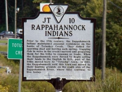
Rappahannock Indians
Erected 2006 by Department of Historic Resources. (Marker Number JT-10.)
Topics and series. This historical marker is listed in this topic list: Native Americans. In addition, it is included in the Virginia Department of Historic Resources (DHR) series list. A significant historical year for this entry is 1651.
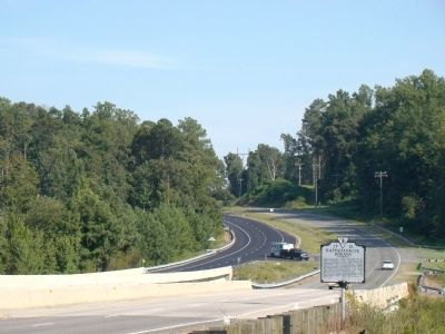
Location. 37° 55.441′ N, 76° 43.283′ W. Marker is near Warsaw, Virginia, in Richmond County. Marker is on History Land Highway (Virginia Route 3) just east of Richmond Hill Road (Virginia Route 620), on the right when traveling east. It is at Ruritan Park on the western bank of Totuskey Creek. Touch for map. Marker is in this post office area: Warsaw VA 22572, United States of America. Touch for directions.
Other nearby markers. At least 8 other markers are within 6 miles of this marker, measured as the crow flies. Saint John’s Church (approx. 2.9 miles away); Hon. William Atkinson Jones (approx. 3 miles away); Veterans Memorial (approx. 3.1 miles away); Richmond County Courthouse (approx. 3.1 miles away); Warsaw (approx. 3.1 miles away); a different marker also named Veterans Memorial (approx. 3.9 miles away); Fort Lowry (approx. 4½ miles away); North Farnham Church (approx. 5.9 miles away). Touch for a list and map of all markers in Warsaw.
Also see . . . A Brief History of the Rappahannocks. “The Rappahannocks first met Captain John Smith in December 1607 at their capital town ‘Topahanocke’ on the banks of the river bearing their name. At the time, Smith was a prisoner of Powhatan’s brother, Opechancanough. He took Smith to the Rappahannocks for the people to determine if Smith was the Englishman who, three years earlier, had murdered their chief and kidnapped some of their people. Smith was found innocent, at least of these crimes. The perpetrator was a tall man. Smith was too short and too fat. Smith returned to the Rappahannock’s homeland in the summer of 1608. He mapped 14 fourteen Rappahannock villages on the north side of the river. The Rappahannock’s territory on the south side of the Rappahannock River was their primary hunting grounds.” (Submitted on October 23, 2009.)
Credits. This page was last revised on July 5, 2021. It was originally submitted on October 23, 2009, by J. J. Prats of Powell, Ohio. This page has been viewed 1,490 times since then and 33 times this year. Photos: 1, 2. submitted on October 23, 2009, by J. J. Prats of Powell, Ohio.

