Saint Anthony Main in Minneapolis in Hennepin County, Minnesota — The American Midwest (Upper Plains)
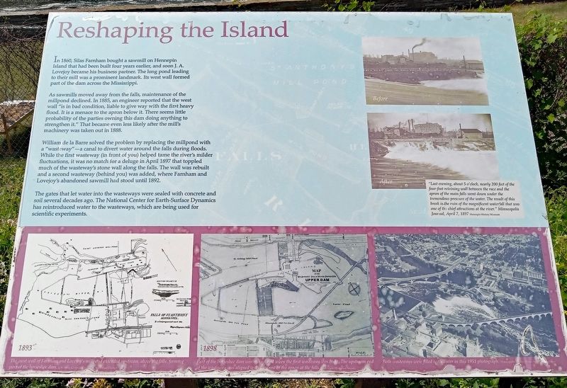
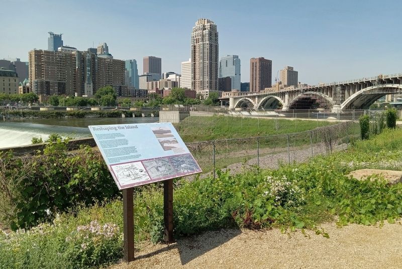
Reshaping the Island
In 1860, Silas Farnham bought a sawmill on Hennepin Island that had been built four years earlier, and soon J.A. Lovejoy became his business partner. The long pond leading to their mill was a prominent landmark. Its west wall formed part of the dam across the Mississippi.
As sawmills moved away from the falls, maintenance of the millpond declined. In 1885, an engineer reported that the west wall "is in bad condition, liable to give way with the first heavy flood. It is a menace to the apron below it. There seems little probability of the parties owning this dam doing anything to strengthen it." That became even less likely after the mill's machinery was taken out in 1888.
William de la Barre solved the problem by replacing the millpond with a "wasteway"—a canal to divert water around the falls during floods. While the first wateway (in front of you) helped tame the river's milder fluctuations, it was no match for a deluge in April 1897 that toppled much of the wateway's stone wall along the falls. The wall was rebuilt and a second wasteway (behind you) was added, where Farnham and Lovejoy's abandoned sawmill had stood until 1892.
The gates that let water into the wasteways were sealed with concrete and soil several decades ago. The National Center for Earth-Surface Dynamics has reintroduced water to the wasteways, which are being used for scientific experiments.
Before
After
"Last evening, about 5 o'clock, nearly 200 feet of the four-foot retaining wall between the race and the apron of the main falls went down under the tremendous pressure of the water. The result of this break is the ruin of the magnificent waterfall that was one of the chief attractions at the river." Minneapolis Journal, April 7, 1897
1893
The west wall of Farnham and Lovejoy's millpond extended upstream, above the falls, forming part of the horseshoe dam.
1898
Part of the horseshoe dam was moved east when the first wasteway was built. The upstream end of the wasteway was aligned with the crest of the apron at the falls.
1951
Both wasteways were filled with water in this 1951 photograph.
Erected by Xcel Energy.
Topics. This historical marker is listed in these topic lists: Disasters • Industry & Commerce • Waterways & Vessels. A significant historical year for this entry is 1860.
Location. 44° 58.975′ N, 93° 15.392′ W. Marker is in Minneapolis, Minnesota, in Hennepin County. It is in Saint Anthony Main. Marker can be reached from SE Main Street. The marker is in Water Power
Park. Touch for map. Marker is at or near this postal address: 204 SE Main Street, Minneapolis MN 55414, United States of America. Touch for directions.
Other nearby markers. At least 8 other markers are within walking distance of this marker. Beneath Your Feet (a few steps from this marker); From Power Plant to Light Switch (within shouting distance of this marker); The Spin on Turbines and Generators (within shouting distance of this marker); A Complex Family Tree (within shouting distance of this marker); The Falls Evolve (within shouting distance of this marker); A Tale of Two Waterpower Companies (within shouting distance of this marker); "Owah-Menah" (within shouting distance of this marker); A Horseshoe for the River (about 300 feet away, measured in a direct line). Touch for a list and map of all markers in Minneapolis.
Credits. This page was last revised on March 25, 2024. It was originally submitted on November 6, 2023, by McGhiever of Minneapolis, Minnesota. This page has been viewed 57 times since then and 28 times this year. Photos: 1, 2. submitted on November 6, 2023, by McGhiever of Minneapolis, Minnesota. • J. Makali Bruton was the editor who published this page.

