Burlington in Chittenden County, Vermont — The American Northeast (New England)
Church Street
— Burlington, VT —
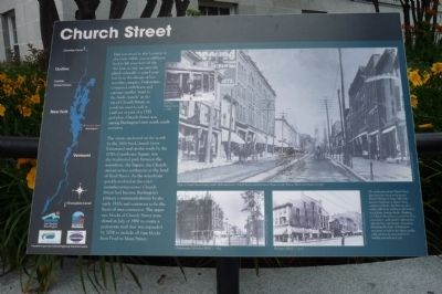
Had you stood at this location in the early 1800s, you would have had to lift your skirt off the dirt lane to step up onto the plank sidewalk or guard your hat from the danger of low wooden canopies. Pedestrians competed with horse and carriage on this “road to the brick church” at the top of Church Street, as residents used to call it. Laid out as part of a 1797 grid plan, Church Street was among Burlington’s first north-south corridors.
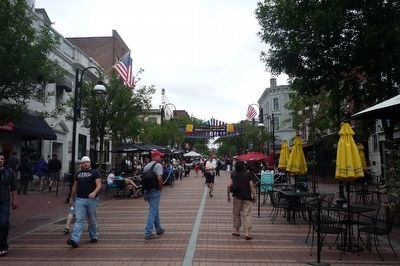
The street, anchored on the north by the 1816 brick church (now Unitarian) and on the south by the 1790s Courthouse Square, was the traditional path between the waterfront, the Square, the Church, and the active settlement at the end of Pearl Street. As the waterfront quickly evolved as the city’s manufacturing center, Church Street had become Burlington’s primary commercial district by the early 1830s and continues to be the heart of area commerce. The upper two blocks of Church Street were closed in July of 1980 to create a pedestrian mall that was expanded by 2004 to include all four blocks from Pearl to Main Street.
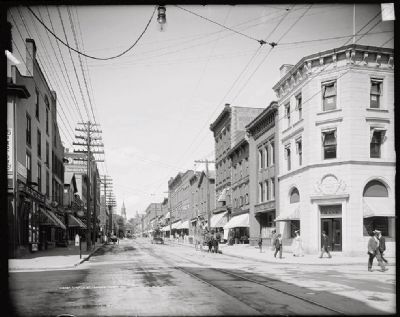
The architecture along Church Street dates from the 1820s to the present. Many buildings are large, high-style, masonry Italianate or Queen Anne commercial blocks, but there are also earlier gable-front residences and modest wood frame business blocks. Buildings on Church Street have received Art Deco renovations, 20th century replacements after fire loss, and historic renovations illustrating the desire of Burlington merchants to build to the highest quality while offering the most modern of building materials and style.
Erected by City of Burlington, funded in part by Federal Highway Administration.
Topics and series. This historical marker is listed in these topic lists: Architecture • Churches & Religion • Industry & Commerce • Roads & Vehicles. In addition, it is included in the Art Deco, and the Unitarian Universalism (UUism) series lists. A significant historical month for this entry is July 1980.
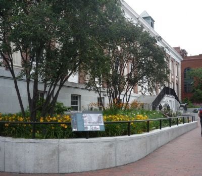
Location. 44° 28.563′ N, 73° 12.758′ W. Marker is in Burlington, Vermont, in Chittenden County. Marker is at the intersection of Main Street (U.S. 2) and Church Street, on the right when traveling west on Main Street. Touch for map. Marker is in this post office area: Burlington VT 05401, United States of America. Touch for directions.
Other nearby markers. At least 8 other markers are within walking distance of this marker. Church Street Marketplace (here, next to this marker); Exchange Block (within shouting distance of this marker); Chittenden County Trust Company (within shouting distance of this marker); City Hall Park (about 300 feet away, measured in a direct line); Site of the American House
(about 300 feet away); Captain John Lonergan (about 400 feet away); Green Mountain Club (about 400 feet away); Howard Bank Building (about 400 feet away). Touch for a list and map of all markers in Burlington.
More about this marker. [Photo caption, small inset in upper left:]
90 & 92 Church Street, c. 1885. (Courtesy of UVM Special Collections.)
[Photo caption, largest picture:]
View of Church Street looking north: Bridesmaid store, Daniel Kearns, and the Opera House on left; Warner Block and Isham’s on right. (Courtesy of UVM Special Collections.)
[Photo caption, picture in lower right:]
Sherman’s Block, c. 1917 (Courtesy of UVM Special Collections.)
[Photo caption, picture in lower left:]
Chateausque Richardson Block, c. 1895. (Courtesy of the Vermont History Center.)
[On the left of the marker is an outline map of the Lake Champlain Basin and logos of: the Lake Champlain Basin Program, the Chittenden County Regional Planning Commission, the Lake Champlain Byway Council, and the City of Burlington.]
Credits. This page was last revised on August 26, 2020. It was originally submitted on October 24, 2009, by Richard E. Miller of Oxon Hill, Maryland. This page has been viewed 1,419 times since then and 36 times this year. It was the Marker of the Week November 22, 2009. Photos: 1, 2, 3. submitted on October 24, 2009, by Richard E. Miller of Oxon Hill, Maryland. 4. submitted on December 27, 2014. • Kevin W. was the editor who published this page.


