Burlington in Chittenden County, Vermont — The American Northeast (New England)
City Hall Park
— Burlington, VT —
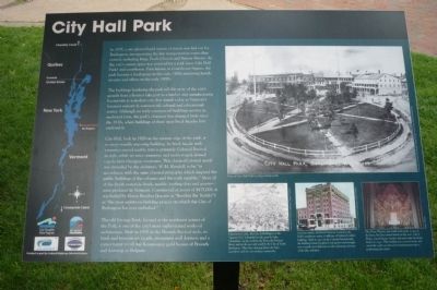
In 1797, a city planned grid system was laid out for Burlington, incorporating the few transportation routes that existed, including King, Pearl, Church and Battery Streets. At the city’s center, space was reserved for a park (now City Hall Park) and courthouse. First known as Courthouse Square, the park became a focal point in the early 1800s attracting hotels, taverns, and offices in the early 1800s.
The buildings bordering the park tell the story of the city’s growth from a frontier lake port to a lumber and manufacturing boomtown to a modern city that stands today as Vermont’s foremost industrial, commercial cultural, and educational center. Although no early commercial buildings survive in unaltered form, the park’s character has changed little since the 1830s, when buildings of three story brick facades first enclosed it.
City Hall, built in 1928 on the eastern edge of the park, is its most visually imposing building. Its brick facade with extensive carved marble trim is primarily Colonial Revival in style, while its strict symmetry and multi-staged domed copula has Georgian overtones. The classical/colonial motif was intended by the architect, W. M. Kendall, to be “in accordance with the same classical principles which inspired the public buildings of the colonies and the early republic.” Most all of the finish materials - brick, marble, roofing slate, granite - were produced in Vermont. Constructed at a cost of $475,000, it was hailed by Mayor Beecher (known as “Beecher the Builder”) as “the most ambitious building project on which the City of Burlington has ever embarked.”
The old Savings Bank, located at the northwest corner of the Park, is one of the City’s most sophisticated works of architecture. Built in 1900 in the Flemish Revival style, its brick and brownstone facade, prominent wall dormers and a corner turret recall the Renaissance guild houses of Brussels and Antwerp in Belgium.
Erected by City of Burlington, funded in part by Federal Highway Administration.
Topics and series. This historical marker is listed in these topic lists: Government & Politics • Notable Places • Settlements & Settlers • Waterways & Vessels. In addition, it is included in the Art Deco series list. A significant historical year for this entry is 1797.
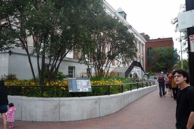
Location. 44° 28.586′ N, 73° 12.812′ W. Marker is in Burlington, Vermont, in Chittenden County. Marker can be reached from Main Street (U.S. 2) east of St. Paul Street when traveling west. The marker is in the City Hall Park, northeast of the Main Street/St. Paul Street intersection.
Touch for map. Marker is in this post office area: Burlington VT 05401, United States of America. Touch for directions.
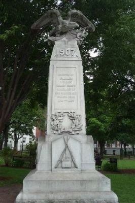
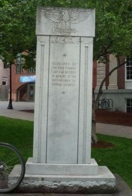
Other nearby markers. At least 8 other markers are within walking distance of this marker. Captain John Lonergan (within shouting distance of this marker); Burlington Civil War Memorial (within shouting distance of this marker); First Vermont Lesbian and Gay Pride Parade (within shouting distance of this marker); Chittenden County Trust Company (within shouting distance of this marker); Site of the American House (within shouting distance of this marker); Site of the Old Gas Station (about 300 feet away, measured in a direct line); Green Mountain Club (about 300 feet away); Church Street (about 300 feet away). Touch for a list and map of all markers in Burlington.
More about this marker. [Photo caption, main (largest) picture:]
View of City Hall Park in 1859 looking north. (University of Vermont Landscape Change Program.)
[Photo caption, bottom left picture:]
Chartered in 1763, the City of Burlington or the “Queen City” is bounded on the west by Lake Champlain, on the north by the Winooski (Onion) River, and on the east and south by the City of South Burlington. This 1877 drawing shows the busy waterfront ant the surrounding countryside. (University of Vermont Landscape Change Program.)
[Photo
caption, bottom middle picture:]
At seven stories, the Hotel Vermont, located at the Park’s southwest corner, is still one of Vermont’s tallest buildings. Built in 1910 in Colonial Revival style, the building featured a glazed roof garden and wrought iron seventh story balconies to take advantage of views of the lake and park. (University of Vermont Landscape Change Program.)
[Photo caption, bottom right picture:]
The Flynn Theater, just south of the park, is one of the finest Art Deco movie houses in the state. John J. Flynn, a local lawyer, banker and real estate developer built it in 1930. This building was restored inside and out in the 1980s as part of its transformation into a performing arts center. (Flynn Theatre.)
[On the left of the marker is an outline map of the Lake Champlain Basin and logos of: the Lake Champlain Basin Program, the Chittenden County Regional Planning Commission, the Lake Champlain Byway Council, and the City of Burlington.
Additional keywords. Maj. Gen. General George J. Stannard.
Credits. This page was last revised on June 16, 2016. It was originally submitted on October 24, 2009, by Richard E. Miller of Oxon Hill, Maryland. This page has been viewed 1,298 times since then and 27 times this year. Photos: 1, 2, 3. submitted on October 24, 2009, by Richard E. Miller of Oxon Hill, Maryland. 4. submitted on February 10, 2010, by Richard E. Miller of Oxon Hill, Maryland. • Kevin W. was the editor who published this page.


