Crawford in Dawes County, Nebraska — The American Midwest (Upper Plains)
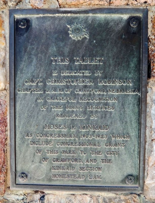
Moses P. Kinkaid
is dedicated by
Capt. Christopher Robinson
Chapter D. A. R. of Crawford, Nebraska,
in grateful recognition
of the many services
rendered by
Moses P. Kinkaid
as Congressman, 1903-1923 which
include Congressional Grant
of this park to the City
of Crawford, and the
Kinkaid Section
Homestead Law.
Erected by Capt. Christopher Robinson Chapter, Daughters of the American Revolution.
Topics and series. This historical marker is listed in these topic lists: Charity & Public Work • Government & Politics • Parks & Recreational Areas • Settlements & Settlers. In addition, it is included in the Daughters of the American Revolution series list. A significant historical year for this entry is 1903.
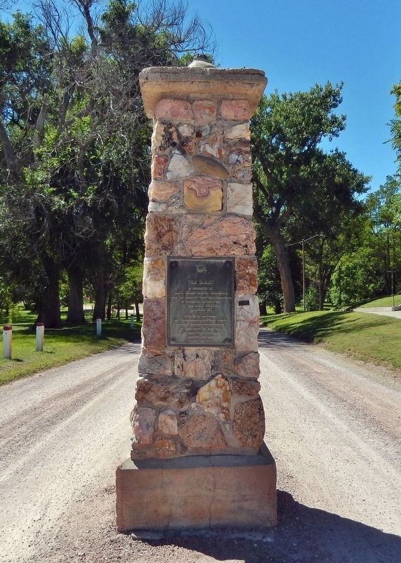
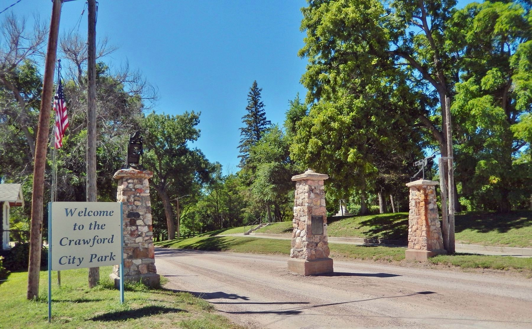
Location. 42° 41.2′ N, 103° 24.991′ W. Marker is in Crawford, Nebraska, in Dawes County. Marker is on Main Street just west of 1st Street, in the median. The marker is mounted at eye-level on the center pillar at the Crawford City Park Entrance, facing east. Touch for map. Marker is at or near this postal address: 45 Main Street, Crawford NE 69339, United States of America. Touch for directions.
Other nearby markers. At least 8 other markers are within 3 miles of this marker, measured as the crow flies. The Death of Baptiste Garnier (approx. 0.2 miles away); Crossing of the Trails (approx. ¼ mile away); Crawford 1891 School Bell (approx. 0.6 miles away); Crawford (approx. 0.9 miles away); Site of Red Cloud Indian Agency (approx. 1½ miles away); Red Cloud Agency (approx. 1½ miles away); German P.O.W. Camp (approx. 1.6 miles away); Fort Robinson and the Railroad (approx. 2.6 miles away). Touch for a list and map of all markers in Crawford.
Also see . . .
1. Moses Pierce Kinkaid (Wikipedia). Excerpt:
At the time that Kinkaid entered Congress, the 1862 Homestead Act allowed settlers to obtain a quarter-section (160 acres) of government land for a nominal fee; the 1873 Timber Culture Act allowed them to claim an additional quarter-section. However, in much of the Sandhills, a half-section was not enough land to sustain a family. In 1904, Kinkaid sponsored and obtained passage of the Kinkaid Act to promote settlement in Nebraska's Sandhills region.(Submitted on November 10, 2023, by Cosmos Mariner of Cape Canaveral, Florida.)
2. Kinkaid Act (Wikipedia). Excerpt:
The Kinkaid Act of 1904 is a U.S. statute that amended the 1862 Homestead Act so that one section (640 acres) of public domain land could be acquired. It applied specifically to 37 counties in northwest Nebraska, in the general area of the Nebraska Sandhills. Only non-irrigable lands were eligible to be claimed under the provisions of the Kinkaid Act; those that were deemed to be practicably irrigable by the Secretary of the Interior were excluded. Claimants of land under the provisions of the Kinkaid Act were generally referred to as "Kinkaiders."(Submitted on November 10, 2023, by Cosmos Mariner of Cape Canaveral, Florida.)
3. Public Land: Whose Land is It?. Excerpt:
It is difficult to measure the effect of the Kinkaid Act accurately. Much of Nebraska’s Sandhills region was unsuited for farming, and 640 acres was not a large enough piece of land to ranch successfully. Farmers who claimed land through the Kinkaid Act mostly failed, due to the dry dune landscape. Ranchers, however, profited by taking over land that the homesteaders abandoned.(Submitted on November 10, 2023, by Cosmos Mariner of Cape Canaveral, Florida.)
Credits. This page was last revised on November 10, 2023. It was originally submitted on November 9, 2023, by Cosmos Mariner of Cape Canaveral, Florida. This page has been viewed 62 times since then and 20 times this year. Photos: 1, 2, 3. submitted on November 10, 2023, by Cosmos Mariner of Cape Canaveral, Florida.


