Crawford in Dawes County, Nebraska — The American Midwest (Upper Plains)
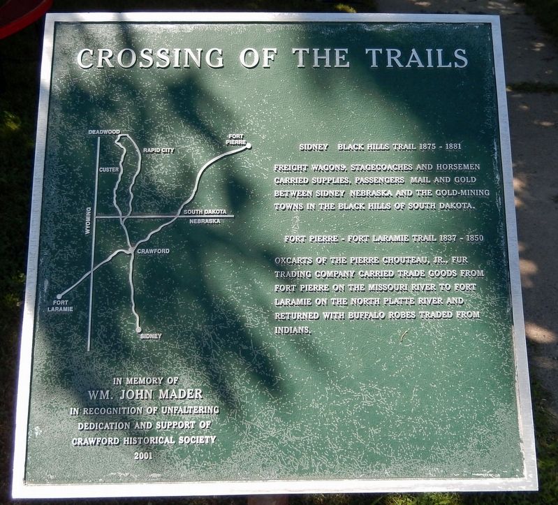
Crossing of the Trails
Sidney — Black Hills Trail 1875-1881
Freight wagons, stagecoaches and horsemen carried supplies, passengers mail and gold between Sydney Nebraska and the gold-mining towns in the Black Hills of South Dakota.
Fort Pierre — Fort Laramie Trail 1837-1850
Oxcarts of the Pierre Chouteau, Jr., Fur Trading Company carried trade goods from Fort Pierre on the Missouri River to Fort Laramie on the North Platte River and returned with buffalo robes traded from Indians.
Wm. John Mader
in recognition of unfaltering
dedication and support of
Crawford Historical Society
Erected 2001 by Crawford Historical Society.
Topics. This historical marker is listed in these topic lists: Industry & Commerce • Roads & Vehicles • Settlements & Settlers. A significant historical year for this entry is 2001.
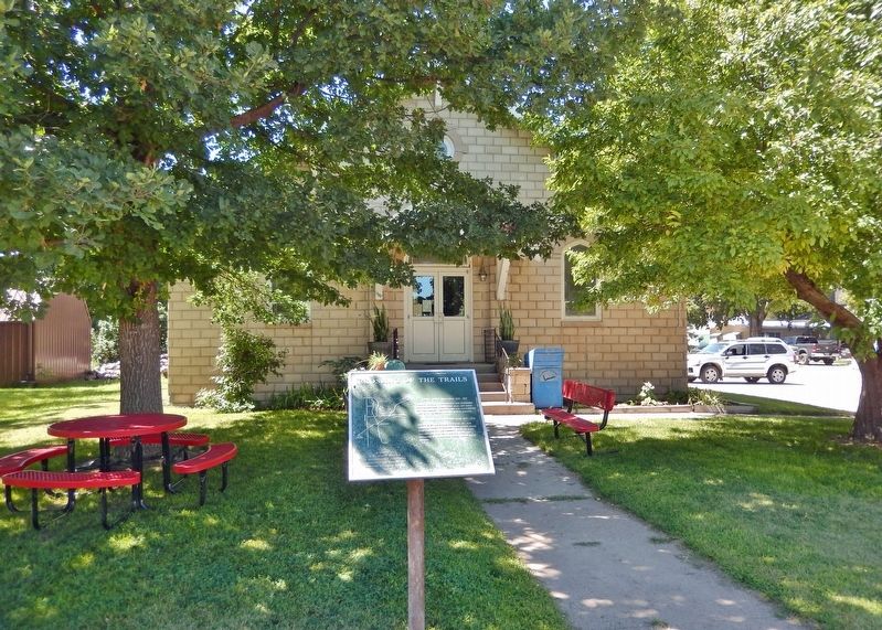
Location. 42° 41.005′ N, 103° 24.801′ W. Marker is in Crawford, Nebraska, in Dawes County. Marker is on 2nd Street just south of Ash Street, on the left when traveling north. The marker is located beside the sidewalk on the east side of the Crawford Public Library. Touch for map. Marker is at or near this postal address: 601 2nd Street, Crawford NE 69339, United States of America. Touch for directions.
Other nearby markers. At least 8 other markers are within 3 miles of this marker, measured as the crow flies. The Death of Baptiste Garnier (approx. 0.2 miles away); Moses P. Kinkaid (approx. ¼ mile away); Crawford 1891 School Bell (approx. 0.3 miles away); Crawford (approx. 0.6 miles away); Site of Red Cloud Indian Agency (approx. 1½ miles away); Red Cloud Agency (approx. 1½ miles away); German P.O.W. Camp (approx. 1½ miles away); Fort Robinson and the Railroad (approx. 2.6 miles away). Touch for a list and map of all markers in Crawford.
Related markers. Click here for a list of markers that are related to this marker.
Also see . . .
1. Sidney-Black Hills Trail (Wikipedia). Excerpt:
The Sidney Black Hills Stage Road or Route was a trail connecting Sidney, Nebraska, Sidney Barracks, and the Union Pacific Railroad with Fort Robinson, Red Cloud Agency, Spotted Tail Agency, Custer City, Dakota Territory, and Deadwood, Dakota Territory between 1876 and 1887, when it was replaced. It competed with the Cheyenne Black Hills Stage Route to supply the gold mining fields of the Black Hills prior to the construction of the Cowboy Line railroad in Northern Nebraska in 1887, which linked the Black Hills by rail to the rest of the world.(Submitted on November 10, 2023, by Cosmos Mariner of Cape Canaveral, Florida.)
2. The Fort Pierre-Fort Laramie Trail
. Excerpt:
From about 1837 until 1850, more than a quarter million buffalo robes bought from Indians and 27 tons of fur company trade goods were hauled over the 300 mile long Fort Pierre-Fort Laramie Trail that followed the White River through this area. First used by the American Fur Company, the trail had its origin as part of an earlier Spanish trade route from Santa Fe to the Missouri River in present South Dakota. During the 1840s the Fort Pierre-Fort Laramie Trail was the shortest overland connection between trading posts on the Platte and steamboats plying the Missouri.(Submitted on November 10, 2023, by Cosmos Mariner of Cape Canaveral, Florida.)
Credits. This page was last revised on November 10, 2023. It was originally submitted on November 10, 2023, by Cosmos Mariner of Cape Canaveral, Florida. This page has been viewed 52 times since then and 13 times this year. Photos: 1, 2. submitted on November 10, 2023, by Cosmos Mariner of Cape Canaveral, Florida.

