Fort Hunter in Montgomery County, New York — The American Northeast (Mid-Atlantic)
The Schoharie Aqueduct
Schoharie Crossing State Historic Site
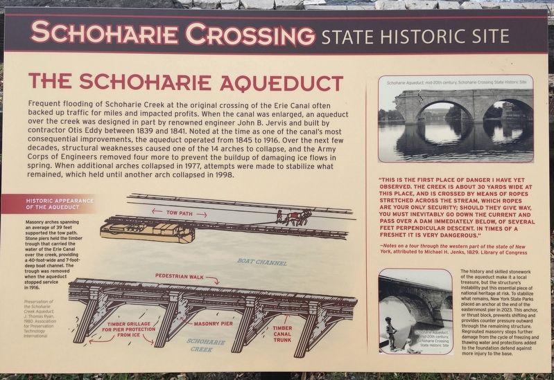
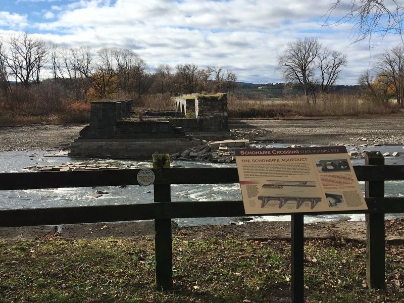
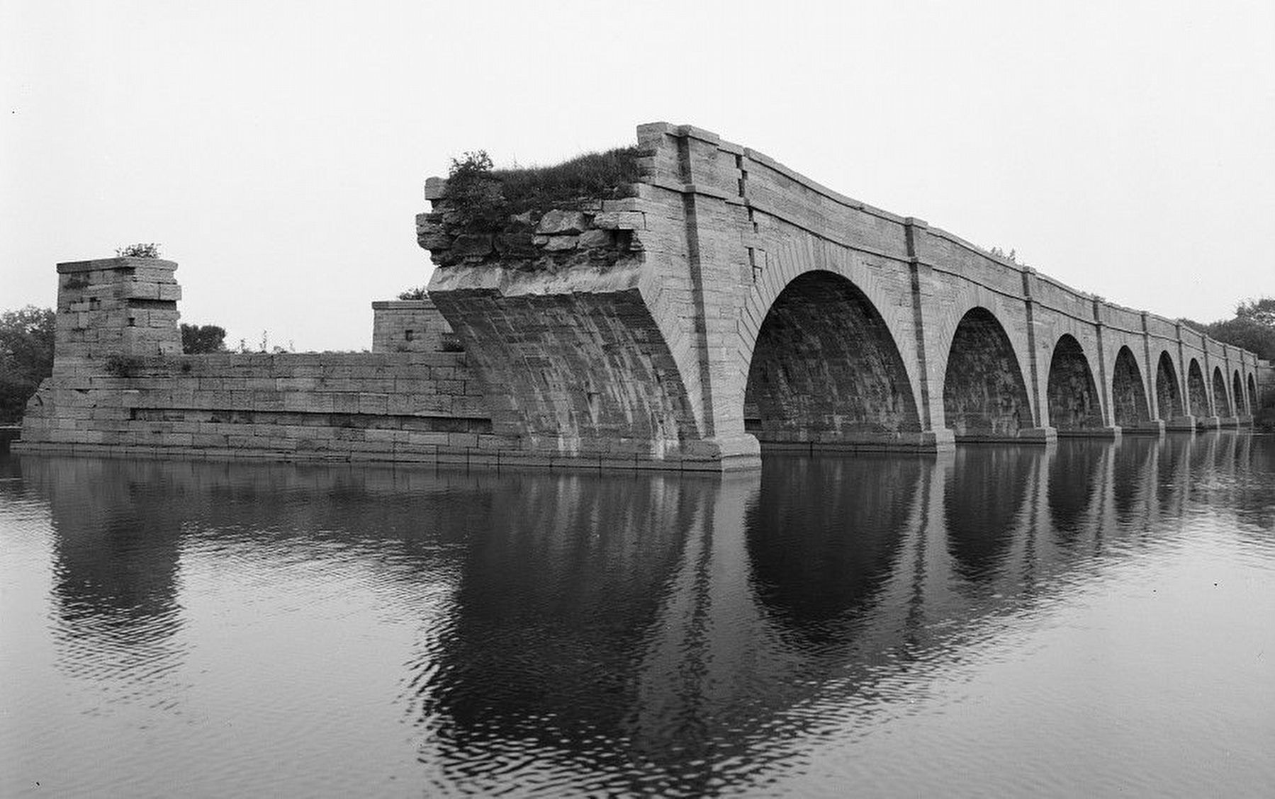
Frequent flooding of Schoharie Creek at the original crossing of the Erie Canal often backed up traffic for miles and impacted profits. When the canal was enlarged, an aqueduct over the creek was designed in part by renowned engineer John B. Jervis and built by contractor Otis Eddy between 1839 and 1841. Noted at the time as one of the canal’s most consequential improvements, the aqueduct operated from 1845 to 1916. Over the next few decades, structural weaknesses caused one of the 14 arches to collapse, and the Army Corps of Engineers removed four more to prevent the buildup of damaging ice flows in spring. When additional arches collapsed in 1977, attempts were made to stabilize what remained, which held until another arch collapsed in 1998.
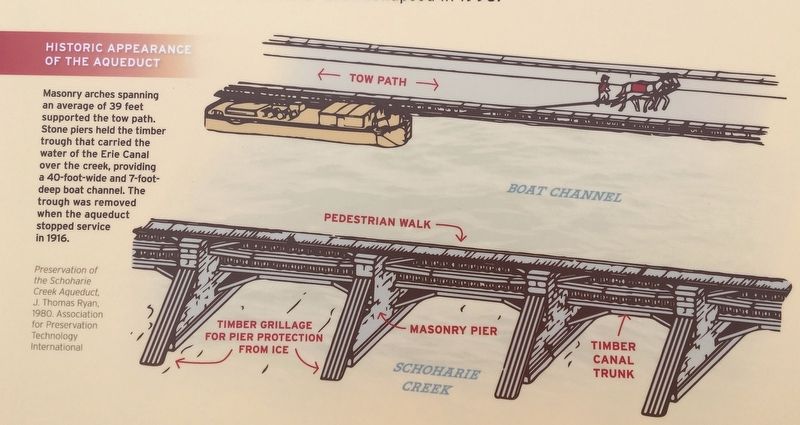
Historic Appearance of the Aqueduct
Masonry arches spanning an average of 39 feet supported the tow path. Stone piers held the timber trough that carried the water of the Erie Canal over the creek, providing a 40-foot-wide and 7-foot deep boat channel. The trough was removed when the aqueduct stopped service in 1916.
Preservation of the Schoharie Creek Aqueduct, J. Thomas Ryan, 1980. Association for Preservation Technology International
( sidebar )
"This is the first place of danger I have yet observed. The creek is about 30 yards wide at this place, and is crossed by means of ropes stretched across the stream, which ropes are your only security; should they give way, you must inevitably go down the current and pass over a dam immediately below, of several feet perpendicular descent. In times of a freshet it is very dangerous.”
- Notes on a tour through the western part of the state of New York, attributed to Michael H. Jenks, 1829. Library of Congress
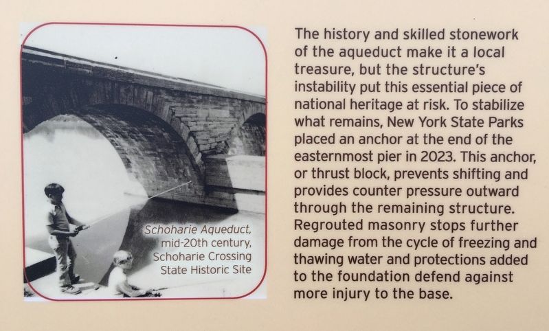
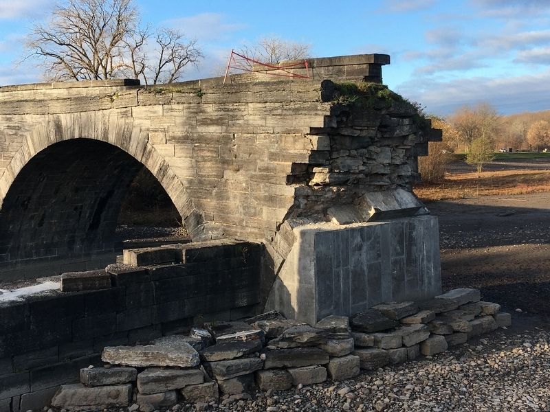
The history and skilled stonework of the aqueduct make it a local treasure, but the structure's instability put this essential piece of national heritage at risk. To stabilize what remains, New York State Parks placed an anchor at the end of the easternmost pier in 2023. This anchor, or thrust block, prevents shifting and provides counter pressure outward through the remaining structure. Regrouted masonry stops further damage from the cycle of freezing and thawing water and protections added to the foundation defend against more injury to the base.
Erected 2023 by Schoharie Crossing State Historic Site.
Topics. This historical marker is listed in these topic lists: Bridges & Viaducts • Industry & Commerce • Waterways & Vessels. A significant historical year for this entry is 1839.
Location. 42° 56.416′ N, 74° 17.144′ W. Marker is in Fort Hunter, New York, in Montgomery County. Marker can be reached from Main Street (Route 27) west of Schoharie Street, on the right when traveling south. Located on the bank of Schoharie Creek, overlooking the remains of the aqueduct. A short walk from a small parking area at the intersection of Main Street and Schoharie Street. Touch for map. Marker is in this post office area: Fort Hunter NY 12069, United States of America. Touch for directions.
Other nearby markers. At least 8 other markers are within walking distance of this marker. Lock 30 (about 400 feet away, measured in a direct line); Schoharie Crossing (about 500 feet away); Once A Farm (approx. 0.2 miles away); Canal Dams (approx. 0.2 miles away); In the Wake of Hurricane Irene (approx. 0.2 miles away); The Fort by the Village (approx. 0.2 miles away); Building Block of the Erie Canal (approx. 0.2 miles away); Site of Queen Anne Chapel (approx. 0.2 miles away). Touch for a list and map of all markers in Fort Hunter.
Also see . . .
1. Stabilization of the Schoharie Creek Aqueduct, 2023. (Submitted on November 12, 2023, by Howard C. Ohlhous of Duanesburg, New York.)
2. The Travels of Tug 44 - Erie Canal - Schoharie Crossing Aqueduct. (Submitted on November 12, 2023, by Howard C. Ohlhous of Duanesburg, New York.)
3. Erie Canal - Schoharie Creek Aqueduct. Documents of the Historic American Engineering Record (Submitted on November 12, 2023, by Howard C. Ohlhous of Duanesburg, New York.)
4. Schoharie Crossing State Historic Site - National Park Service. Download National Register of Historic Places documentation (Submitted on March 24, 2024, by Anton Schwarzmueller of Wilson, New York.)
Additional keywords. Aqueduct Stabilization, Aqueduct Repair, Aqueduct Stonework, Aqueduct Stone work
Photographed By Howard C. Ohlhous, November 11, 2023
5. The Schoharie Aqueduct Stabilizing "Thrust Block"
To stabilize what remains of the Schoharie Creek Aqueduct, New York State Parks placed an anchor at the end of the easternmost pier in 2023. This anchor, or thrust block, prevents shifting and provides counter pressure outward through the remaining structure. The trust block is the poured concrete at the base of the fallen arch. Loose stone has been placed around the thrust block to reduce erosion.
Photographed By Howard C. Ohlhous, November 11, 2023
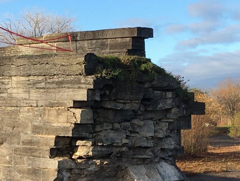
6. The Otis Eddy Stone
The contractor, Otis Eddy, who built the Schoharie Creek Aqueduct between 1839 and 1841 placed a capstone on the towpath railing with his name engraved in the stone. That stone is the uppermost stone, all the way to the right in this photo.
Credits. This page was last revised on March 24, 2024. It was originally submitted on November 12, 2023, by Howard C. Ohlhous of Duanesburg, New York. This page has been viewed 89 times since then and 22 times this year. Photos: 1, 2, 3, 4, 5, 6, 7. submitted on November 12, 2023, by Howard C. Ohlhous of Duanesburg, New York. • Michael Herrick was the editor who published this page.
