North Riverfront Park in Alpena in Alpena County, Michigan — The American Midwest (Great Lakes)
Montana
| — | Great Lakes Maritime Heritage Trail | — |
Photographed by J. J. Prats, September 23, 2023
1. Montana Marker
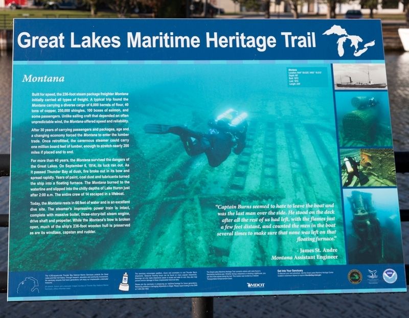
After 30 years of carrying passengers and packages, age and a changing economy forced the Montana to enter the lumber trade. Once retrofitted, the cavernous steamer could carry one million board feet of lumber, enough to stretch nearly 200 miles if placed end to end.
For more than 40 years, the Montana survived the dangers of the Great Lakes. On September 6, 1914, its luck ran out. As It passed Thunder Bay at dusk, fire broke out in its bow and spread rapidly. Years of paint, coal dust and lubricants turned the ship into a floating furnace. The Montana burned to the waterline and slipped into the chilly depths of Lake Huron just after 2:00 am. The entire crew of 14 escaped in a lifeboat.
Today, the Montana rests in 66 feet of water
this page online
“Captain Burns seemed to hate to leave the boat and was the last man over the side. He stood on the deck after all the rest of us had left, with the flames just a few feet distant, and counted the men in the boat several times to make sure that none was left on that floating furnace.” —James St. Andre, Montana Assistant Engineer
Erected by Great Lakes Maritime Heritage Trail.
Topics. This historical marker is listed in this topic list: Waterways & Vessels. A significant historical date for this entry is September 6, 1914.
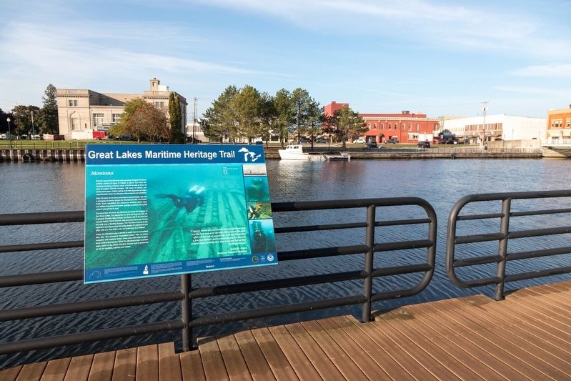
Location. 45° 3.809′ N, 83° 25.785′ W. Marker is in Alpena, Michigan, in Alpena County. It is in North Riverfront Park. It is on East Fletcher Street south of North 2nd Avenue, on the right when traveling south. Touch for map. Marker is in this post office area: Alpena MI 49707, United States of America. Touch for directions.

Regionally,
Photographed by J. J. Prats, September 23, 2023
2. Montana Marker
Other nearby markers. At least 8 other markers are within walking distance of this marker: Abby’s Story (within shouting distance of this marker); Thomas Stafford Dog Park (within shouting distance of this marker); Grecian (within shouting distance of this marker); Nordmeer (within shouting distance of this marker); Thunder Bay National Marine Sanctuary (within shouting distance of this marker); Winter Layup (within shouting distance of this marker); Alpena’s Second Avenue Bridge (within shouting distance of this marker); Welcome to the Alpena Water Level Station (about 300 feet away, measured in a direct line). Touch for a list and map of all markers in Alpena.
Other markers no longer nearby. Winter Layups (was within shouting distance of this marker but has been replaced with another marker now near it); The Ties That Bind (was within shouting distance of this marker but has been replaced with another marker now near it).
More about this marker. This interpretive panel is illustrated with a large photograph of a diver inspecting the wreck with this caption,
Montana — Location: N44° 59.025', W83° 16.013' • Depth: 66' • Built: 1872 • Lost: 1914 • Length: 236'There are four uncaptioned photographs on the right, the first a black-and-white portrait of the Montana and below it three underwater photographs of the wreck.
Additional keywords. Montana
Credits. This page was last revised on November 18, 2023. It was originally submitted on November 12, 2023, by J. J. Prats of Powell, Ohio. This page has been viewed 160 times since then and 24 times this year. Photos: 1. submitted on November 12, 2023, by J. J. Prats of Powell, Ohio. 2. submitted on November 18, 2023, by J. J. Prats of Powell, Ohio.
