Santa Barbara in Santa Barbara County, California — The American West (Pacific Coastal)
Mission Waterworks System
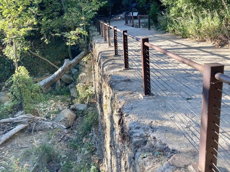
Santa Barbara Mission Dam
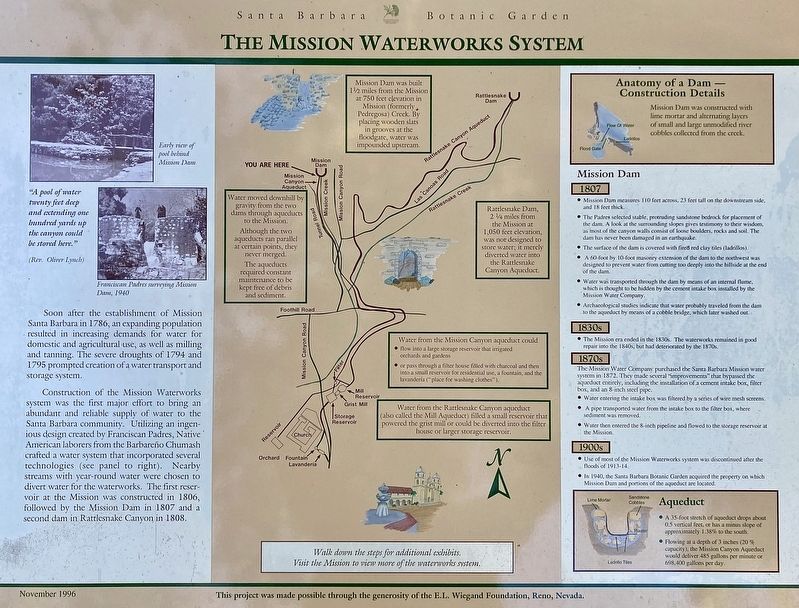
Soon after the establishment of Mission Santa Barbara in 1786, an expanding population resulted in increasing demands for water for domestic and agricultural use, as well as milling and tanning. The severe droughts of 1794 and 1795 prompted creation of a water transport and storage system.
Construction of the Mission Waterworks system was the first major effort to bring an abundant and reliable supply of water to the Santa Barbara community. Utilizing an ingenious design created by Franciscan Padres, Native American laborers from the Barbareño Chumash crafted a water system that incorporated several technologies (see panel to right). Nearby streams with year-round water were chosen to divert water for the waterworks. The first reservoir at the Mission was constructed in 1806, followed by the Mission Dam in 1807 and a second dam in Rattlesnake Canyon in 1808.
"A pool of water twenty feet deep and extending one hundred yards up the canyon could be stored here."
(Rev. Oliver Lynch)
Mission Dam was built 1½ miles from the Mission at 750 feet elevation in Mission (formerly Pedregosa) Creek. By placing wooden slats in grooves at the floodgate, water was impounded upstream.
Rattlesnake Dam, 2¼ miles from the Mission at 1,050 feet elevation, was not designed to store water; it merely diverted water to the Rattlesnake Canyon Aqueduct.
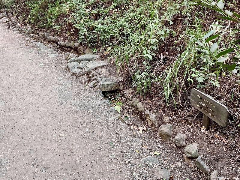
Water moved downhill by gravity from the two dams through aqueducts to the Mission.
Although the two aqueducts ran parallel at certain points, they never merged.
The aqueducts required constant maintenance to be kept free of debris and sediment.
Water from the Mission Canyon aqueduct could
• flow into a large storage reservoir that irrigated orchards and gardens.
• or pass through a filter house filled with charcoal and then into a small reservoir for residential use, a fountain, and the lavendería (place for washing clothes).
Water from the Rattlesnake Canyon aqueduct (also called the Mill Aqueduct) filled a small reservoir that powered the grist mill or could be diverted into the filter house or larger storage reservoir.
Walk down the steps for additional exhibits.
Visit the Mission to view more of the waterworks system.
Anatomy of a Dam - Construction Details.
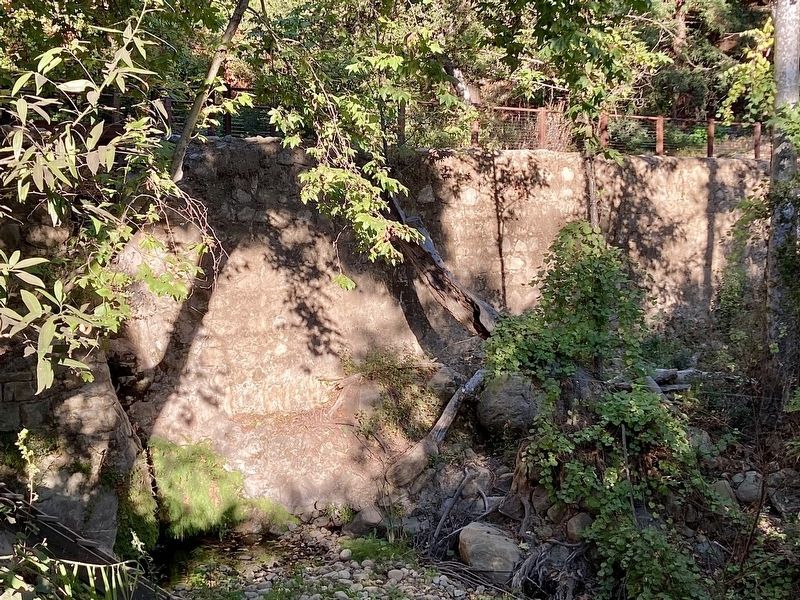
Mission Dam was constructed with lime mortar and alternating layers of small and large unmodified river cobbles collected from the creek.
Mission Dam
1807
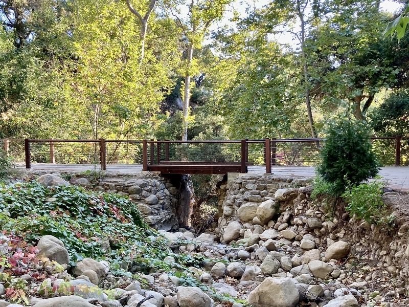
• Mission Dam measures 110 feet across, 23 feet tall on the downstream side, and 18 feet thick.
• The Padres selected stable, protruding sandstone bedrock for placement of the dam. A look at the surrounding slopes gives testimony to their wisdom, as most of the canyon walls consist of loose boulders, rocks and soil. The dam has never been damaged in an earthquake.
• The surface of the dam is covered with fired red clay tiles (ladrillos).
• A 60-foot by 10-foot masonry extension of the dam to the northwest was designed to prevent water from cutting too deeply into the hillside at the end of the dam.
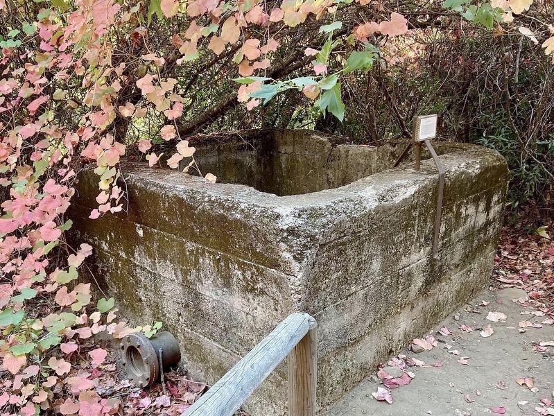
• Water was transported through the dam by means of an internal flume, which is thought to be hidden by the cement intake box installed by the Mission Water Company.
• Archaeological studies indicate that water probably traveled from the dam to the aqueduct by means of a cobble bridge, which later washed out.
1830s
• The Mission era ended in the 1830s. The waterworks remained in good repair into the 1840s, but had deteriorated by the 1870s.
1870s
The Mission Water Company purchased the Santa Barbara Mission water system in 1872. They made several "improvements" that bypassed the aqueduct entirely, including the installation of a cement intake box, filter box, and an 8-inch steel pipe.
• Water entering the intake box was filtered by a series of wire mesh screens.
• A pipe transported water from the intake box to the filter box, where sediment was removed.
• Water then entered the 8-inch pipeline and flowed to the storage reservoir at the Mission.
1900s
• Use of most of the Mission Waterworks system was discontinued after the floods of 1913-14.
• In 1940, the Santa Barbara Botanic Garden acquired the property on which Mission Dam and portions of the aqueduct are located.
Aqueduct
• A 35-foot stretch of aqueduct drops about 0.5 vertical feet, or has a minus slope of approximately 1.38% to the south.
• Flowing at a depth of 3 inches (20% capacity), the Mission Canyon Aqueduct would deliver 485 gallons per minute or 698,400 gallons per day.
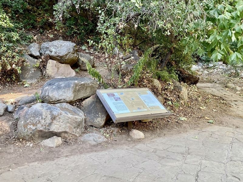
Erected 1996 by Santa Barbara Botanic Garden, and E.L. Wiegand Foundation.
Topics. This historical marker is listed in these topic lists: Churches & Religion • Native Americans. A significant historical year for this entry is 1807.
Location. 34° 27.529′ N, 119° 42.606′ W. Marker is in Santa Barbara, California, in Santa Barbara County. Marker can be reached from Mission Canyon Road, 0.8 miles north of Foothill Road (California Route 192), on the left when traveling north. Located in Santa Barbara Botanic Garden near the north end. There is an admission fee. Touch for map. Marker is at or near this postal address: 1212 Mission Canyon Rd, Santa Barbara CA 93105, United States of America. Touch for directions.
Other nearby markers. At least 8 other markers are within 2 miles of this marker, measured as the crow flies. Assembly Required (approx. 1.3 miles away); Mission Historical Park (approx. 1.3 miles away); Santa Barbara Mission Early Water Supply (approx. 1.3 miles away); Santa Barbara Mission Aqueduct (approx. 1.4 miles away); Juana Maria (approx. 1.4 miles away); Santa Barbara Mission (approx. 1.4 miles away); Don Jose Francisco De Ortega (approx. 1.4 miles away); Moorish Fountain and Indian Community Laundry (approx. 1½ miles away). Touch for a list and map of all markers in Santa Barbara.
Also see . . . Santa Barbara Botanic Garden. See the website for hours, admission, events, features, map, history, photos, etc. (Submitted on November 12, 2023.)
Credits. This page was last revised on November 22, 2023. It was originally submitted on November 12, 2023, by Craig Baker of Sylmar, California. This page has been viewed 76 times since then and 29 times this year. Photos: 1, 2, 3, 4, 5, 6, 7, 8. submitted on November 12, 2023, by Craig Baker of Sylmar, California.
