Old Town in Alexandria, Virginia — The American South (Mid-Atlantic)
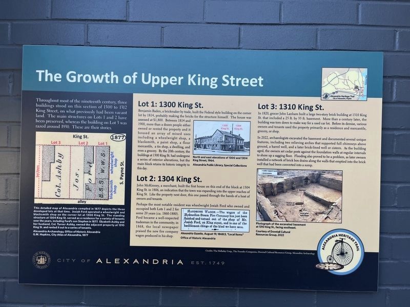
The Growth of Upper King Street
Alexandria Heritage Trail
— City of Alexandria, Est. 1749 —

Photographed By Devry Becker Jones (CC0), November 11, 2023
1. The Growth of Upper King Street Marker
Throughout most of the nineteenth century, three buildings stood on this section of 1300 to 1312 King Street, on what previously had been vacant land. The main structures on Lots 1 and 2 have been preserved, whereas the building on Lot 3 was razed around 1930. These are their stories.
Lot 1: 1300 King St.
Benjamin Badin, a brickmaker by trade, built the Federal style building on the corner lot by 1814, probably making the bricks for the structure himself. The house was assessed at $1,800. Between 1814 and 1900, more than a dozen people either owned or rented the property and it housed an array of mixed uses including a wheelwright shop, a blacksmith, a paint shop, a flour mercantile, a tin shop, a dwelling, and even a grocery. By the 20th century, the buildings at 1300 King St. had undergone a series of exterior alterations, but the main block retains its historic integrity to this day.
Lot 2: 1304 King St.
John McKinney, a merchant, built the first house on this end of the block at 1304 King St. in 1806, an indication that the town was expanding into the upper reaches of King St. Like the property next door, this one passed through the hands of a host of owners and tenants.
Perhaps the most notable resident was the wheelwright Josiah Ford who owned and occupied both Lots 1 and 2 for some 20 years (ca. 1860-1880). Ford became a well-respected tradesman in the community; in 1868, the local newspaper praised the new fire company wagon in his shop.
Lot 3: 1310 King St.
In 1820, grocer John Lanham built a large two-story brick building at 1310 King St. that included a 25 ft. by 35 ft. basement. More than a century later, the building was torn down to make way for a used car lot. Before its demise, various owners and tenants used the property primarily as a residence and mercantile, grocery, or shop.
In 2022, archaeologists excavated the basement and documented several unique features, including two relieving arches that supported full chimneys above ground, a barrel well, and a later brick-lined well or cistern. As the building aged, the owners set cedar posts against the foundation walls at regular intervals to shore up a sagging floor. Flooding also proved to be a problem, as later owners installed a network of brick box drains along the walls that emptied into the brick well that had been converted into a sump.
[Caption:]
This detailed map of Alexandria compiled in 1877 depicts the three developed lots at that time. Josiah Ford operated a wheelwright and blacksmith shop on the corner lot at 1300 King St. The standing structure at 1304 King St. served as a residence for a variety of tenants

Photographed By Devry Becker Jones (CC0), November 11, 2023
2. The Growth of Upper King Street Marker
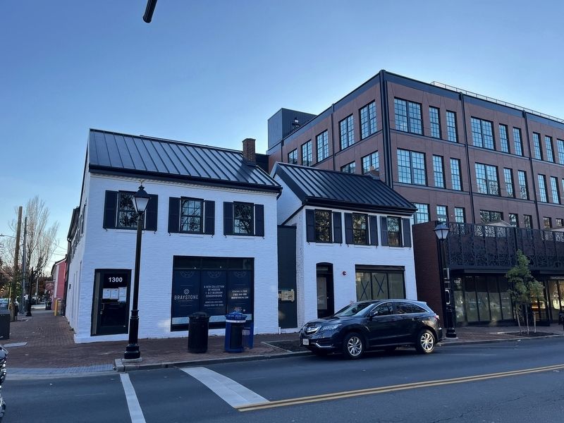
The marker can be found between 1300 and 1302 King Street.
Alexandria Archaeology, Office of Historic Alexandria
G.M. Hopkins, City Atlas of Alexandria, 1877
Erected by City of Alexandria, Virginia.
Topics and series. This historical marker is listed in these topic lists: Anthropology & Archaeology • Architecture • Industry & Commerce. In addition, it is included in the Virginia, The City of Alexandria series list. A significant historical year for this entry is 1300.
Location. 38° 48.352′ N, 77° 3.227′ W. Marker is in Alexandria, Virginia. It is in Old Town. Marker is on King Street (Virginia Route 7) west of South Payne Street, on the left when traveling west. Touch for map. Marker is at or near this postal address: 1302 King St, Alexandria VA 22314, United States of America. Touch for directions.
Other nearby markers. At least 8 other markers are within walking distance of this marker. Alexandria, D.C. (within shouting distance of this marker); Freedom House Museum (about 300 feet away, measured in a direct line); Port City (about 300 feet away); Carver School (about 400 feet away); L’Ouverture Hospital (about 400 feet away); L'Overture Hospital HQ (about 600 feet away); Capt. James McGuire House (about 600 feet away); James Harris House (about 600 feet away). Touch for a list and map of all markers in Alexandria.
Credits. This page was last revised on November 13, 2023. It was originally submitted on November 13, 2023, by Devry Becker Jones of Washington, District of Columbia. This page has been viewed 83 times since then and 38 times this year. Photos: 1, 2. submitted on November 13, 2023, by Devry Becker Jones of Washington, District of Columbia.