Morristown in St. Lawrence County, New York — The American Northeast (Mid-Atlantic)
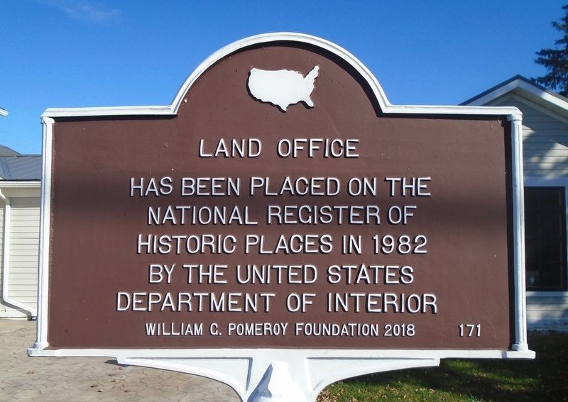
Land Office
Photographed by William Fischer, Jr., November 12, 2023
1. Land Office NRHP Marker
National Register of Historic Places
in 1982 by the United States
Department of [the] Interior
Erected 2018 by William G. Pomeroy Foundation. (Marker Number 171.)
Topics and series. This historical marker is listed in this topic list: Notable Buildings. In addition, it is included in the National Register of Historic Places (NRHP), and the William G. Pomeroy Foundation series lists. A significant historical year for this entry is 1982.
Location. 44° 35.329′ N, 75° 39.029′ W. Marker is in Morristown, New York, in St. Lawrence County. It is on Main Street north of Morris Street, on the right when traveling north. Touch for map. Marker is at or near this postal address: 200 Main Street, Morristown NY 13664, United States of America. Touch for directions.

Regionally, this marker is in Upstate New York and in the Adirondacks & North Country. It is also in the American Northeast and in the Mid-Atlantic. Globally, it is in North America, the Western Hemisphere, the Western World, and the Anglosphere. Historically, it finds itself in what was once the Viceroyalty of New France, the Haudenosaunee
this page online
Other nearby markers. At least 8 other markers are within 3 kilometers of this marker, measured as the crow flies: Stone Wind Mill (about 700 feet away, measured in a direct line); Honor Roll (about 700 feet away); A Tribute to Our Nation's Defenders (about 800 feet away); Fulford Place (approx. 1.2 miles away in Canada); Senator George T. Fulford (approx. 1.9 kilometers away in Canada); Indian Cliff (approx. 2.1 kilometers away in Canada); Samuel Reynolds House (approx. 2.2 kilometers away in Canada); Centeen Memorial Dive Park (approx. 2.2 kilometers away in Canada). Touch for a list and map of all markers in Morristown.
Regarding Land Office.
HISTORICAL AND ARCHITECTURAL IMPORTANCE:
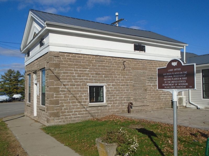
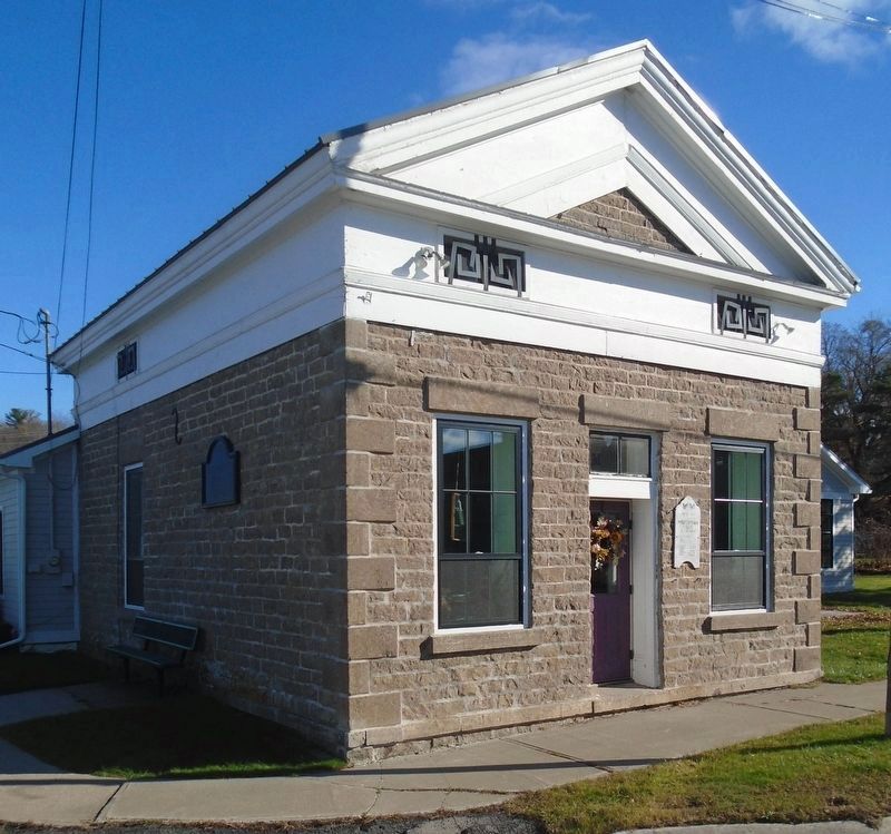
This stone building was constructed as a land office by the Chapman family around 1820. The Chapmans, together with other early land owners such as the Ogdens, Fords, and Judsons, were instrumental in the early growth and development of Morristown particularly in the area of trade with Canada. The land office is an important local example of the Greek Revival style
Photographed by William Fischer, Jr., November 12, 2023
2. Land Office and Marker
The building remained in the Chapman family until 1904, when it was deeded to the village for use as a public library. The building represents highly refined characteristics of limestone building practices in the St. Lawrence region.
Also see . . . Morristown Village Multiple Resource Survey. (Submitted on November 13, 2023, by William Fischer, Jr. of Reynoldsburg, Ohio.)
Photographed by William Fischer, Jr., November 12, 2023
3. Land Office
Credits. This page was last revised on November 13, 2023. It was originally submitted on November 13, 2023, by William Fischer, Jr. of Reynoldsburg, Ohio. This page has been viewed 143 times since then and 13 times this year. Photos: 1, 2, 3. submitted on November 13, 2023, by William Fischer, Jr. of Reynoldsburg, Ohio.
