Elkhart in Elkhart County, Indiana — The American Midwest (Great Lakes)
The Rivers for Commerce
Our Rivers Story
Transporting Goods on the Rivers
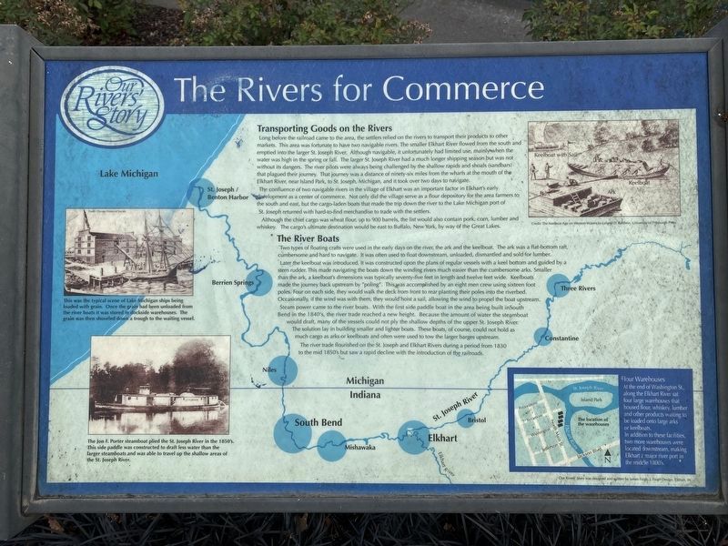
Long before the railroad came to the area, the settlers relied on the rivers to transport their products to other markets. This area was fortunate to have two navigable rivers. The smaller Elkhart River flowed from the south and emptied into the larger St. Joseph River. Although navigable, it unfortunately had limited use, mainly when the water was high in the spring or fall. The larger St. Joseph River had a much longer shipping season but was not without its dangers. The river pilots were always being challenged by the shallow rapids and shoals (sandbars) that plagued their journey. That journey was a distance of ninety-six miles from the wharfs at the mouth of the Elkhart River, near Island Park, to St. Joseph, Michigan, and it took over two days to navigate.
The confluence of two navigable rivers in the village of Elkhart was an important factor in Elkhart's early development as a center of commerce. Not only did the village serve as a flour depository for the area farmers to the south and east, but the cargo-laden boats that made the trip down the river to the Lake Michigan port of St. Joseph returned with hard-to-find merchandise to trade with the settlers.
Although the chief cargo was wheat flour, up to 900 barrels, the list would also contain pork, corn, lumber and whiskey. The cargo's ultimate destination would be east to Buffalo, New York, by way of the Great Lakes.
The River Boats
Two types of floating crafts were used in the early days on the river, the ark and the keelboat. The ark was a flat-bottom raft, cumbersome and hard to navigate. It was often used to float downstream, unloaded, dismantled and sold for lumber.
Later the keelboat was introduced. It was constructed upon the plans of regular vessels with a keel bottom and guided by stern rudder. This made navigating the boats down the winding rivers much easier than the cumbersome arks. Smaller than the ark, a keelboat's dimensions were typically seventy-five feet in length and twelve feet wide. Keelboats made the journey back upstream by "poling". This was accomplished by an eight men crew using sixteen foot poles. Four on each side, they would walk the deck from front to rear planting their poles into the riverbed.Occasionally, if the wind was with them, they would hoist a sail, allowing the wind to propel the boat upstream.
Steam power came to the river boats. With the first side paddle boat in the area being built in South Bend in the 1840's, the river trade reached a new height. Because the amount of water the steamboat would draft, many of the vessels could not ply the shallow depths of the upper St. Joseph River. The solution lay in building smaller and lighter boats. These boats, of course, could not hold as much cargo as arks or keelboats and often were used to tow the larger barges upstream.
The river trade flourished on the St. Joseph and Elkhart Rivers during a period from 1830 to the mid 1850's but saw a rapid decline with the introduction of the railroads.
[Captions:]
This was the typical scene of Lake Michigan ships being loaded with grain. Once the grain had been unloaded from the river boats it was stored in dockside warehouses. The grain was then shoveled down a trough to the waiting vessel.
The Jon F. Porter steamboat plied the St. Joseph River in the 1850's.This side paddle was constructed to draft less water than the arger steamboats and was able to travel up the shallow areas of the St. Joseph
The Keelboat Age on Western Waters by Leland D. Baldwin, University of Pittsburgh Press
Flour Warehouses At the end of Washington St., along the Elkhart River sat four large warehouses that housed flour, whiskey, lumber and other products waiting to be loaded onto large arks or keelboats.
In addition to these facilities, two more warehouses were located downstream, making Elkhart a major river port in the middle 1800's
Our Rivers Story was designed and written by James Faigh, J. Faigh Design, Elkhart, IN
Topics. This historical marker is listed in these topic lists: Industry & Commerce • Railroads & Streetcars • Settlements & Settlers • Waterways & Vessels. A significant historical year for this entry is 1830.
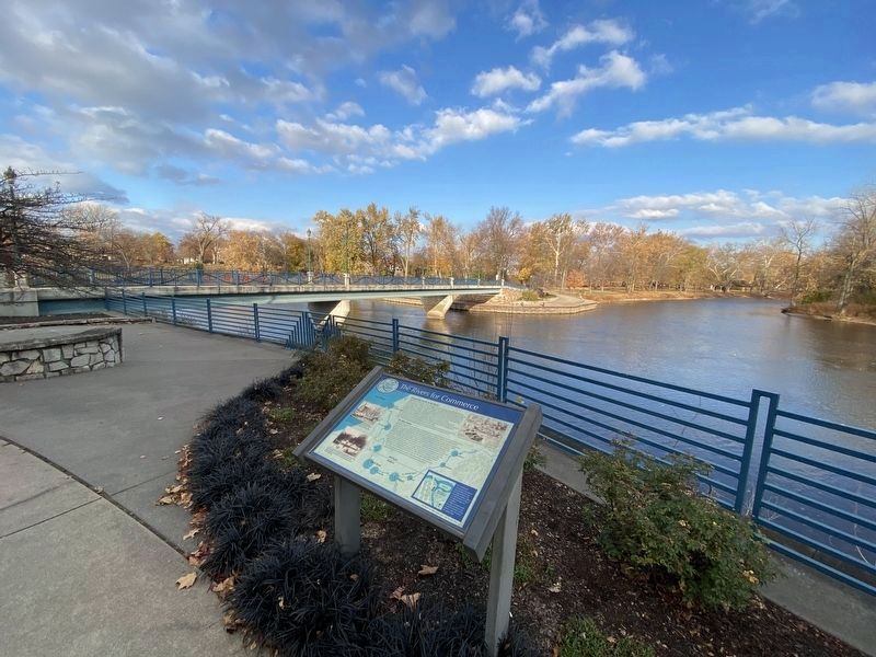
Location. 41° 41.447′ N, 85° 58.426′ W. Marker is in Elkhart, Indiana, in Elkhart County. Marker can be reached from Riverwalk Drive south of East Sycamore Street, on the right when traveling north. Marker is on the River Walk Culture Trail on the west side of the Elkhart River just south of the entrance to the Sycamore St. pedestrian bridge that goes to Island Park. Touch for map. Marker is at or near this postal address: 300 Riverwalk Dr, Elkhart IN 46516, United States of America. Touch for directions.
Other nearby markers. At least 8 other markers are within walking distance of this marker. Elkhart River Wharves (about 300 feet away, measured in a direct line); Island Park (about 400 feet away); The Rivers for Recreation (about 800 feet away); Development of Diagnostic Test Strips (approx. 0.2 miles away); Main St. Memorial Bridge (approx. 0.2 miles away); Ruthmere (approx. 0.2 miles away); The Rivers for Industry (approx. 0.2 miles away); The Rivers and the Native Americans (approx. 0.2 miles away). Touch for a list and map of all markers in Elkhart.
Credits. This page was last revised on November 18, 2023. It was originally submitted on November 13, 2023, by Lou Donkle of Valparaiso, Indiana. This page has been viewed 42 times since then and 8 times this year. Photos: 1, 2. submitted on November 13, 2023, by Lou Donkle of Valparaiso, Indiana. • Devry Becker Jones was the editor who published this page.

