Saline in Washtenaw County, Michigan — The American Midwest (Great Lakes)
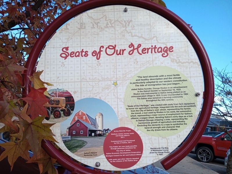
Seats of Our Heritage
stated Saline founder, Orange Risdon in an advertisement in the Detroit Gazette on September 10, 1825. Risdon was instrumental in Saline being platted as an unincorporated village in 1832. It was incorporated in 1866. The Saline area remained a farming community throughout the 20th century.
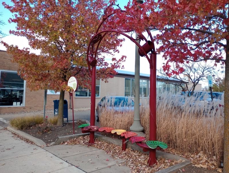
"Seats of Our Heritage," was created with seats from farm equipment to honor our agricultural heritage. Integrated into the arch are symbols from the City of Saline's seal: wheat, representing the farmer; the transit, a tool used by Risdon in his work; the automotive wheel, representing a major source of employment for Saline's citizens; a wagon wheel, denoting Saline's early days as a hub in Detroit-Chicago shipping; a tree, representing the harmonious growth of agriculture and industry. Encircling the elements is a rope to symbolize the band of strength and character that the city draws from its citizens.
Saline's Historic Rentschler Farm
Artist: Rick De Troyer
Medium: metal, tractor seats and found objects 2011
Commissioned and Purchased by City of Saline, 2011
This Public Art was made possible through generous donations by:
The City of Saline Saline Economic Development Corporation Michigan Council for Art and Cultural Affairs
with seats and other objects donated by the citizens of the Saline Area
Background: Plat Map of Washtenaw County drawn by Orange Risdon in 1825.
Erected 2011 by The City of Saline Saline Economic Development Corporation Michigan Council for Art and Cultural Affairs.
Topics. This historical marker is listed in these topic lists: Agriculture • Arts, Letters, Music • Settlements & Settlers. A significant historical date for this entry is September 10, 1825.
Location. 42° 10.043′ N, 83° 46.9′ W. Marker is in Saline, Michigan, in Washtenaw County. Marker is on North Ann Arbor Street, on the right when traveling north. Touch for map. Marker is at or near this postal address: 106 N Ann Arbor Street, Saline MI 48176, United States of America. Touch for directions.
Other nearby markers. At least 8 other markers are within walking distance of this marker. The Citizens Bank Building (within shouting distance of this marker); Saline Presbyterian Church (about 300 feet away, measured in a direct line); The Union Block (about 400 feet away); Salt Springs / Saline (about 500 feet away); The Fire Bell (approx. 0.2 miles away); Robison-Bahnmiller Funeral Home (approx. ¼ mile away); In Memory Of All American Veterans (approx. 0.4 miles away); Davenport House (approx. 0.4 miles away). Touch for a list and map of all markers in Saline.
Credits. This page was last revised on November 30, 2023. It was originally submitted on November 14, 2023, by Craig Doda of Napoleon, Ohio. This page has been viewed 38 times since then and 8 times this year. Photos: 1, 2. submitted on November 14, 2023, by Craig Doda of Napoleon, Ohio. • Andrew Ruppenstein was the editor who published this page.

