Waterfront in Santa Barbara in Santa Barbara County, California — The American West (Pacific Coastal)
Purisima
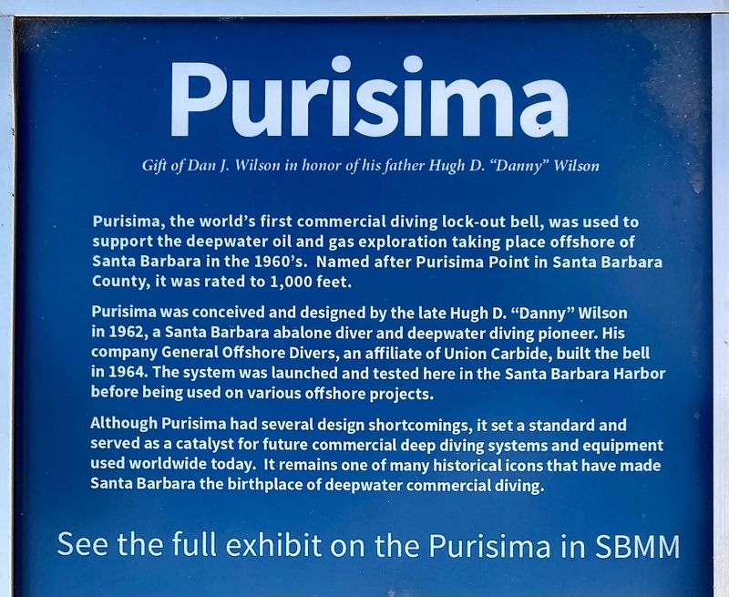
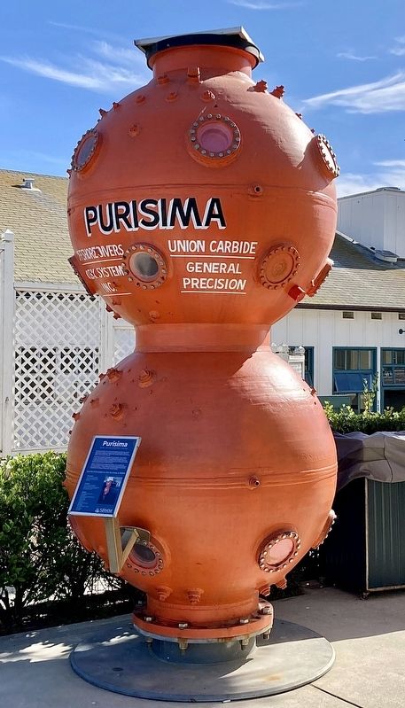
Purisima, the world's first commercial diving lock-out bell, was used to support the deepwater oil and gas exploration taking place offshore of Santa Barbara in the 1960's. Named after Purisima Point in Santa Barbara County, it was rated to 1,000 feet.
Purisima was conceived and designed by the late Hugh D. "Danny" Wilson in 1962, a Santa Barbara abalone diver and deepwater diving pioneer. His company General Offshore Divers, an affiliate of Union Carbide, built the bell in 1964. The system was launched and tested here in the Santa Barbara Harbor before being used on various offshore projects.
Although Purisima had several design shortcomings, it set a standard and served as a catalyst for future commercial deep diving systems and equipment used worldwide today. It remains one of many historical icons that have made Santa Barbara the birthplace of deepwater commercial diving.
See the full exhibit on the Purisima in SBMM.
Erected 2011 by Santa Barbara Maritime Museum.
Topics. This historical marker is listed in this topic list: Science & Medicine. A significant historical year for this entry is 1964.
Location. 34° 24.243′ N, 119° 41.61′ W. Marker is in Santa Barbara, California, in Santa Barbara County. It is in Waterfront. Marker can be reached from Harbor Way near Shoreline Drive. Located near the Santa Barbara Maritime Museum. Touch for map. Marker is at or near this postal address: 113 Harbor Way, Santa Barbara CA 93109, United States of America. Touch for directions.
Other nearby markers. At least 8 other markers are within walking distance of this marker. Naval Reserve Building (a few steps from this marker); Red Abalone (within shouting distance of this marker); Santa Barbara Yacht Club (about 300 feet away, measured in a direct line); Los Baños del Mar Pool (approx. ¼ mile away); Sambo's Birthplace (approx. 0.4 miles away); Burton Mound (approx. half a mile away); Santa Barbara Veterans' Memorial Building (approx. half a mile away); Trussell-Winchester Adobe (approx. half a mile away). Touch for a list and map of all markers in Santa Barbara.
Also see . . . Purisima Diving Bell. Santa Barbara Maritime Museum website, excerpt:
The Purisima was used to increase the safety and efficacy of deep dives by keeping the divers warm and dry on the trip to and from the job site.(Submitted on November 15, 2023.)
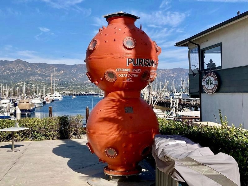
Two dry spheres were utilized to transport and protect both divers and subsea engineers. The upper sphere could be kept at surface pressure to house engineers and observers, while the bottom sphere was pressurized at depth, permitting divers to lockout and work on subsea structures at depth, and providing a space for decompression after the dive, allowing them to reach depths unattainable by surface divers. Although the design wasn’t perfect and ended up needing a third bell for stabilization, it helped shape the next generation of commercial diving technology, including the development of lightweight diving gear that became important in allowing divers ease of exit and entry through the hatch of the bell.
The Purisima has been located on SBMM’s front patio since 2011, and there is an exhibit and video inside the Museum.
Credits. This page was last revised on November 15, 2023. It was originally submitted on November 15, 2023, by Craig Baker of Sylmar, California. This page has been viewed 66 times since then and 20 times this year. Photos: 1, 2, 3. submitted on November 15, 2023, by Craig Baker of Sylmar, California.


