Jekerkwartier in Maastricht, Limburg, Netherlands — Northwestern Europe
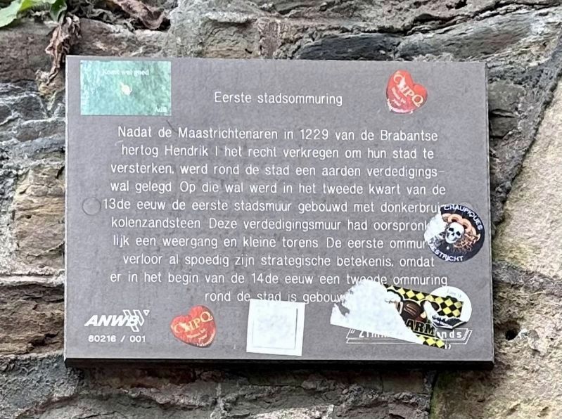
Eerste Stadsommuring / First City Wall
Inscription.
After the people of Maastricht in 1229 obtained from the Brabant Duke Henry I the right to strengthen their city’s defenses, an earthen defensive wall was built around the city. On top of that wall in the second quarter of the the 13th century, the first stone city wall was built with dark brown coal sandstone. This defensive wall originally had a rampart and small towers. The first wall soon lost its strategic significance, because at the beginning of the 14th century a second wall was built around the city.
Erected by ANWB, VVV, Zimmermanfonds.
Topics. This historical marker is listed in this topic list: Forts and Castles. A significant historical year for this entry is 1229.
Location. 50° 50.736′ N, 5° 41.542′ E. Marker is in Maastricht, Limburg. It is in Jekerkwartier. Marker is at the intersection of Lange Grachtje and Sint Pieterstraat, on the left when traveling north on Lange Grachtje. Touch for map. Marker is at or near this postal address: Sint Pieterstraat 26, Maastricht, Limburg 6211 JN, Netherlands. Touch for directions.
Other nearby markers. At least 8 other markers are within walking distance of this marker. Non Sum Qualis Eram (a few steps from this marker); Franciscanen- of Minderbroederskerk / Franciscan or “Little Brothers” Church (within shouting distance of this marker); De Waalse of Franse kerk / The Walloon or French Church (within shouting distance of this marker); Faliezustersklooster / Sisters of the Veil Convent (within shouting distance of this marker); De Bisschopsmolen / The Bishop’s Mill (about 90 meters away, measured in a direct line); Waterpoort Achter de Minderbroeders / “Behind the Franciscans” Water Gate (about 90 meters away); Huis de Ridder / House of Ridder (about 90 meters away); Stadsommuring / City Walls (about 120 meters away). Touch for a list and map of all markers in Maastricht.
Related markers. Click here for a list of markers that are related to this marker.
Also see . . .
1. Vestingwerken van Maastricht (Wikipedia, in Dutch).
Overview (in translation): The Maastricht fortifications are the fortifications of the Dutch-Limburg city of Maastricht, built over a period of 1,500 years to protect the city and its inhabitants against enemy attacks.(Submitted on November 16, 2023.)
The city was walled and fortified from Roman times until after 1867 (when its fortress status was lifted). Over the centuries, ramparts, walls, gates, towers, bastions and other fortifications were continuously being built. Roughly speaking, one can speak of four construction periods: the Romano-Celtic fortifications, the early medieval fortifications, the medieval city walls and the 16th to 19th century outbuildings. For centuries, the fortified city of Maastricht was known as the "stronghold of the Netherlands", an advanced post of the Republic of the Seven United Netherlands.
Although large parts of the city walls (including all but one of the city gates) and outer works were demolished in the 19th century, the remaining fortifications (a total of approximately 150 objects with 30,000 m2 of walls and 11 km of corridor systems) form a unique sample of a fortified city through the ages.
2. Lang Grachtje en Klein Grachtje (Wikipedia, in Dutch).
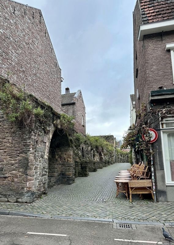
Overview (in translation): Lang Grachtje and Klein Grachtje are two streets and city walls in the center of the Dutch city of Maastricht, which are very similar in location, history and appearance. The city wall on the south side of both streets was once part of the first medieval city wall of Maastricht. The rampart wall dates from the 13th century, but has been restored many times over the centuries. The two streets in the Jekerkwartier have seven national monuments, all of which are part of the city wall.(Submitted on November 16, 2023.)
Credits. This page was last revised on December 31, 2023. It was originally submitted on November 16, 2023, by Andrew Ruppenstein of Lamorinda, California. This page has been viewed 39 times since then and 6 times this year. Photos: 1, 2. submitted on November 16, 2023, by Andrew Ruppenstein of Lamorinda, California.

