Pella in Marion County, Iowa — The American Midwest (Upper Plains)
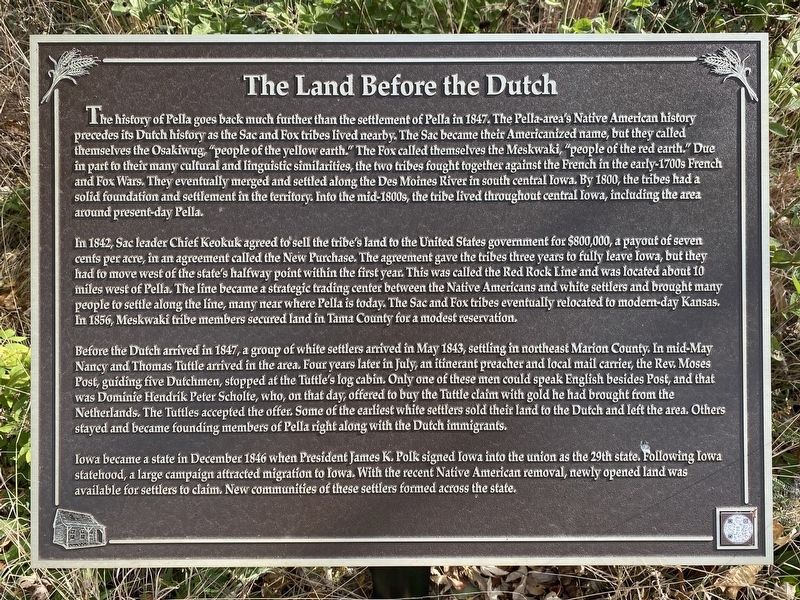
The Land Before the Dutch
November 5, 2023
1. The Land Before the Dutch Marker
In 1842, Sac leader Chief Keokuk agreed to sell the tribe's land to the United States government for $800,000, a payout of seven cents per acre, in an agreement called the New Purchase. The agreement gave the tribes three years to fully leave Iowa, but they had to move west of the state's halfway point within the first year. This was called the
this page online
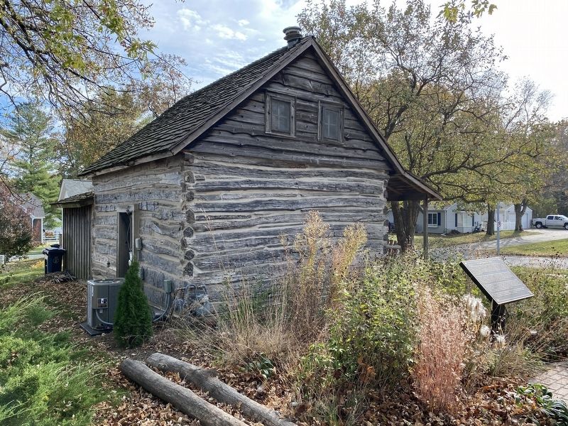
Before the Dutch arrived in 1847, a group of white settlers arrived in May 1843, settling in northeast Marion County. In mid-May Nancy and Thomas Tuttle arrived in the area. Four years later in July, an itinerant preacher and local mail carrier, the Rev. Moses Post, guiding five Dutchmen, stopped at the Tuttle's log cabin. Only one of these men could speak English besides Post, and that was Dominie Hendrik Peter Scholte, who, on that day, offered to buy the Tuttle claim with gold he had brought from the Netherlands. The Tuttles accepted the offer. Some of the earliest white settlers sold their land to the Dutch and left the area. Others stayed and became founding members of Pella right along with the Dutch immigrants.
Iowa became a state in December
November 5, 2023
2. The Land Before the Dutch Marker & Tuttle Cabin
Erected 2021 by Historic Pella Trust.
Topics. This historical marker is listed in these topic lists: Indigenous Peoples and Communities • Settlements & Settlers. A significant historical year for this entry is 1842.
Location. 41° 24.653′ N, 92° 54.946′ W. Marker is in Pella, Iowa, in Marion County. It can be reached from Lincoln Street west of Houston Avenue, on the right when traveling west. Located along the Tuttle Learning Walk, between Tuttle Cabin and Sunken Garden Park. Touch for map. Marker is at or near this postal address: 608 Lincoln St, Pella IA 50219, United States of America. Touch for directions.

Regionally, this marker is in Southern Iowa. It is also in the American Midwest and in the Corn Belt. Globally, it is in North America, the Western Hemisphere, the Western World, and the Anglosphere. Historically, it finds itself in what was once the territory of the Mississippian Culture and also the Louisiana Purchase.
Other nearby markers. At least 8 other markers are within walking distance of this marker: Tuttle Cabin (a few steps from this marker); Why the Dutch Left Their Homeland (a few steps from this marker); A Nod to the Baptists (within shouting distance of this marker); The Early Years (within shouting distance of this marker); Pella and the Civil War (within shouting distance of this marker); Dutch Influence on Today's Pella (within shouting distance of this marker); Tulip Time and Sunken Garden (within shouting distance of this marker); Pella Civil War Monument (approx. ¼ mile away). Touch for a list and map of all markers in Pella.
Credits. This page was last revised on November 18, 2023. It was originally submitted on November 18, 2023. This page has been viewed 233 times since then and 29 times this year. Photos: 1, 2. submitted on November 18, 2023.
