East Vancouver in Metro Vancouver, British Columbia — Canada’s West Coast (North America)
Vancouver City Hall
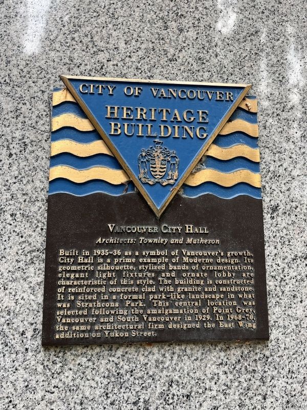
| — | City of Vancouver Heritage Building | — |
Photographed by Adam Margolis, October 14, 2023
1. Vancouver City Hall Marker
Vancouver City Hall
Architects: Townley and Matheson
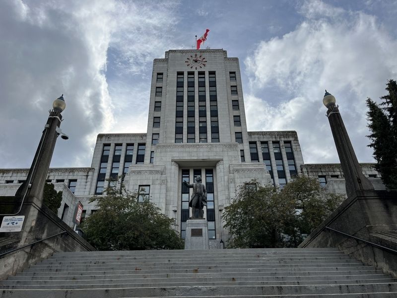
Built in 1935-36 as a symbol of Vancouver's growth, City Hall is a prime example of Moderne design. Its geometric silhouette, stylized bands of ornamentation, elegant light fixtures and ornate lobby are characteristic of this style. The building is constructed of reinforced concrete clad with granite and sandstone. It is sited in a formal park-like landscape in what was Strathcona Park. This central location was selected following the amalgamation of Point Grey, Vancouver and South Vancouver in 1926. In 1968-70, the same architectural firm designed the East Wing addition on Yukon Street.
Erected by City of Vancouver.
Topics and series. This historical marker is listed in these topic lists: Architecture • Government & Politics. In addition, it is included in the Canada, Vancouver, City of Vancouver Heritage Buildings series list. A significant historical year for this entry is 1926.
Location. 49° 15.641′ N, 123° 6.841′ W. Marker is in Vancouver, British Columbia, in Metro Vancouver. It is in East Vancouver. It can be reached from West 12th Avenue. Touch for map.
this page online

Regionally, this marker is on the Lower Mainland and in Coast & Mountains. Globally, it is in North America, in the Cascade Range, in the Inside Passage, on the Ring of Fire, on the Pacific Rim, in the Western Hemisphere, in the Western World, and in the Anglosphere. Historically, it finds itself in what was once a British colony.
Other nearby markers. At least 8 other markers are within walking distance of this marker: Captain George Vancouver R.N. (within shouting distance of this marker); Manzo Nagano (1853 - 1924) (about 90 meters away, measured in a direct line); Helena Gutteridge (about 120 meters away); Normal School (about 180 meters away); Model School (about 180 meters away); Grauer Residence (about 180 meters away); 150 West 10th Avenue (approx. 0.4 kilometers away); 148 West 10th Avenue (approx. 0.4 kilometers away). Touch for a list and map of all markers in Vancouver.
Photographed by Adam Margolis, October 14, 2023
2. Vancouver City Hall Marker
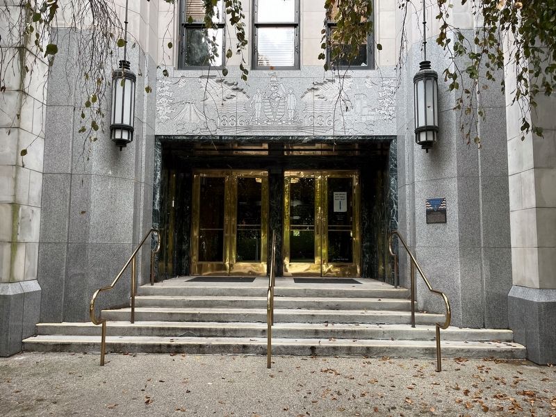
Marker located on the right side of the north facing entrance.
Photographed by Adam Margolis, October 14, 2023
3. Vancouver City Hall Marker
Photographed by Adam Margolis, October 14, 2023
4. Vancouver City Hall Marker
Cornerstone on the south facing entrance.
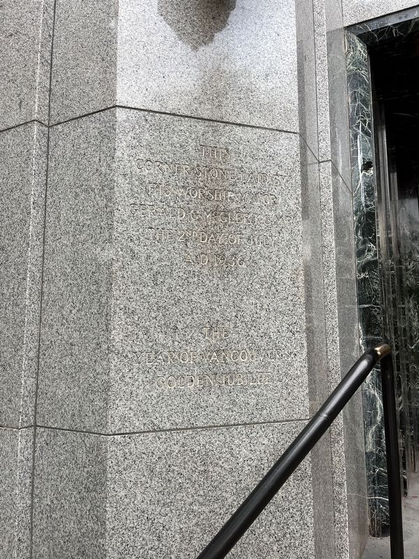
Photographed by Adam Margolis, October 14, 2023
5. Vancouver City Hall Marker
Cornerstone on the south facing entrance.
Photographed by Adam Margolis, October 14, 2023
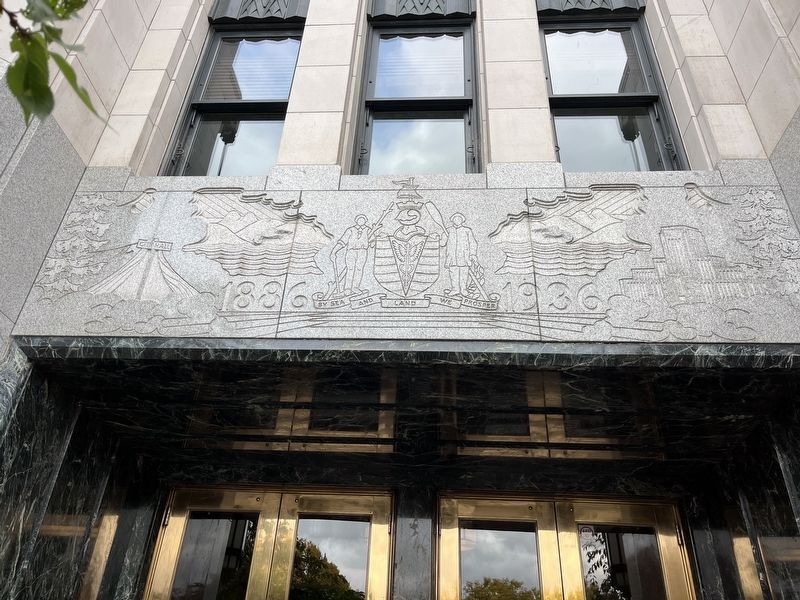
6. Vancouver City Hall Marker
Artwork above the south facing entrance.
Credits. This page was last revised on November 23, 2023. It was originally submitted on November 23, 2023, by Adam Margolis of Mission Viejo, California. This page has been viewed 293 times since then and 48 times this year. Photos: 1, 2, 3, 4, 5, 6. submitted on November 23, 2023, by Adam Margolis of Mission Viejo, California. • Andrew Ruppenstein was the editor who published this page.
