Rione X Campitelli in Roma in Città metropolitana di Roma Capitale, Latium, Rome, Italy — Central Italy (Tyrrhenian Coast)
Foro di Nerva / Forum of Nerva
Didascalie
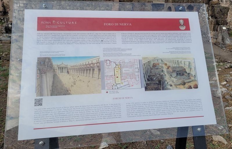
Sinistra: Veduta ricostruttiva del Foro di Nerva in epoca imperiate (Sovrintendenza Capitolina al Beni Culturali)
Centro: Pianta del Foro di Nerva e dell'area circostante. In nero le strutture di epoca romana; in rosso la situazione e la viabilità attuali. Nella pianta, oltre il Foro di Nerva, si possono vedere il percorso sotterraneo della Cloaca Maxima (A), la Curia (B) e la Basilica Emilia (C)
Destro: Veduta ricostruttiva del Foro di Nerva nel X secolo. Da notare le residenze aristocratiche, di cui vedete i resti davanti a voi (Sovrintendenza Capitolina al Beni Culturali)
You are in the area of the Forum of Nerva, which takes its name from the emperor (AD 96-98; in the photo
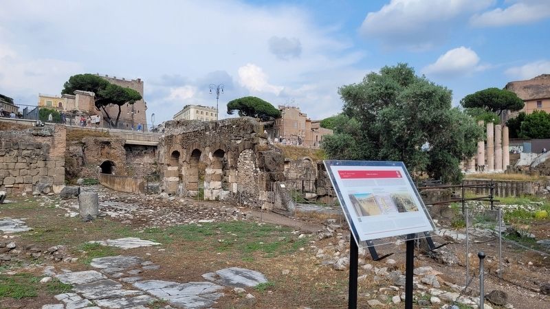
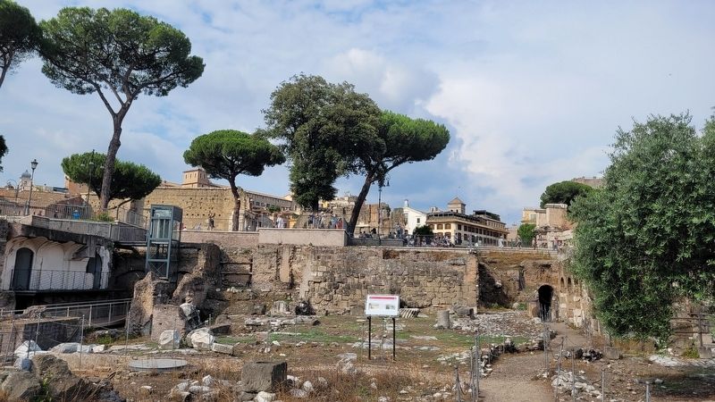
top right) who inaugurated it in AD 97. This Forum, the fourth of the Imperial Fora, is found between the Temple of Peace to the South (to your right) and the Fora of Caesar and Augustus to the North (to your left). It took place of a very ancient road, the Argiletum, which ran from Suburra (today, the Rione Monti) to the Roman Forum (behind you). Due to the lack of available space, a long, narrow piazza was built, bordered by a high wall in tufa blocks covered in marble, from which columns projected, these were mounted by an attic decorated with Stories of deities and representations of the people who lived in the Roman Empire. On the short eastern side of the Forum, you will find the Temple of Minerva (Map-1), demolished between the end of the 16th century and the start of the 17th century in order to reuse the precious marble as construction material. The eastern and western sectors of the Forum of Nerva are known and visible today, while the central part lies still unexplored beneath the Via dei Fori Imperiali. You are now in the western sector, brought to light at the end of the 20th century. The most important discoveries from those excavations include the remains of the two buildings which you see in front of you constructed in tufa blocks dating to the 9th-10th centuries, they are exceptional examples of aristocratic residences of the age. In the eastern sector of
the Forum, beyond Via dei Fori Imperiali and visible from the road, you will find the only two surviving columns from the Imperial era, popularly known as ’Colonnacce’ (ruined columns) due to their poor condition (Map-2).
Captions
Left: Reconstructed view of the Forum of Nerva in Imperial times (Superintendency of Cultural Heritage for the City of Rome)
Center: Map of the Forum of Nerva and surrounding area. In black: the Ancient Roman structures; in red: today's buildings and roads. On the map, as well as the Forum of Nerva, you can see the underground path of the Cloaca Maxima (literally: Greatest Sewer) (A), the Curia (B) and the Basilica Aemilia (C)
Right: Reconstructed view of the Forum of Nerva in the 10th century. Note the aristocratic residences, the remains of which can be seen in front of you (Superintendency of Cultural Heritage for the City of Rome)
Erected by Roma Culture and Sovrintendenza Capitolina ai Beni Culturali.
Topics. This historical marker is listed in these topic lists: Anthropology & Archaeology • Architecture. A significant historical year for this entry is 97 CE.
Location. 41° 53.59′ N, 12° 29.166′ E. Marker is in Roma, Lazio (Latium, Rome), in Città metropolitana di Roma Capitale. It is in Rione X Campitelli. Marker is on Via dei Fori Imperiali, 0.1 kilometers west of L.go della Salara Vecchia. The marker is located along the pathway in the Largo Romolo e Remo. Touch for map. Marker is in this post office area: Roma, Lazio 00186, Italy. Touch for directions.
Other nearby markers. At least 8 other markers are within walking distance of this marker. Foro di Cesare / Forum of Caesar (within shouting distance of this marker); Basi Marmoree / Marble Bases (within shouting distance of this marker); Basilica Aemilia (within shouting distance of this marker); Il Pavimento in Opus Sectile Della / The Opus Sectile Marble Floor (about 90 meters away, measured in a direct line); Basilica Aemilia Entablature / Trabeazione (about 90 meters away); a different marker also named Foro di Cesare / Forum of Caesar (about 90 meters away); Shrine of Venus Cloacina / Sacello di Venere Cloacina (about 90 meters away); Tabernae at the Front of the Basilica Aemilia (about 90 meters away). Touch for a list and map of all markers in Roma.
More about this marker. The marker is located in the Parco Archeologico del Colosseo (Roman Forum Archaeological Park) and it does require an entry fee to visit.
Also see . . .
1. Il Foro di Nerva. Roma Culture and Sovrintendenza Capitolina ai Beni Culturali (Submitted on November 24, 2023, by James Hulse of Medina, Texas.)
2. Forum of Nerva. Wikipedia
The Forum of Nerva was the fourth and smallest of the imperial fora. Its construction was started by Emperor Domitian before the year 85 AD, but officially completed and opened by his successor, Nerva, in 97 AD, hence its official name. The street, which the forum replaced, the Argiletum, had long served as a market area, especially for booksellers and cobblers; the new forum continued to serve as both a thoroughfare and as a monumental entrance to the larger Roman Fora.(Submitted on November 24, 2023, by James Hulse of Medina, Texas.)
Credits. This page was last revised on December 18, 2023. It was originally submitted on November 23, 2023, by James Hulse of Medina, Texas. This page has been viewed 49 times since then and 13 times this year. Photos: 1, 2, 3. submitted on November 24, 2023, by James Hulse of Medina, Texas.


