Cliffside in Scarborough in Toronto, Ontario — Central Canada (North America)
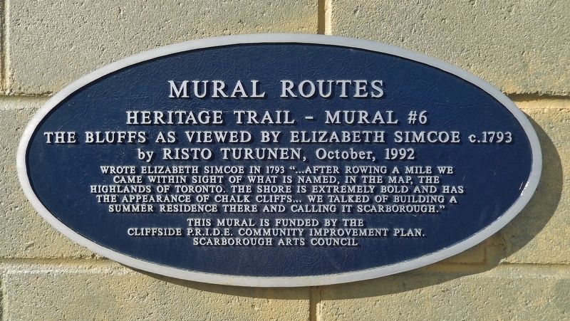
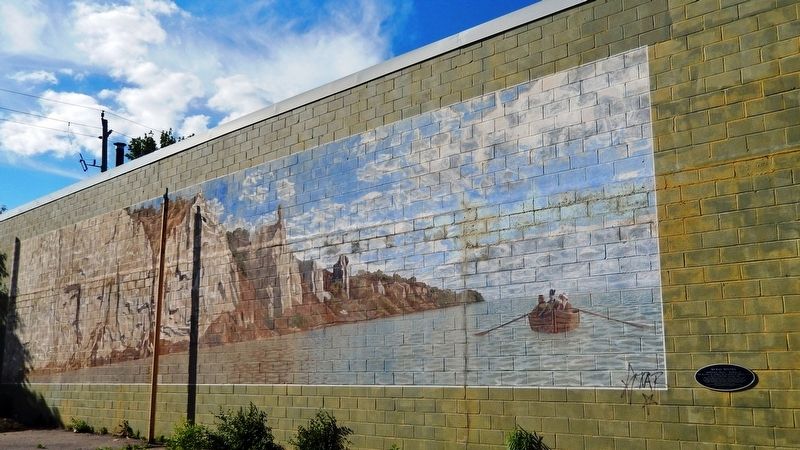
The Bluffs as Viewed by Elizabeth Simcoe c.1793
— Mural Routes Heritage Trail —
Inscription.
Wrote Elizabeth Simcoe in 1793 “…After rowing a mile we came within sight of what is named, in the map, the Highlands of Toronto. The shore is extremely bold and has the appearance of chalk cliffs… We talked of building a summer residence there and calling it Scarborough.”
This mural is funded by the
Cliffside P.R.I.D.E. Community Improvement Plan.
Erected 1992 by Scarborough Arts Council. (Marker Number 6.)
Topics. This historical marker is listed in these topic lists: Arts, Letters, Music • Natural Features • Settlements & Settlers. A significant historical year for this entry is 1793.
Location. 43° 42.48′ N, 79° 15.041′ W. Marker is in Scarborough, Ontario, in Toronto. It is in Cliffside. Marker is on Kingston Road south of Sandown Avenue, on the right when traveling south. Mural covers the south facade of the building at this address. Marker is on the right/east side of the mural. Touch for map. Marker is at or near this postal address: 2384 Kingston Road, Scarborough ON M1N 1V2, Canada. Touch for directions.
Other nearby markers. At least 8 other markers are within 13 kilometers of this marker, measured as the crow flies. Cliffside Golf Course (about 180 meters away, measured in a direct line); Scarborough Bluffs (approx. 1.2 kilometers away); J. Tuzo Wilson (approx. 7.1 kilometers away); The Ashbridge Estate / Le Domaine des Ashbridge (approx. 7.5 kilometers away); Toronto's first professional stadium: Sunlight Park 1886 - 1896 (approx. 9.9 kilometers away); York Post Office / Le Bureau de Poste de York (approx. 11.5 kilometers away); George Brown College (approx. 11.5 kilometers away); De La Salle Institute Building (approx. 11.5 kilometers away).
Related markers. Click here for a list of markers that are related to this marker.
Also see . . . Scarborough Bluffs (Wikipedia). Excerpt:
The Scarborough Bluffs, also known as The Bluffs, is an escarpment in the Scarborough district of Toronto, Ontario, Canada. Forming much of the eastern portion of Toronto's waterfront, the Scarborough Bluffs stands above the shoreline of Lake Ontario. At its highest point, the escarpment rises 90 metres (300 ft) above the coastline and spans a length of 15 kilometres. In the 1788 Plan of Toronto by Alexander Aitken, the bluffs were simply known as the High Lands. They became known as the Scarborough Highlands in 1793 named after Scarborough, North Yorkshire. This name was chosen by Elizabeth Simcoe, who was the wife of the first lieutenant governor of Upper Canada, John Graves Simcoe. The escarpment along Lake Ontario reminded Elizabeth Simcoe of the limestone cliffs in her hometown.(Submitted on November 25, 2023, by Cosmos Mariner of Cape Canaveral, Florida.)
Credits. This page was last revised on November 25, 2023. It was originally submitted on November 24, 2023, by Cosmos Mariner of Cape Canaveral, Florida. This page has been viewed 60 times since then and 30 times this year. Photos: 1, 2, 3. submitted on November 25, 2023, by Cosmos Mariner of Cape Canaveral, Florida.


