Fishermen's Wharf in San Francisco City and County, California — The American West (Pacific Coastal)
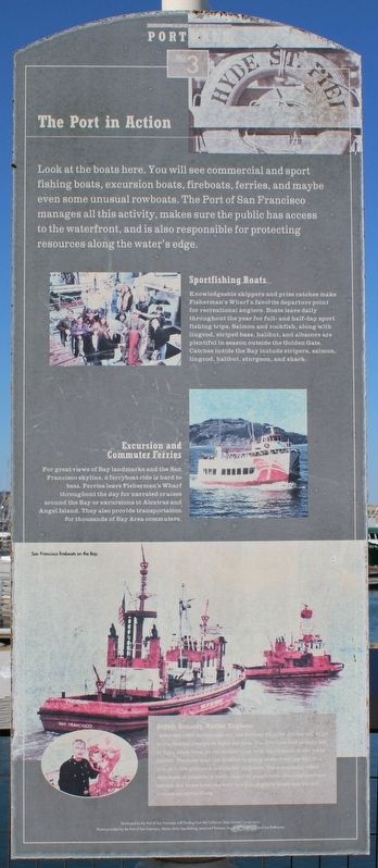
The Port in Action
Fishermen’s Wharf
— Port Walk —
Sportfishing Boats
Knowledgeable skippers and prize catches make Fishermen’s Wharf a favorite departure point for recreational anglers. Boats leave daily throughout the year for full- and half-day sport fishing trips. Salmon and rockfish, along with lingcod, striped bass, halibut, and albacore are plentiful in season outside the Golden Gate. Catches inside the Bay include stripers, salmon, lingcod, halibut, sturgeon, and shark.
Excursions and Commuter Ferries
For great views of Bay landmarks and the San Francisco skyline, a ferryboat ride is hard to beat. Ferries leave Fishermen’s Wharf throughout the day for narrated cruises around the Bay or excursions to Alcatraz and Angel Island. They also provide transportation for thousands of Bay Area commuters.
Dennis Kennedy, Marine Engineer
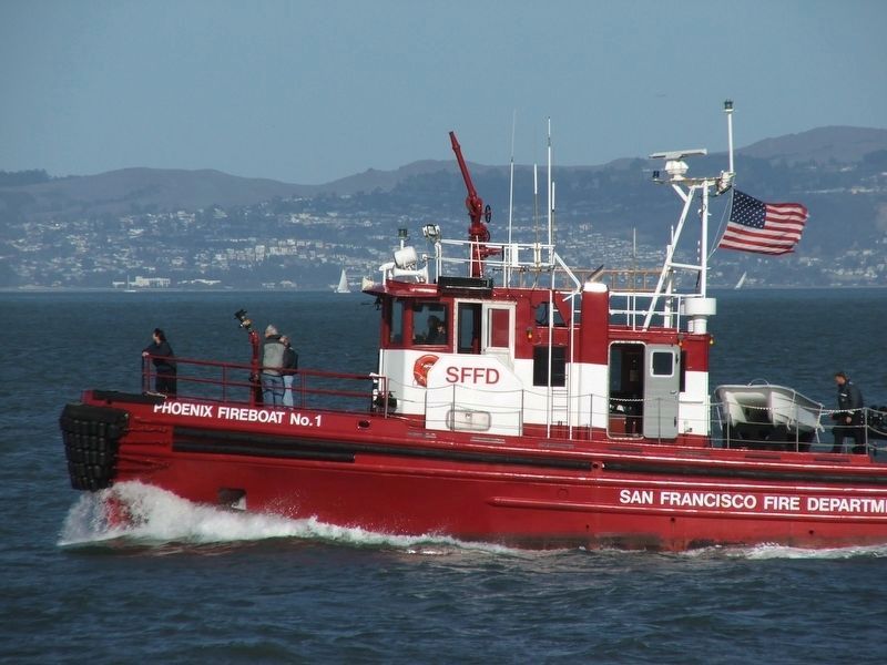
“After the 1989 earthquake hit, the fireboat Phoenix got the call to go to the Marina District to fight the fires. The fire crew had already left to fight other fires, so the marine crew took the Phoenix to the yacht harbor. The crew used the fireboat to pump water from the Bay at a rate of 6,400 gallons a minute for 15 hours. The community effort that made it possible: a daisy chain of people from the neighborhood carried the hoses from the boat to a fire engine’s hoses and up and around an entire block.
Developed by the Port of San Francisco with funding from the California State Coastal Conservancy. Photos provided by the Port of San Francisco, Wacky Jacky Sportfishing, Lenat and Partners, Inc. [illegible], and Jon Betthauser.
Erected by Port of San Francisco. (Marker Number 3.)
Topics. This historical marker is listed in these topic lists: Disasters • Waterways & Vessels. A significant historical year for this entry is 1989.
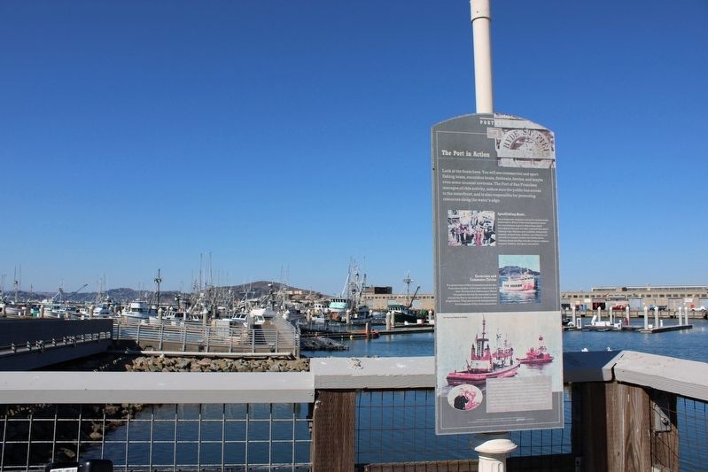
Location. 37° 48.524′ N, 122° 25.235′ W. Marker is in San Francisco, California, in San Francisco City and County. It is in Fishermen's Wharf. Marker can be reached from Jefferson Street east of Hyde Street, on the right when traveling west. The resin marker is mounted at the end of the water taxi landing. Touch for map. Marker is in this post office area: San Francisco CA 94109, United States of America. Touch for directions.
Other nearby markers. At least 8 other markers are within walking distance of this marker. Why Here? (a few steps from this marker); Sanitation at Sea (within shouting distance of this marker); Highway 101 (within shouting distance of this marker); Lewis Bay Ark (about 300 feet away, measured in a direct line); Hyde Street Pier Was Part of Highway 101 (about 300 feet away); Petaluma’s Sternwheel (about 300 feet away); Wapama’s Engine (about 300 feet away); Steam Donkey Engine (about 300 feet away). Touch for a list and map of all markers in San Francisco.
Also see . . .
1. Pier 22½ & the SFFD Fire Boats. Atlas Obscura
"The Phoenix was a vital tool in the Marina District during the chaotic aftermath of the 1989 Loma Prieta Earthquake. Pumping water from the St. Francis Yacht Harbor into the SFFD’s portable water system, the Phoenix delivered critical assistance to the conflagration at Beach and Divisadero Streets, saving countless homes."(Submitted on November 25, 2023, by Joseph Alvarado of Livermore, California.)
2. The Boat That Saved the Neighborhood. NBC Bay Area
"The fire department responded, but soon discovered another problem: The earthquake hadn't just broken gas lines. It had also broken the water pipes feeding the neighborhood's fire hydrants. As fire engines ferried in water from blocks away, and volunteers scooped up what water they could carry in paint buckets to throw on the fire, dispatchers summoned up a rarely-used resource: San Francisco's lone fireboat, the Phoenix."(Submitted on November 25, 2023, by Joseph Alvarado of Livermore, California.)
Credits. This page was last revised on November 25, 2023. It was originally submitted on November 25, 2023, by Joseph Alvarado of Livermore, California. This page has been viewed 41 times since then and 9 times this year. Photos: 1, 2, 3. submitted on November 25, 2023, by Joseph Alvarado of Livermore, California.


