Montreat in Buncombe County, North Carolina — The American South (South Atlantic)
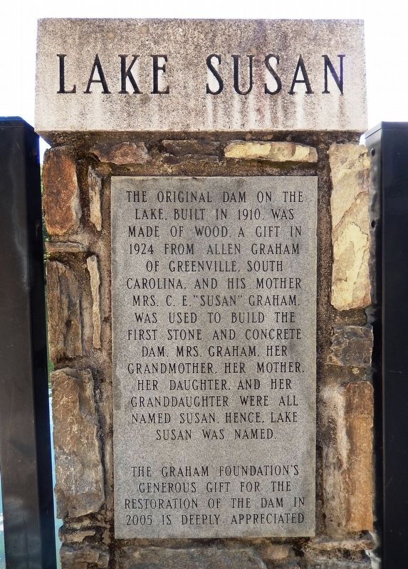
Lake Susan
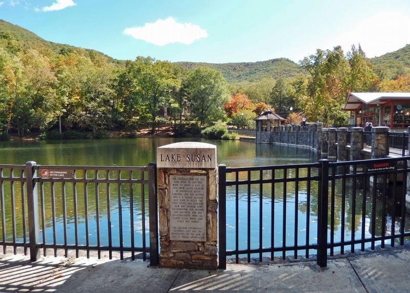
The original dam on this lake, built in 1910, was made of wood. A gift in 1924 from Allen Graham of Greenville, South Carolina, and his mother Mrs. C. E. “Susan” Graham, was used to build the first stone and concrete dam. Mrs. Graham, her grandmother, her mother, her daughter, and her granddaughter were all named Susan, hence, Lake Susan was named.
The Graham Foundation’s generous gift for the restoration of the dam in 2005 is deeply appreciated.
Topics. This historical marker is listed in these topic lists: Charity & Public Work • Waterways & Vessels. A significant historical year for this entry is 1910.
Location. 35° 38.838′ N, 82° 17.949′ W. Marker is in Montreat, North Carolina, in Buncombe County. Marker is at the intersection of Assembly Drive (Greybeard Trail) and Georgia Terrace, on the right when traveling north on Assembly Drive (Greybeard Trail). The marker is mounted on a stone fence column overlooking the lake. Touch for map. Marker is in this post office area: Montreat NC 28757, United States of America. Touch for directions.
Other nearby markers. At least 8 other markers are within 3 miles of this marker, measured as the crow flies. Boone Trail Highway (about 300 feet away, measured in a direct line); Montreat's Rich Heritage is a Place of Renewal (about 300 feet away); Beetles Bring Hope for Hemlock Survival (approx. ¼ mile away); Mount Mitchell Railroad (approx. 1.9 miles away); Stoneman's Raid (approx. 2.2 miles away); Swannanoa Gap Engagement (approx. 2.3 miles away); Swannanoa Tunnel (approx. 2.3 miles away); Montreat College (approx. 2.3 miles away). Touch for a list and map of all markers in Montreat.
Also see . . . The Lake — Lure & Lore of the Montreat Dam. Presbyterian Heritage Center website entry:
Excerpt:
The South Fork of the Swannanoa River, generally known as Flat Creek, flowed through the center of Montreat. During 1908 - 1909, a wooden dam was built by the Mountain Retreat Association. By 1924, the MRA administration decided to replace the wooden dam with a concrete structure. The funding for the new dam was donated by Allen Graham and his mother, Mrs. C. E. Graham. There were additional lake and dam reconstructions over the years. On May 4, 2004, a 35-foot portion of the earthen dam wall partially collapsed, forcing the Conference Center to drain the lake. The dam was completely renovated, and walkways improved, with the lake being refilled and re-opened in 2006.(Submitted on December 4, 2023, by Cosmos Mariner of Cape Canaveral, Florida.)
Credits. This page was last revised on February 8, 2024. It was originally submitted on December 3, 2023, by Cosmos Mariner of Cape Canaveral, Florida. This page has been viewed 81 times since then and 40 times this year. Photos: 1, 2, 3. submitted on December 4, 2023, by Cosmos Mariner of Cape Canaveral, Florida.


