
Dale City in Prince William County, Virginia — The American South (Mid-Atlantic)
New School Baptist Church
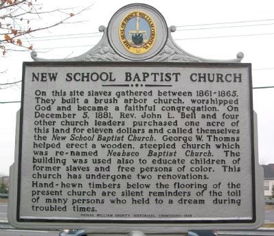
Photographed by Kevin W., February 22, 2008
1. New School Baptist Church Marker
Hand-hewn timbers below the flooring of the present church are silent reminders of the toil of many persons who held to a dream during troubled times.
Erected 1999 by Prince William County Historical Commission.
Topics and series. This historical marker is listed in these topic lists: African Americans • Education • Religion & Religious Structures. In addition, it is included in the Virginia, Prince William County Historical Commission series list. A significant historical date for this entry is December 5, 1881.
Location. 38° 36.929′ N, 77° 18.978′ W. Marker is in Dale City, Virginia, in
this page online

Regionally, this marker is in the Washington Metropolitan Area, in Northern Virginia, and in the Piedmont. It is also in the American South, specifically in the Upper South, in the Mid-Atlantic, and on the Eastern Seaboard. Globally, it is in the North Atlantic Region, North America, the Western Hemisphere, the Western World, and the Anglosphere. Historically, it finds itself in what was once the territory of the Mississippian Culture, one of the original Thirteen Colonies, one of the Confederate States of America, and the Antebellum South.
Other nearby markers. At least 8 other markers are within 2 miles of this marker, measured as the crow flies: The Courageous Four (approx. 0.4 miles away); Benita Fitzgerald Drive (approx. 0.9 miles away); Like to Eat? (approx. one mile away); Dumfries Rest Area (approx. one mile away); Neabsco Mills Ironworks (approx. one mile
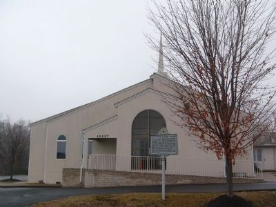
Photographed by Kevin W., February 22, 2008
2. Neabsco Baptist Church and New School Baptist Church Marker
Other markers no longer nearby. “Leesylvania” (was approx. 1.4 miles away but has been confirmed missing); Events Along Neabsco Creek (was approx. 1.4 miles away but has been confirmed missing).
Credits. This page was last revised on December 4, 2023. It was originally submitted on February 22, 2008, by Kevin W. of Stafford, Virginia. This page has been viewed 1,643 times since then and 73 times this year. Last updated on December 4, 2023, by N. Jozsa of Woodbridge, Virginia. Photos: 1, 2. submitted on February 22, 2008, by Kevin W. of Stafford, Virginia. • Bernard Fisher was the editor who published this page.
