Houlton in St. Croix County, Wisconsin — The American Midwest (Great Lakes)
Glacial Landscape
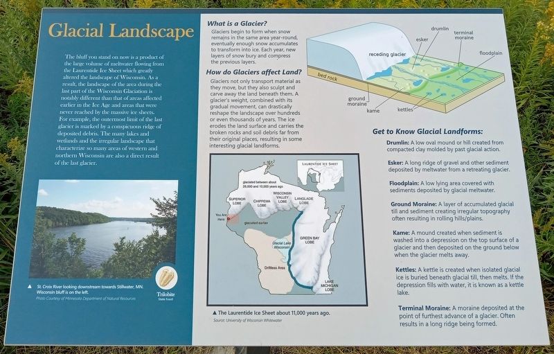
The bluff you stand on now is a product of the large volume of meltwater flowing from the Laurentide Ice Sheet which greatly altered the landscape of Wisconsin. As a result, the landscape of the area during the last part of the Wisconsin Glaciation is notably different than that of areas affected earlier in the Ice Age and areas that were never reached by the massive ice sheets. For example, the outermost limit of the last glacier is marked by a conspicuous ridge of deposited debris. The many lakes and wetlands and the irregular landscape that characterize so many areas of western and northern Wisconsin are also a direct result of the last glacier.
St. Croix River looking downstream towards Stillwater, MN. Wisconsin bluff is on the left.
Trilobite
State Fossil
What is a Glacier?
Glaciers begin to form when snow remains in the same area year-round, eventually enough snow accumulates to transform into ice. Each year, new layers of snow bury and compress the previous layers.
How do Glaciers affect Land?
Glaciers not only transport material as they move, but they also sculpt and carve away the land beneath them. A glacier's weight, combined with its gradual movement, can drastically reshape the landscape over hundreds or even thousands of years. The ice erodes the land surface and carries the broken rocks and soil debris far from their original places, resulting in some interesting glacial landforms.
The Laurentide Ice Sheet about 11,000 years ago.
Get to Know Glacial Landforms:
Drumlin: A low oval mound or hill created from compacted clay molded by past glacial action.
Esker: A long ridge of gravel and other sediment deposited by meltwater from a retreating glacier.
Floodplain: A low lying area covered with sediments deposited by glacial meltwater.
Ground Moraine: A layer of accumulated glacial till and sediment creating irregular topography often resulting in rolling hills/plains.
Kame: A mound created when sediment is washed into a depression on the top surface of a glacier and then deposited on the ground below when the glacier melts away.
Kettles: A kettle is created when isolated glacial ice is buried beneath glacial till, then melts. If the depression fills with water, it is known as a kettle lake.
Terminal Moraine: A moraine deposited at the point of furthest advance of a glacier. Often results in a long ridge being formed.
Topics. This historical marker is listed in this topic list: Environment.
Location.
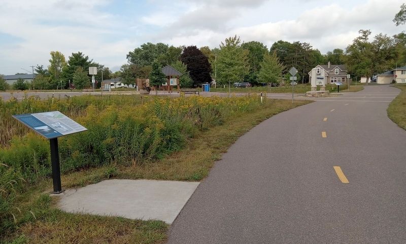
45° 3.796′ N, 92° 47.566′ W. Marker is in Houlton, Wisconsin, in St. Croix County. Marker can be reached from the intersection of Hilltop Drive and Hilltop Road, on the left when traveling south. The marker is on the St. Croix River Crossing Loop Trail, just west of the Hilltop Trailhead. Touch for map. Marker is in this post office area: Houlton WI 54082, United States of America. Touch for directions.
Other nearby markers. At least 8 other markers are within walking distance of this marker. Loop Trail Fun Facts (within shouting distance of this marker); Lower St. Croix River Sandbars (approx. 0.3 miles away); Town of St. Joseph (approx. 0.3 miles away); Western Prairie Restoration (approx. 0.4 miles away); Houlton Hill History (approx. 0.4 miles away); Lower St. Croix Scenic Riverway (approx. 0.4 miles away); Indigenous Communities (approx. 0.6 miles away); Native American Communities (approx. 0.6 miles away). Touch for a list and map of all markers in Houlton.
Credits. This page was last revised on December 5, 2023. It was originally submitted on December 4, 2023, by McGhiever of Minneapolis, Minnesota. This page has been viewed 55 times since then and 18 times this year. Photos: 1, 2. submitted on December 4, 2023, by McGhiever of Minneapolis, Minnesota. • J. Makali Bruton was the editor who published this page.

