
Ballpark District in Denver in Denver County, Colorado — The American Mountains (Southwest)
Union Station Area
Lower Downtown Historic District
| — | Established 1988 | — |
Photographed by Christopher Light, December 23, 2007
1. Union Area Station Marker
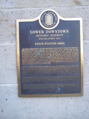
Denver's emergence as the metropolis of the Rockies is directly related to its role as the regional rail hub. When the transcontinental railroad chose Cheyenne and not Denver as its gateway to the west, Denverites rallied. Civic leaders such as Governor John Evans, Walter Scott Cheeseman, William J. Palmer and David Holliday Moffat, Jr. knew Denver would not survive without a railroad. Coloradans raised $300,000 in three days to build a 106-mile rail link to connect Denver with Cheyenne. At the ground breaking, Denverites celebrated more than a railroad. They were welcoming a vital link to commerce and industry that would ensure their city's future.
Union Station was first opened in 1881 to consolidate passenger service for Denver's expanding railroads. Destroyed in 1894 by fire, Union Station's central lobby was rebuilt and then enlarged in 1914. Prominently located at the terminus of 18th street, Union Station to this day is the focal point of the Lower Downtown District.
With the building of Union Station, 18th Street gained prominence as the premiere location for many of Denver's office buildings, banks, and
this page online
Union Station and its surrounding landmarks are the heart of Denver and gracious hallmarks of why Denver became the Queen City of the mountains and plains.
Erected 1988 by Denver Landmark Commission.
Topics. This historical marker is listed in these topic lists: Industry & Commerce • Railroads & Streetcars. A significant historical year for this entry is 1881.
Location. 39° 45.167′ N, 104° 59.998′ W. Marker is in Denver, Colorado, in Denver County. It is in the Ballpark District. It is on Wynkoop St near 17th Street. Touch for map. Marker is at or near this postal address: 1701 Wynkoop St, Denver CO 80202, United States of America. Touch for directions.

Regionally, this marker is in Colorado’s Front Range. It is also in the American Mountain West. Globally, it is in North America, the Rocky Mountains, the Western Hemisphere, the Western World, and the Anglosphere. Historically, it finds itself in what was once the Louisiana Purchase.
Other nearby markers. At least 8 other markers are within walking distance of this marker: Union Station Timeline
Photographed by Christopher Light, July 2, 2007
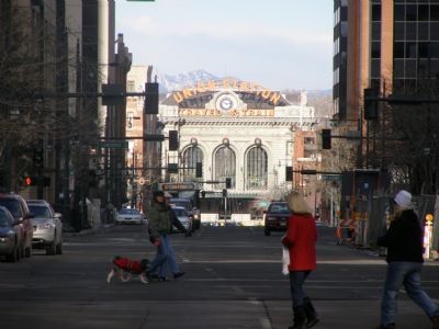
2. View down 17th Street towards the Station
Photographed by Christopher Light, December 24, 2007
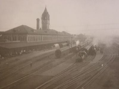
3. Historic view (1870)
This is a W.H. Jackson photograph of the 1st Union Station. This building burned in 1894 and was replaced by the current central structure.
Photographed by Christopher Light, December 24, 2007
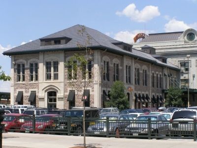
4. South Wing of the Station
The station was enlarged in 1914 with a north and south wing to provide lodging and other services.
Credits. This page was last revised on October 18, 2025. It was originally submitted on January 9, 2008, by Christopher Light of Valparaiso, Indiana. This page has been viewed 2,355 times since then and 22 times this year. Last updated on December 5, 2023, by Carl Gordon Moore Jr. of North East, Maryland. Photos: 1, 2, 3, 4. submitted on January 9, 2008, by Christopher Light of Valparaiso, Indiana. • J. Makali Bruton was the editor who published this page.
