Near New Ulm in Nicollet County, Minnesota — The American Midwest (Upper Plains)
New Ulm Spring
Roadside Parking Area
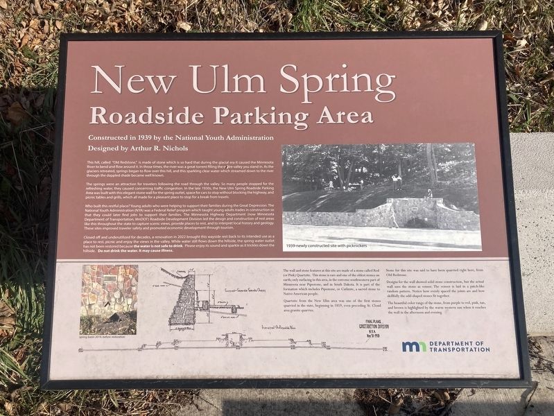
Constructed in 1939 by the National Youth Administration
Designed by Arthur R. Nichols
This hill, called "Old Redstone, is made of stone which is so hard that during the glacial era it caused the Minnesota River to bend and flow around it. In those times, the river was a great torrent filling the entire valley you stand in. As the glaciers retreated, springs began to flow over this hill, and this sparkling clear water which streamed down to the river through the dappled shade became well known.
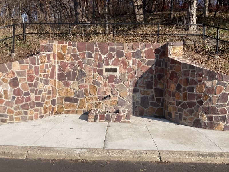
The springs were an attraction for travelers following the road through the valley. So many people stopped for the refreshing water, they caused concerning traffic congestion. In the late 1930s, the New Ulm Spring Roadside Parking Area was built with this elegant stone wall for the spring outlet, space for cars to stop without blocking the highway, and picnic tables and grills, which all made for a pleasant place to stop for a break from travels.
Who built this restful place? Young adults who were helping to support their families during the Great Depression. The National Youth Administration (NYA) was a Federal Relief program which taught young adults trades in construction so that they could later hind jobs to support their families. The Minnesota Highway Department now Minnesota Department of Transportation, MnDOT Roadside Development Division led the design and construction of rest areas like this throughout the state to capture scenic views, provide places to rest, and to interpret local history and geology. These sites improved traveler safety and promoted economic development through tourism.
Closed off and underutilized for decades, a renovation in 2022 brought this wayside rest back to its intended use as a place to rest, picnic and enjoy the views in the valley. While water still flows down the hillside, the spring water outlet has not been restored because the water is not safe to drink. Please enjoy its sound and sparkle as it trickles down the hillside. Do not drink the water. It may cause illness.
The wall and stone features at this site are made of a stone called Red (or Pink) Quartzite. This stone is rare and one of the oldest stones on earth; only surfacing in this area, in the extreme southwestern part of Minnesota near Pipestone, and in South Dakota. It is part of the formation which includes Pipestone, or Catlinite, a sacred stone to Native American people.
Quartzite from the New Ulm area was one of the first stones quarried in the state, beginning in 1859, even preceding St. Cloud area granite quarries.
Stone for this site was said to have been quarried right here, from Old Redstone.
Designs for the wall showed solid stone construction, but the actual wall uses the stone as veneer. The veneer is laid in a patch-like random pattern. Notice how evenly spaced the joints are and how skillfully the odd-shaped stones fit together.
The beautiful color range of the stone, from purple to red, pink, tan, and brown is highlighted by the warm western sun when it reaches the wall in the afternoon and evening.
Captions:
1939-newly constructed site with picnickers
spring basin 2019, before restoration
Erected 2023 by Minnesota Department of Transportation.
Topics. This historical marker is listed in these topic lists: Charity & Public Work • Roads & Vehicles. A significant historical year for this entry is 1939.
Location. 44° 18.702′ N, 94° 25.812′ W. Marker is near New Ulm, Minnesota, in Nicollet County. Marker is on U.S. 14 west of County Route 37, on the right when traveling west. Touch for map. Marker is in this post office area: New Ulm MN 56073, United States of America. Touch for directions.
Other nearby markers. At least 8 other markers are within 2 miles of this marker, measured as the crow flies. Gänseviertel (Goosetown) (approx. 1.1 miles away); Upper Minnesota River Transportation (approx. 1.1 miles away); 2011 Centennial of The Church of St. Mary (approx. 1.2 miles away); Flandrau's Charge (approx. 1.3 miles away); City Meat Market (approx. 1.4 miles away); Brown County Bank (approx. 1.4 miles away); Herman’s Footprint (approx. 1.4 miles away); Boesch, Hummel, and Maltzahn Block (approx. 1.4 miles away). Touch for a list and map of all markers in New Ulm.
Credits. This page was last revised on December 5, 2023. It was originally submitted on December 5, 2023, by Connor Olson of Kewaskum, Wisconsin. This page has been viewed 98 times since then and 48 times this year. Photos: 1, 2. submitted on December 5, 2023, by Connor Olson of Kewaskum, Wisconsin. • J. Makali Bruton was the editor who published this page.

