Pequot Lakes in Crow Wing County, Minnesota — The American Midwest (Upper Plains)
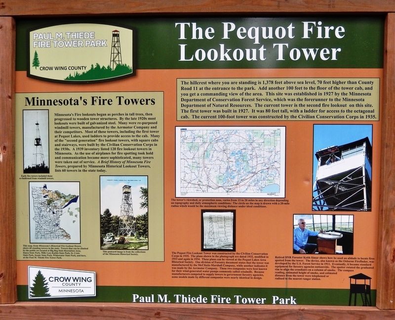
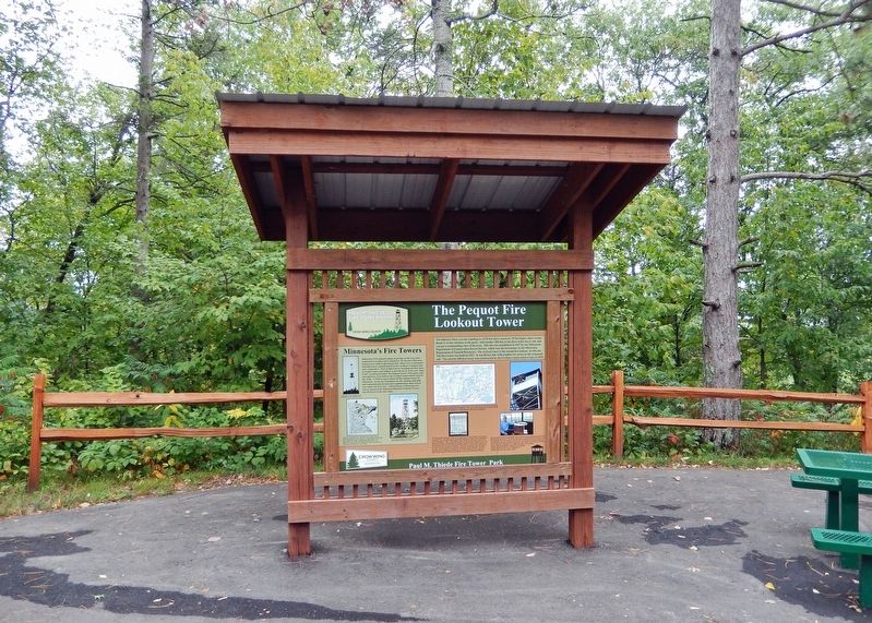
The Pequot Fire Lookout Tower
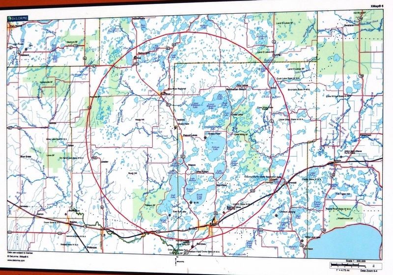
The tower's viewshed, or protection zone, varies from 15 to 20 miles in any direction depending on topography and daily atmospheric conditions. The circle on the map is drawn with a 20-mile radius which would be the maximum viewing distance under ideal conditions.
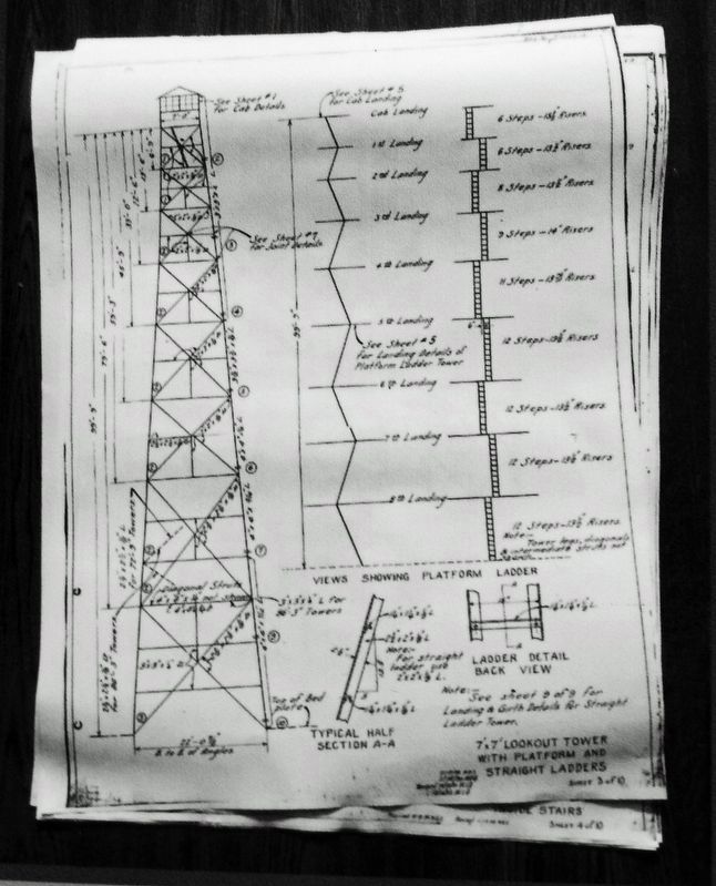
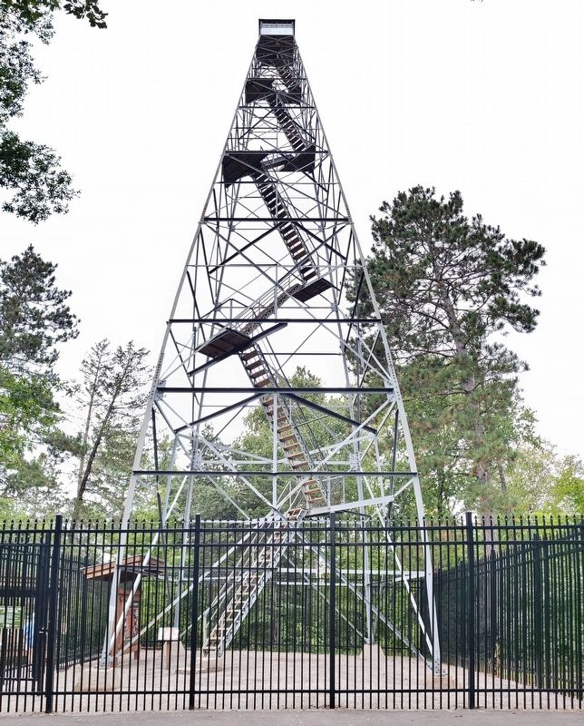
The Pequot Fire Lookout Tower was constructed by the Civilian Conservation Corps in 1935. The plans shown in the photograph are dated 1932, modified in 1933 and again in 1934. These plans can be viewed at the Pequot Lakes Area Historical Society. One division of Forestry document states that the tower was manufactured by the McClintic-Marshall Company, while another indicates it was made by the Aermotor Company. These two companies were best known for their wind-generated water pumps commonly called windmills. Because manufacturers competed to supply towers to government forestry agencies, some models made by different companies were nearly identical in design.
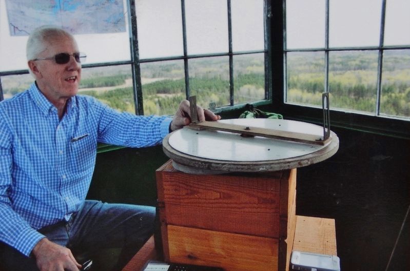
Retired DNR Forester Keith Simar shows how he used an alidade to locate fires spotted from the tower. The device, also known as the Osborne Firefinder, was developed by the U.S. Forest Service in 1911. Eventually, it became standard equipment for forestry agencies nationwide. The spotter rotated the graduated rim to align the crosshairs on a column of smoke. The compass reading, estimated height of smoke, and estimated distance from the tower were telephoned or radioed to the nearest ranger station.
[photo captions]
• Early fire towers included those re-fashioned from windmill towers.
• This map, from Minnesota's Historical Fire Lookout Towers, shows 60 standing towers in the state. Towers that can be climbed by the public are located at Big Bog State Recreation Area, Itasca State Park, Milk Lacs Kathio State Park, St. Croix State Park, Scenic State Park, Whitewater State Park, and here, at the Paul M. Thiede Fire Tower Park.
• This postcard image is from the collections of the Minnesota Historical Society.
Erected by Crow Wing County, Minnesota.
Topics and series. This historical marker is listed in these topic lists: Architecture • Charity & Public Work • Horticulture & Forestry • Parks & Recreational Areas. In addition, it is included in the Civilian Conservation Corps (CCC), and the National Register of Historic Places series lists. A significant historical year for this entry is 1935.
Location. 46° 36.232′ N, 94° 17.821′ W. Marker is in Pequot Lakes, Minnesota, in Crow Wing County. Marker can be reached from County Road 11, 0.3 miles east of State Highway 371, on the left when traveling east. The marker and tower are located along the Fire Tower Trail, at the top of the hill, in Paul M. Thiede Fire Tower Park. Touch for map. Marker is at or near this postal address: 5230 County Road 11, Pequot Lakes MN 56472, United States of America. Touch for directions.
Other nearby markers. At least 8 other markers are within walking distance of this marker. Art Savage, Fire Tower Ranger (a few steps from this marker); Fires and Firefighting (within shouting distance of this marker); The Warehouse & Office (within shouting distance of this marker); The Spotter's Cabin (within shouting distance of this marker); The Growing Forest (about 500 feet away, measured in a direct line); Don Nelson (about 600 feet away); Firefighting Heritage (about 700 feet away); Traditional Landscape (about 700 feet away). Touch for a list and map of all markers in Pequot Lakes.
Regarding The Pequot Fire Lookout Tower. National Register of Historic Places #100001297.
From the National Register Nomination:
The Pequot Fire Lookout Tower is an intact 100'-tall steel fire lookout tower built by the Civilian Conservation Corps (CCC) in 1935 for the Forestry Division of the Minnesota Department of Conservation (now Department of Natural Resources). The property played an instrumental role in the detection and suppression of forest fires in Minnesota between 1935 and 1970 while the use of fire lookout towers was the most important fire detection method. The Pequot tower is an excellent example of the permanent physical accomplishments of CCC forestry work in the Brainerd area. It is associated with the New Deal's unprecedented dedication of public resources to forestry and natural resource conservation in Minnesota and is associated with the massive federal and state effort to combat the devastating poverty and social impacts of the Great Depression by providing meaningful work to the poor while at the same time constructing necessary public infrastructure.
Related markers. Click here for a list of markers that are related to this marker. Paul M. Thiede Fire Tower Park
Also see . . .
1. Pequot Fire Tower. Excerpt:
Minnesota’s Pequot Lookout Tower was built by the CCC and MN-DNR Division of Forestry crews in 1934. At 100’ with a 7x7 cab, it is still valued as a detection site in the popular wooded lakes region of central Minnesota. The tower is now the centerpiece of Paul M. Thiede Fire Tower Park, named after a former Crow Wing County commissioner who spearheaded preservation of the tower.(Submitted on December 8, 2023, by Cosmos Mariner of Cape Canaveral, Florida.)
2. Minn. fire tower wins historic site designation
. Excerpt:
For more than eight decades, the Pequot Fire Tower has stood sentinel in Minnesota, a Depression-era legacy essential to forest safety and, later, an attraction drawing tourists to its 100-foot-tall structure. In 1934, the Civilian Conservation Corps erected the steel tower in Pequot Lakes, Crow Wing County, to replace a shorter 1927 tower. It sits atop one of the highest hills in the area, surrounded by privately and publicly owned woodlands and farmland, including a 40-acre parcel of forested state land. Spotters can see for 15 miles in every direction. The Pequot Fire Tower was one of 11 lookout towers in the 2 million-acre Brainerd Ranger District, which was threatened by hundreds of forest fires each year. Only three others still stand.(Submitted on December 8, 2023, by Cosmos Mariner of Cape Canaveral, Florida.)
Credits. This page was last revised on December 9, 2023. It was originally submitted on December 7, 2023, by Cosmos Mariner of Cape Canaveral, Florida. This page has been viewed 58 times since then and 15 times this year. Photos: 1, 2, 3, 4, 5, 6. submitted on December 8, 2023, by Cosmos Mariner of Cape Canaveral, Florida.
