Mankato in Blue Earth County, Minnesota — The American Midwest (Upper Plains)
Early European Explorers
— Minnesota River Valley History Walk —
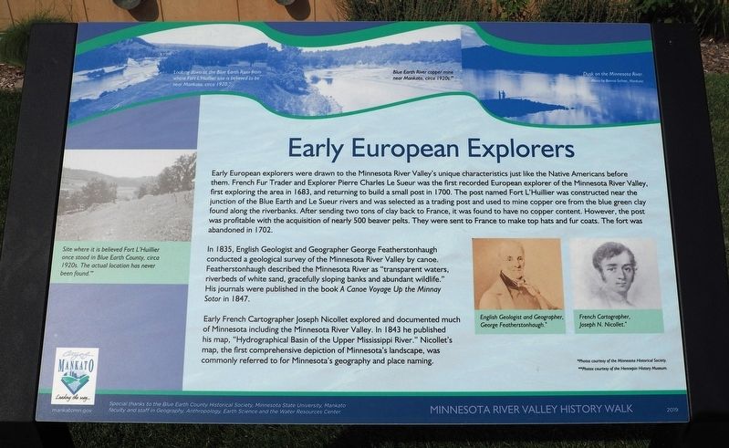
Early European explorers were drawn to the Minnesota River Valley's unique characteristics just like the Native Americans before them. French Fur Trader and Explorer Pierre Charles Le Sueur was the first recorded European explorer of the Minnesota River Valley, first exploring the area in 1683, and returning to build a small post in 1700. The post named Fort L'Huillier was constructed near the junction of the Blue Earth and Le Sueur rivers and was selected as a trading post and used to mine copper ore from the blue green clay found along the riverbanks. After sending two tons of clay back to France, it was found to have no copper content. However, the post was profitable with the acquisition of nearly 500 beaver pelts. They were sent to France to make top hats and fur coats. The fort was abandoned in 1702.
In 1835, English Geologist and Geographer George Featherstonhaugh conducted a geological survey of the Minnesota River Valley by canoe. Featherstonhaugh described the Minnesota River as "transparent waters, riverbeds of white sand, gracefully sloping banks and abundant wildlife." His journals were published in the book A Canoe Voyage Up the Minnay Sotor in 1847.
Early French Cartographer Joseph Nicollet explored and documented much of Minnesota including the Minnesota River Valley. In 1843 he published his map, "Hydrographical Basin of the Upper Mississippi River." Nicollet's map, the first comprehensive depiction of Minnesota's landscape, was commonly referred to for Minnesota's geography and place naming.
Looking down at the Blue Earth River from where Fort L'Huillier site is believed to be near Mankato, circa 1920.
Blue Earth River copper mine near Mankato, circa 1920s.
Dusk on the Minnesota River.
Site where it is believed Fort L'Huillier once stood in Blue Earth County, circa 1920s. The actual location has never been found.
English Geologist and Geographer George Featherstonhaugh.
French Cartographer, Joseph N. Nicollet.
Special thanks to the Blue Earth County Historical Society, Minnesota State University, Mankato faculty and staff in Geography, Anthropology, Earth Science and the Water Resources Center.
Erected 2019 by City of Mankato.
Topics. This historical marker is listed in these topic lists: Exploration • Forts and Castles • Industry & Commerce • Waterways & Vessels. A significant historical year for this entry is 1683.
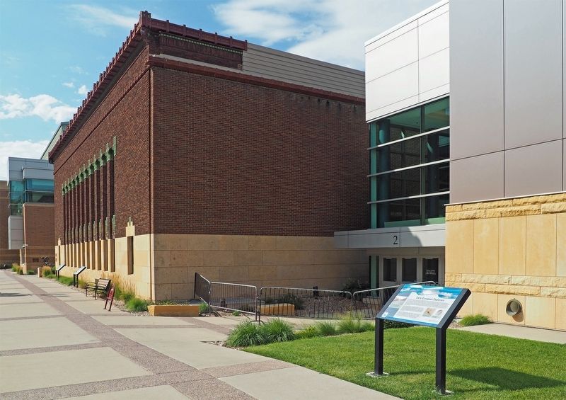
Location. 44° 9.925′ N, 94° 0.233′ W. Marker is in Mankato, Minnesota, in Blue Earth County. Marker is on Civic Center Plaza (Hickory Street) west
of S. 2nd Street, on the right when traveling west. The marker is outside Door 2 of the Mankato Civic Center. Touch for map. Marker is at or near this postal address: 1 Civic Center Plaza, Mankato MN 56001, United States of America. Touch for directions.
Other nearby markers. At least 8 other markers are within walking distance of this marker. Early Settlers (a few steps from this marker); Navigating the River (within shouting distance of this marker); Native Americans (within shouting distance of this marker); Sinclair Lewis House (about 700 feet away, measured in a direct line); Korean War (approx. 0.2 miles away); Dakota (Sioux) Memorial – 1862 (approx. 0.2 miles away); Minnesota River Steamboating (approx. 0.2 miles away); The Lorin & Lulu Cray Home (approx. ¼ mile away). Touch for a list and map of all markers in Mankato.
Credits. This page was last revised on December 18, 2023. It was originally submitted on December 9, 2023, by McGhiever of Minneapolis, Minnesota. This page has been viewed 58 times since then and 30 times this year. Photos: 1, 2. submitted on December 9, 2023, by McGhiever of Minneapolis, Minnesota. • J. Makali Bruton was the editor who published this page.

