North Salem in Westchester County, New York — The American Northeast (Mid-Atlantic)
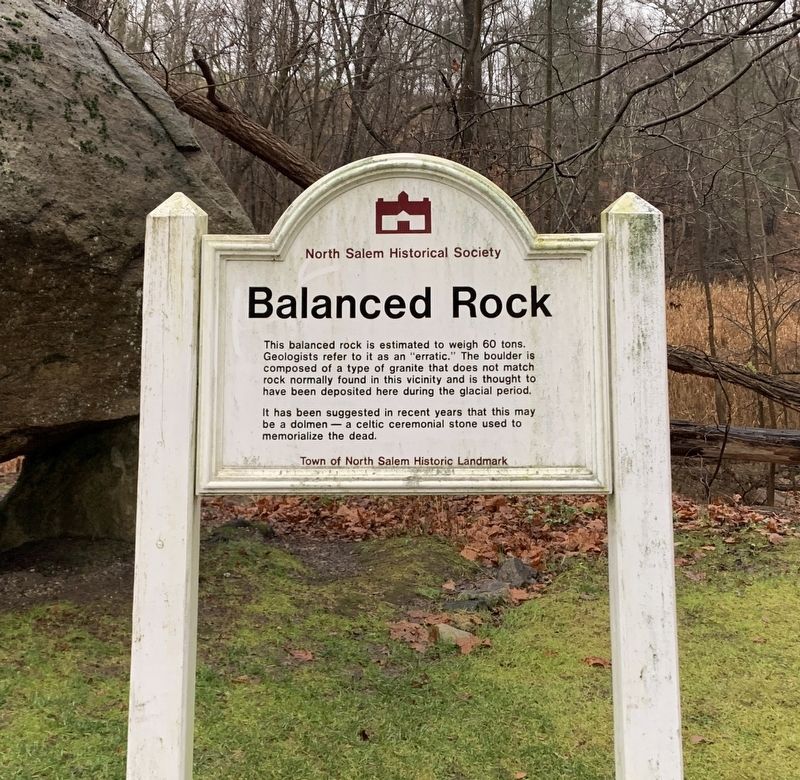
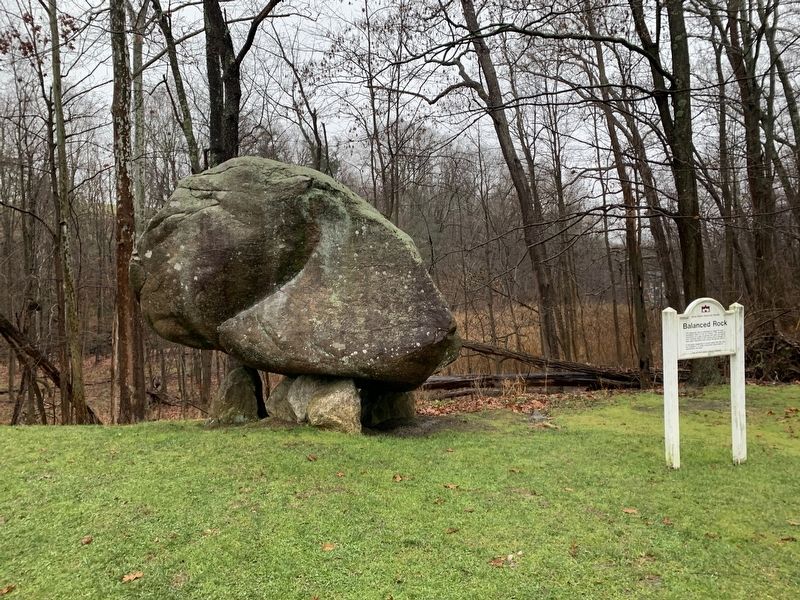
Balanced Rock
This balanced rock is estimated to weigh 60 tons. Geologists refer to it as an "erratic." The boulder is composed of a type of granite that does not match rock normally found in this vicinity and is thought to have been deposited here during the glacial period.
It has been suggested in recent years that this may be a dolmen -a Celtic ceremonial stone used to memorialize the dead.
Town of North Salem Historic Landmark
Erected by North Salem Historical Society.
Topics. This historical marker is listed in this topic list: Natural Features.
Location. 41° 20.043′ N, 73° 34.298′ W. Marker is in North Salem, New York, in Westchester County. Marker is on Titicus Road (Route 121) south of Keeper Lane, on the right when traveling north. Touch for map. Marker is at or near this postal address: 667 Titicus Road, North Salem NY 10560, United States of America. Touch for directions.
Other nearby markers. At least 8 other markers are within 4 miles of this marker, measured as the crow flies. Our Warning Ring (approx. 0.9 miles away); June Cemetery (approx. one mile away); North Salem World War I Memorial (approx. 1.4 miles away); Peach Pond Cemetery (approx. 1.4 miles away); Washington – Rochambeau Revolutionary Route (approx. 2½ miles away in Connecticut); Ridgebury Congregational Church (approx. 3.1 miles away in Connecticut); Ridgebury – George Washington Slept Here (approx. 3.1 miles away in Connecticut); Drewsclift Cemetery (approx. 3.6 miles away). Touch for a list and map of all markers in North Salem.
Also see . . . North Salem Balanced Rock (Hudson Valley Geologist blog).
Excerpt: So, how did something like this form? Well, all over the Hudson Valley of New York we find big boulders sitting around (really, all over the northern parts of the United States). They were picked up and transported by massive continental glaciers during the last ice age (actually, several advances and retreats of glacial ice between 2 million and ten thousand years ago). When the glaciers melted, these rocks, some as large as houses, were dropped out and are known as glacial erratics…. While most rocks were dumped onto the ground, this one happened to be dumped onto a few other rocks forming the unique structure we see today.(Submitted on December 10, 2023.)
Credits. This page was last revised on December 13, 2023. It was originally submitted on December 3, 2023, by Steve Stoessel of Niskayuna, New York. This page has been viewed 74 times since then and 31 times this year. Last updated on December 10, 2023, by Steve Stoessel of Niskayuna, New York. Photos: 1, 2. submitted on December 3, 2023, by Steve Stoessel of Niskayuna, New York. • Michael Herrick was the editor who published this page.

