Fort York in Toronto, Ontario — Central Canada (North America)
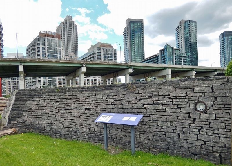
Circular, or Government House, Battery
c. 1811
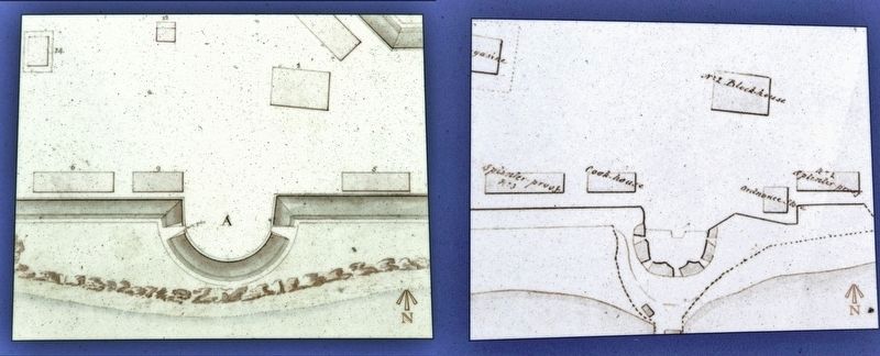
This battery saw action during the Battle of York in 1813. It survived the American occupation and became part of the rebuilt fort of 1813-15. Today it reflects its 1816 appearance, when it held two artillery pieces. It was modified to hold five guns during the Rebellion Crisis in 1838. It covered the fort's south wall and helped guard the harbour entrance.
The guns are original Georgian-era artillery pieces. The one facing west is a 24-pounder, which could fire a 10.9 kilogram shot 1700 metres; the one facing east is a 32-pounder, which could fire a 14.5-kilogram shot 2600 metres. In the War of 1812, 24-pounders were the largest guns defending Upper Canada. Britain sent 32-pounders afterwards to better protect the colony.
The gun carriages are reproductions. In peacetime in the Georgian era, the army often used iron carriages because they were weather-resistant. Wooden carriages were stored indoors, to be used in times of conflict because they could better withstand the shock of firing guns.
Topics. This historical marker is listed in these topic lists: Colonial Era • Forts and Castles • War of 1812. A significant historical year for this entry is 1811.
Location. 43° 38.32′ N, 79° 24.177′ W. Marker is in Toronto, Ontario. It is in Fort York. Marker can be reached from Fort York Boulevard, 0.2 kilometers north of Lake Shore Boulevard West. The marker and battery are located along the interpretive walkway at Fort York National Historic Site. Touch for map. Marker is at or near this postal address: 250 Fort York Boulevard, Toronto ON M5V 3K9, Canada. Touch for directions.
Other nearby markers. At least 8 other markers are within walking distance of this marker. No. 2 (Centre) Blockhouse (within shouting distance of this marker); Stone Magazine (within shouting distance of this marker); Well and Well House (within shouting distance of this marker); Officers' Blue Barracks (within shouting distance of this marker); Government House (within shouting distance of this marker); Fort York / Le Fort York (about 90 meters away, measured in a direct line); Brick Magazine (about 90 meters away); No. 1 (East) Blockhouse (about 90 meters away). Touch for a list and map of all markers in Toronto.
Related markers. Click here for a list of markers that are related to this marker. Fort York National Historic Site
Also see . . .
1. Fort York National Historic Site. Excerpt:
The Fort York National Historic Site was built in 1793 and is the birthplace of urban Toronto. The Fort served as the city’s primary harbour defence between the 1790s and the 1880s and was the home of a military garrison until the 1930s. Fort York is where British soldiers, First Nations warriors and Upper Canadian militiamen stood together against the United States and its mission to capture Toronto in the War of 1812. The bloody Battle of York that ensued was a dark and dramatic moment in the history of the city.(Submitted on December 12, 2023, by Cosmos Mariner of Cape Canaveral, Florida.)
2. Battle of York (Wikipedia). Excerpt:
The Battle of York was a War of 1812 battle fought in York, Upper Canada (today's Toronto, Ontario, Canada) on April 27, 1813. An American force, supported by a naval flotilla, landed on the western lakeshore and captured the provincial capital after defeating an outnumbered force of regulars, militia and Ojibwe natives. Although the Americans won a clear victory, the battle did not have decisive strategic results as York was a less important objective in military terms than Kingston, where the British armed vessels on Lake Ontario were based.(Submitted on December 12, 2023, by Cosmos Mariner of Cape Canaveral, Florida.)

Library and Archives Canada, NMC-23139 and c-137340
3. Marker detail: The Circular Battery, 1812 & 1830s
The Circular Battery at the end of the War of 1812 (left) and as altered during the Rebellion Crisis of the 1830s (right). (Maps by Surveyor J. B. Duberger, Royal Engineers, 1816, and Captain Vincent Biscoe, Royal Engineers, 1842)
Credits. This page was last revised on December 12, 2023. It was originally submitted on December 10, 2023, by Cosmos Mariner of Cape Canaveral, Florida. This page has been viewed 47 times since then and 11 times this year. Photos: 1, 2, 3, 4, 5. submitted on December 12, 2023, by Cosmos Mariner of Cape Canaveral, Florida.


