
Beallsville in Montgomery County, Maryland — The American Northeast (Mid-Atlantic)
The Darby Store
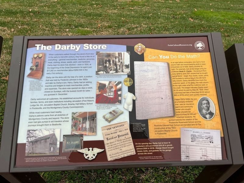
When customers walked through this store's front door in the early to mid-20th century, they found a little bit of everything — general merchandise, medicine, groceries, meat, clothing, shoes, seeds, paint, and hardware. Darby kept his store fully stocked — even in 1930, at the beginning of the Great Depression he spent over $17,282 on merchandise (about $262,500 in the early 21st century).
Darby ran the store with the help of a clerk, a position that was held by Frederick Johnson in the 1920s and later by Darby's son, Harry. Darby had an adding machine and ledgers to track merchandise, profits, and expenses. The store was opened six days a week, closed on Sundays, with the busiest month for sales — you guessed it: December.
Darby welcomed all customers. He established accounts for individuals, families, farms, and even institutions including Jerusalem (Free Mason) Lodge No. 64, Jerusalem Baptist Church, Briarley Hall Military School in Poolesville, and the Montgomery County Commissioners.
While most customers lived nearby, Darby's patrons came from all stretches of Montgomery County and beyond. the store even
this page online
Can You Do the Math?
In an age before computers, one had to have sound math and record-keeping skills to keep a business out of debt. Darby excelled at both. For example, look at the ledger entry for customer Noah E. Clarke — his account from June 1909 to June 1911 shows that he bought typical items — sugar, flour, boots, socks, pants, and buckets to name a few. In the left-hand tally column, Darby identified how much the customer spent, or his debt. The next column to the right notes what the customer paid, or his credit. The ledger indicates Clarke owed $2.35 which he paid by May 26, 1909. Often customers had tabs of less than $3.00 (about $85 in 2019) which were quickly resolved.
Clarke (1878-1958), the son of a formerly enslaved man, was an insurance agent and community leader who sought better educational opportunities for African American students. He worked towards the creation of the Poolesville Rosenwald School and the Rockville Colored High School and donated the land for the construction of the 1923 Jerusalem Baptist Church in Poolesville.
[Captions:]
Original c. 1911 Western Electric Company telephone donated by Donna Darby Rowe in 2020. With a telephone in the store, H.C. Darby was able to quickly place orders to vendors as far away as Richmond.
The photos show the building prior to and during the rehabilitation project (completed in 2015) as part of that effort the store was moved about 25 feet back from the corner. (Courtesy: M-NCPPC)
H.C. Darby's great, great grandson repainted the numbers on the original nail bin as part of the rehab project. (Courtesy: M-NCPPC)
Archaeological excavations in 2009 and 2010 recovered almost 13,300 artifacts, including the tows and eagle pin seen here. (Courtesy: M-NCPPC)
On
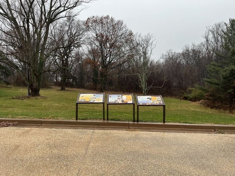
Erected by Montgomery Parks.
Topics and series. This historical marker is listed in these topic lists: African Americans • Education • Industry & Commerce. In addition, it is included in the Maryland, Montgomery Parks, and the Rosenwald Schools series lists. A significant historical date for this entry is May 26, 1909.
Location. 39° 10.795′ N, 77° 24.766′ W. Marker is in Beallsville, Maryland, in Montgomery County. It is on Beallsville Road (Maryland Route 109) just north of Darnestown Road ( Route 28), on the right when traveling south. The marker is on the grounds of Darby Store Cultural Park. Touch for map. Marker is at or near this postal address: 19801 Darnestown Road, Bealsville MD 20839, United States of America. Touch for directions.

Regionally, this marker is in the Washington Metropolitan Area. It is also in the American Mid-Atlantic. Globally, it is in the North Atlantic Region, North America, the Western Hemisphere, the Western World, and the Anglosphere. Historically, it finds itself in what was once one of the original Thirteen Colonies and also the Antebellum South.
Other nearby markers. At least 8 other markers are within 2 miles of this marker, measured as the crow flies: The Country Store (here, next to this marker); The Darby Family (here, next to this marker); Beallsville (about 300 feet away, measured in a direct line); In Loving Memory (about 600 feet away); African American Soldiers from Montgomery County (approx. 0.8 miles away); Brewer Farmstead (approx. 0.8 miles away); Equestrian Heritage (approx. 0.9 miles away); Washington's Farm (approx. 1½ miles away). Touch for a list and map of all markers in Beallsville.
Credits. This page was last revised on December 10, 2023. It was originally submitted on December 10, 2023, by Devry Becker Jones of Washington, District of Columbia. This page has been viewed 393 times since then and 50 times this year. Photos: 1, 2. submitted on December 10, 2023, by Devry Becker Jones of Washington, District of Columbia.
