Davis in Tucker County, West Virginia — The American South (Appalachia)
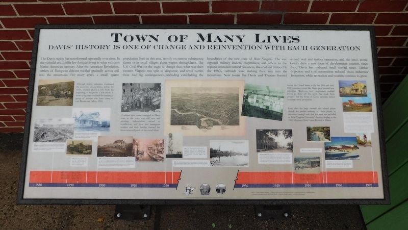
Town Of Many Lives
Davis' History Is One Of Change And Reinvention With Each Generation
The Davis region has transformed repeatedly over time. In the colonial era, British law forbade living in what was then Native American territory. After the American Revolution, settlers of European descent trickled gradually across and into the mountains. For many years, a small, sparse population lived in this area, mostly on remote subsistence farms or in small villages along wagon throughfares. The U.S. Civil War set the stage to change that; what was then western Virginia was split in allegiance, and small battles there had big consequences, including establishing the boundaries of the new state of West Virginia. The war exposed military leaders, mapmakers, and others to the region's abundant natural resources, like coal and timber. By the 1880s, railroads were making their way into the mountains. New towns like Davis and Thomas formed around coal and timber extraction, and the area's scenic beauty drew a new form of development: tourism. Since then, Davis has reshaped itself several times. Timber depletion and coal automation reduced those industries' footprints, while recreation and tourism continue to grow.
(Captions):
Although timber industries dominated the economy around Davis before the 1920s, tourism played a role from the beginning, as the photo at left attests. It shows a log train outfitted for carrying a group of tourists who have come to visit Blackwater Falls in 1910.
A robust civic scene emerged in Davis even as the town was still new and growing. Industrialists served as benefactors, and local and immigrant workers and their families formed the interconnected parts of the social fabric.
Across the United States in the late 19th and early 20th centuries, towns like Davis grew around new industries. "Birds-eye view" mapmakers enabled towns to show off the assets that made them prosper. For the Town of Davis, riverside timber industries were prominent.
Even after the large sawmill and related plants closed, the timber industry in Davis played an important enough role that this map was included in West Virginia University's history display at the 1960 Mountain State Forest Festival in Elkins.
Despite being only two miles from the railroad main line in Thomas, it took 6.3 miles of track to reach Davis due to topography. Railroad service to Davis began in 1884 and lasted until 1942.
1884: The WVC&P&P Railroad arrives. Two years later, the Rumbarger sawmill and Fryweather and La Dew tannery both open, marking the start of an industrial boom in what was mostly a wilderness and small farm region. As a formative town begins to grow, the rapidly cleared land earns it the nickname "Stumptown."
1889: With a population of 909, the town of Davis forms a government and is incorporated.
1892: The first part of the stone National Bank of Davis building is complete, and it opens for business.
1895: The West Virginia Pulp and Paper Company opens its pulp mill at the west edge of Davis, continuing a trend of rapid local industrial growth.
1898: Although the town has been growing for just over 10 years, and the "Stumptown" landscape has begun to subside, much growth has yet to occur at the time of the parade shown taking place in this July 4, 1898 photograph. However, businesses continued to open, driven by the timber industries. Erhard Jewelry, which also served as an optometrist's shop, was one of them. It mas have been located on the ground floor of today's Bright Morning Inn.
1920: The Monongahela National Forest is established under the U.S. Department of Agriculture, charged with managing largely logged-over timber lands and some wild areas for conservation, controlled logging, and recreation.
1922: The old Rumbarger sawmill, by then operated by Pittsburgh's Babcock Boom and Lumber Company, closes. Timber lands around Davis are heavily logged over, and the town's timber industries are in a state of decline.
Mid-late 1940s: The downtown area of Davis has been filled in for nearly three decades. William Ave. from the Bank to Town Hall is paved, and residents have automobiles. There is still some employment in timber industries, but only a fraction of what there was at the peak of production in the early 20th century. Coal mining will eventually decline too, but is still very active at this time, and tourism
1950: Robert Barton opens a ski resort at Canaan Valley, just twelve miles from Davis, putting a new winter tourism trend into motion.
1955: The first Winter Carnival takes place.
1956: Blackwater Falls State Park Lodge opens. Although tourists have been coming to the falls for decades, new facilities at the falls combine with rapid growth in automobile travel to bring unprecedented visitation.
1950s to today: Davis offers winter sports and scenic highlights all year. Prosperity and the automobile drive tourism-related growth in businesses like lodging. Accommodations evolve from downtown hotels to roadside motels like the one shown above. Since then, bed and breakfast lodgings like Bright Morning Inn (a former boarding house above a downtown storefront) have also become popular. Second home development in nearby Canaan Valley also attracts new residents and businesses.
Local outdoor recreation grew from visits to the falls and skiing into a wide range of activities that also includes hunting, fishing, hiking, mountain biking, rock climbing, and others. The Moon Rocks, named for its boulders (exposed when logged-over lands burned in forest fires), is a popular mountain biking spot.
Photo credits: Dante Alighieri | Alamy Stock Photo; SS Prinzess Irene | prinzessirene.com; wedding photo | courtesy Jeannette Ware; above left (both) | Quattro family; above | Sirianni's Restaurant
Layouts and text by David A. Vago Historic Resource Planning & Design
Erected 2023 by The West Virginia Humanities Council, Friends of Blackwater and Davis West Virginia.
Topics. This historical marker is listed in these topic lists: Industry & Commerce • Settlements & Settlers • War, US Civil. A significant historical year for this entry is 1910.
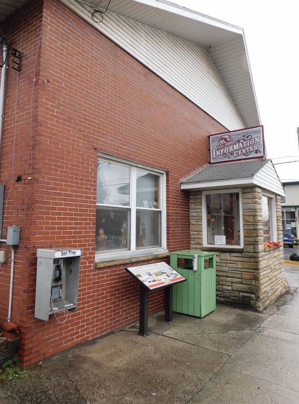
Location. 39° 7.734′ N, 79° 27.908′ W. Marker is in Davis, West Virginia, in Tucker County. Marker is on William Avenue (West Virginia Route 32) west of Fourth Street, on the left when traveling east. Marker is located in front of the Tucker County Information Center. Touch for map. Marker is at or near this postal address: 410 William Avenue, Davis WV 26260, United States of America. Touch for directions.
Other nearby markers. At least 8 other markers are within walking distance of this marker. The Blackwater Hotel (a few steps from this marker); In Memory of All American Veterans (a few steps from this marker); The Pennsylvania House (within shouting distance of this marker); Railroad Depot (within shouting distance of this marker); Babcock Office & Store (within shouting distance of this marker); National Bank of Davis (within shouting distance of this marker); Verzi's Saloon (within shouting distance of this marker); Shipping By Rail (about 300 feet away, measured in a direct line). Touch for a list and map of all markers in Davis.
Credits. This page was last revised on January 2, 2024. It was originally submitted on December 17, 2023, by Bradley Owen of Morgantown, West Virginia. This page has been viewed 63 times since then and 62 times this year. Photos: 1, 2. submitted on January 2, 2024, by Bradley Owen of Morgantown, West Virginia.

