Forest City in Rutherford County, North Carolina — The American South (South Atlantic)
Building the Community Connector
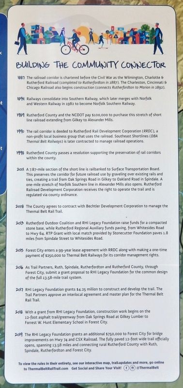
1887 The railroad corridor is chartered before the Civil War as the Wilmington, Charlotte & Rutherford Railroad (completed to Rutherfordton in 1887). The Charleston, Cincinnati & Chicago Railroad also begins construction (connects Rutherfordton to Marion in 1892).
1894 Railways consolidate into Southern Railway, which later merges with Norfolk and Western Railway in 1982 to become Norfolk Southern Railway.
1989 Rutherford County and the NCDOT pay $100,000 to purchase this stretch of short line railroad extending from Gilkey to Alexander Mills.
1990 The rail corridor is deeded to Rutherford Rail Development Corporation (RRDC), a non-profit local business group that uses the railroad. Southeast Shortlines (DBA Thermal Belt Railways) is later contracted to manage railroad operations.
1998 Rutherford County passes a resolution supporting the preservation of rail corridors within the county.
2001 A 7.87-mile section of the short line is railbanked to Surface Transportation Board. This preserves the corridor for future railroad use by graveling over existing rails and ties, creating a trail from Oak Springs Road in Gilkey to Oakland Road in Spindale. A one-mile stretch of Norfolk Southern line in Alexander Mills also opens. Rutherford Railroad Development Corporation receives the right to operate the trail and is regulated via county ordinance.
2008 The County agrees to contract with Bechtler Development Corporation to manage the Thermal Belt Rail Trail.
2013 Rutherford Outdoor Coalition and RHI Legacy Foundation raise funds for a compacted stone base, while Rutherford Regional Auxiliary funds paving, from Whitesides Road to Hwy 64. RTP Grant with local match provided by Stonecutter Foundation paves 1.8 miles from Spindale Street to Whitesides Road.
2015 Forest City enters a 99-year lease agreement with RRDC along with making a one-time payment of $250,000 to Thermal Belt Railways for its corridor management rights.
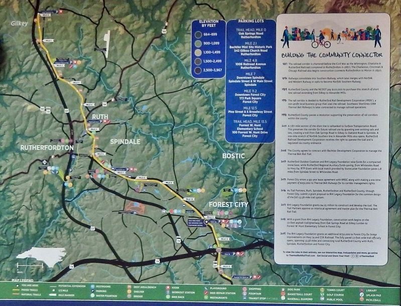
2016 As Trail Partners, Ruth, Spindale, Rutherfordton and Rutherford County, through Forest City, submit a grant proposal to RHI Legacy Foundation for the common design of the full 13.58-mile trail system.
2017 RHI Legacy Foundation grants $4.25 million to construct and develop the trail. The Trail Partners approve an interlocal agreement and master plan for the Thermal Belt Rail Trail.
2018 With a grant from RHI Legacy Foundation, construction work begins on the 12-foot asphalt trail/greenway from Oak Springs Road at Gilkey Lumber to Forrest W. Hunt Elementary School in Forest City.
2019 The
RHI Legacy Foundation grants an additional $750,000 to Forest City for bridge improvements on Hwy 74 and CSX Railroad. The fully paved 12-foot wide trail officially opens, spanning 13.58 miles and connecting rural Rutherford County with Ruth, Spindale, Rutherfordton and Forest City.
Topics. This historical marker is listed in these topic lists: Parks & Recreational Areas • Railroads & Streetcars.
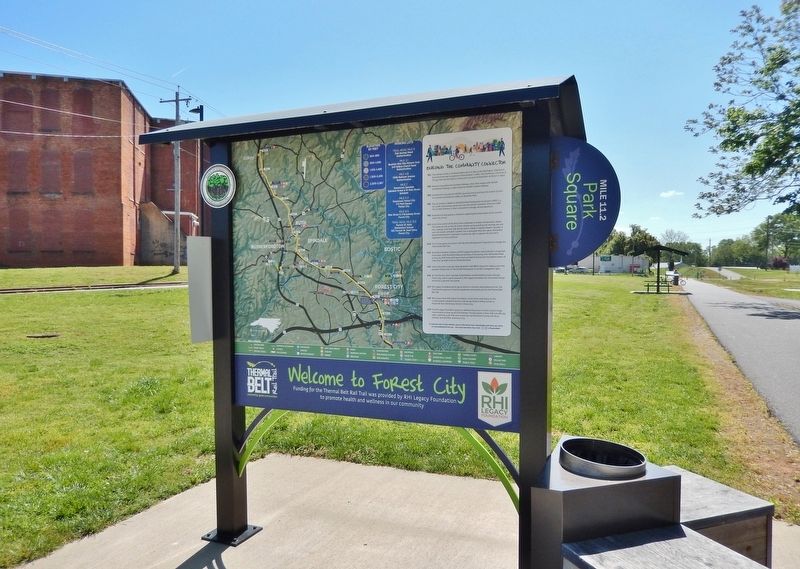
Location. 35° 19.888′ N, 81° 51.984′ W. Marker is in Forest City, North Carolina, in Rutherford County. Marker can be reached from Park Street just east of Young Street, on the left when traveling east. Marker is located at the Park Square Trailhead, at milepost 11.2 on the Thermal Belt Rail Trail. Touch for map. Marker is in this post office area: Forest City NC 28043, United States of America. Touch for directions.
Other nearby markers. At least 8 other markers are within walking distance of this marker. Forest City Confederate Memorial (approx. 0.2 miles away); Town of Burnt Chimney (approx. 0.2 miles away); Police Memorial (approx. 0.2 miles away); Forest City (approx. 0.2 miles away); Rutherford County Memorial (approx. 0.2 miles away); First Baptist Church (approx. ¼ mile away); Elisha Baxter (approx. 0.3 miles away); Cool Springs High School (approx. 0.6 miles away). Touch for a list and map of all markers in Forest City.
Also see . . .
1. Carolina Central Railroad (Wikipedia)
. Excerpt:
The Carolina Central Railroad was incorporated in 1855 as the Wilmington and Charlotte Railroad and was renamed the Wilmington, Charlotte and Rutherford Railroad shortly after. It was reorganized as the Carolina Central Railway in 1873. It built 152 miles of track, in two unconnected sections, in the southern part of North Carolina. The company was again reorganized as the Carolina Central Railroad in 1880. In 1900, the Carolina Central Railroad was merged into the Seaboard Air Line Railroad. Its lines are now owned by CSX Transportation.(Submitted on December 17, 2023, by Cosmos Mariner of Cape Canaveral, Florida.)
2. Charleston Cincinnati & Chicago Railroad. Excerpt:
In 1886 the 3Cs Railroad was proposed to be 625 miles, stretching from Ashland KY to Charleston SC. Within 5 years, almost 150 miles had been partially completed, and over 200 miles were completed and operated. This was a total of almost 400 miles of partial grading, roadbed, or completed rail line. However, financial panics hit in both 1890 and 1893, with less than half of the proposed construction budget having been spent. The toughest, most-mountainous segments had been saved for last, and thus construction on those two main segments were never started. Due to those severe world economic downturns, the 3Cs was in foreclosure from 1890 to 1893.(Submitted on December 17, 2023, by Cosmos Mariner of Cape Canaveral, Florida.)
Credits. This page was last revised on December 17, 2023. It was originally submitted on December 17, 2023, by Cosmos Mariner of Cape Canaveral, Florida. This page has been viewed 57 times since then and 12 times this year. Photos: 1, 2, 3. submitted on December 17, 2023, by Cosmos Mariner of Cape Canaveral, Florida.


